
Bird's Eye View of the Burnaby Lake Area
https://search.heritageburnaby.ca/link/museumdescription15144
- Repository
- Burnaby Village Museum
- Date
- 1977
- Collection/Fonds
- Century Park Museum Association fonds
- Description Level
- Item
- Physical Description
- 1 map : b&w print on paper ; 43 x 63.5 cm
- Scope and Content
- Item consists of a map titled "Birds Eye View of the Burnaby Lake Area Circa 1910". The overview of the Burnaby Lake area was compiled and drawn at Heritage Village by curator John Adams and artist, Carol Swan. The map identifies the Burnaby Lake inter-urban tram line; roads including: Sperling Ave…
- Repository
- Burnaby Village Museum
- Collection/Fonds
- Century Park Museum Association fonds
- Description Level
- Item
- Physical Description
- 1 map : b&w print on paper ; 43 x 63.5 cm
- Material Details
- Scale indeterminable
- Scope and Content
- Item consists of a map titled "Birds Eye View of the Burnaby Lake Area Circa 1910". The overview of the Burnaby Lake area was compiled and drawn at Heritage Village by curator John Adams and artist, Carol Swan. The map identifies the Burnaby Lake inter-urban tram line; roads including: Sperling Avenue (Pole Line Road); Gilpin Avenue; Douglas Road; trail to Vancouver Westminster Road (Kingsway); Buckingham Avenue; Haszard Street; various farms and residences including: Charles Sprott "Norland"; H.T. Ceperley "Fairacres"; Claude Hill's "Brookfield farm" and "Broadview"; F.J. Hart's "Avalon"; Miss Woodward's former and new home, school and post office; Councillor Edgar's hunting cabin; Edgar Sprott's "Mayfield farm" and "Mayfield Lodge"; F.J. Peers "Greyfriars"; Arthur de Windt Haszard; Bernard Hill's boathouse as well as other landmarks including: Doran's Mill; tram stations; Burnaby Lake Store; logging camps; wood cutter's shacks; ice houses; cranberry bog; Still Creek; Deer Lake; Burnaby Lake; Deer Lake Creek; Provincial Government Reserve Proposed Hospital (later Oakalla Prison).
- Creator
- Adams, John
- Swan, Carol
- Names
- Hill, Arthur Claude
- Sprott, Charles Frederick
- Sprott, Louis "Edgar"
- Hart, Frederick John, 1884-1945
- Ceperley, H.T.
- Woodward, Maude
- Woodward, Harriet
- Peers, Francis J.
- Haszard, Arthur de Windt
- Hill, Bernard R.
- Geographic Access
- Deer Lake Avenue
- Sperling Avenue
- Haszard Street
- Buckingham Avenue
- Accession Code
- BV021.1.3
- Access Restriction
- No restrictions
- Reproduction Restriction
- No known restrictions
- Date
- 1977
- Media Type
- Cartographic Material
- Historic Neighbourhood
- Burnaby Lake (Historic Neighbourhood)
- Planning Study Area
- Burnaby Lake Area
- Related Material
- See also: Life with the Moores of Hart House : pioneer days on Burnaby's Deer Lake
- Scan Resolution
- 600
- Scan Date
- 2021-11-12
- Scale
- 100
- Notes
- Transcribed title
- Compiled by John Adams; illustration by Carol Swan
- The map depicts the Burnaby Lake Tram Line as being double tracked, whereas in reality it was single tracked.
- Map is part of the book "Life with the Moores of Hart House : pioneer days on Burnaby's Deer Lake https://search.heritageburnaby.ca/permalink/museumlibrary6314-102
Images


Bird's Eye View of the Burnaby Lake Area
https://search.heritageburnaby.ca/link/museumdescription17543
- Repository
- Burnaby Village Museum
- Date
- 1977
- Collection/Fonds
- Century Park Museum Association fonds
- Description Level
- Item
- Physical Description
- 1 map : b&w print with watercolour ; 43 x 63.5 cm
- Scope and Content
- Item consists of a map titled "Birds Eye View of the Burnaby Lake Area Circa 1910". The overview of the Burnaby Lake area was compiled and drawn at Heritage Village by curator John Adams and artist, Carol Swan. The map identifies the Burnaby Lake inter-urban tram line; roads including: Sperling Ave…
- Repository
- Burnaby Village Museum
- Collection/Fonds
- Century Park Museum Association fonds
- Description Level
- Item
- Physical Description
- 1 map : b&w print with watercolour ; 43 x 63.5 cm
- Material Details
- Scale indeterminable
- Scope and Content
- Item consists of a map titled "Birds Eye View of the Burnaby Lake Area Circa 1910". The overview of the Burnaby Lake area was compiled and drawn at Heritage Village by curator John Adams and artist, Carol Swan. The map identifies the Burnaby Lake inter-urban tram line; roads including: Sperling Avenue (Pole Line Road); Gilpin Avenue; Douglas Road; trail to Vancouver Westminster Road (Kingsway); Buckingham Avenue; Haszard Street; various farms and residences including: Charles Sprott "Norland"; H.T. Ceperley "Fairacres"; Claude Hill's "Brookfield farm" and "Broadview"; F.J. Hart's "Avalon"; Miss Woodward's former and new home, school and post office; Councillor Edgar's hunting cabin; Edgar Sprott's "Mayfield farm" and "Mayfield Lodge"; F.J. Peers "Greyfriars"; Arthur de Windt Haszard; Bernard Hill's boathouse as well as other landmarks including: Doran's Mill; tram stations; Burnaby Lake Store; logging camps; wood cutter's shacks; ice houses; cranberry bog; Still Creek; Deer Lake; Burnaby Lake; Deer Lake Creek; Provincial Government Reserve Proposed Hospital (later Oakalla Prison).
- Creator
- Adams, John
- Swan, Carol
- Names
- Hill, Arthur Claude
- Sprott, Charles Frederick
- Sprott, Louis "Edgar"
- Hart, Frederick John, 1884-1945
- Ceperley, H.T.
- Woodward, Maude
- Woodward, Harriet
- Peers, Francis J.
- Haszard, Arthur de Windt
- Hill, Bernard R.
- Geographic Access
- Deer Lake Avenue
- Sperling Avenue
- Haszard Street
- Buckingham Avenue
- Accession Code
- BV021.1.4
- Access Restriction
- No restrictions
- Reproduction Restriction
- No known restrictions
- Date
- 1977
- Media Type
- Cartographic Material
- Historic Neighbourhood
- Burnaby Lake (Historic Neighbourhood)
- Planning Study Area
- Burnaby Lake Area
- Related Material
- See also: Life with the Moores of Hart House : pioneer days on Burnaby's Deer Lake
- Scan Resolution
- 600
- Scan Date
- 2021-11-12
- Scale
- 100
- Notes
- Transcribed title
- Compiled by John Adams; illustration by Carol Swan
- The map depicts the Burnaby Lake Tram Line as being double tracked, whereas in reality it was single tracked.
- Map is part of the book "Life with the Moores of Hart House : pioneer days on Burnaby's Deer Lake https://search.heritageburnaby.ca/permalink/museumlibrary6314-102
- This is a print made from original illustration and appears to be hand-coloured with watercolour at a later date.
Images


Cabin
https://search.heritageburnaby.ca/link/museumdescription13061
- Repository
- Burnaby Village Museum
- Date
- 1973 (date of original), digitized in 2020
- Collection/Fonds
- Burnaby Village Museum Film and Video collection
- Description Level
- Item
- Physical Description
- 1 film reel (22 min., 22 sec.) : 24 fps, polyester, positive, col., sd. ; 16 mm
- Scope and Content
- Item consists of a film titled "Cabin" that is produced and directed by James Bizzochi. The film documents the building of a log cabin using pioneer tools. The building takes place at Heritage Village (now Burnaby Village Museum) and includes a commentary by the craftsman, Earl Carter. Opening foot…
- Repository
- Burnaby Village Museum
- Collection/Fonds
- Burnaby Village Museum Film and Video collection
- Description Level
- Item
- Physical Description
- 1 film reel (22 min., 22 sec.) : 24 fps, polyester, positive, col., sd. ; 16 mm
- Material Details
- Producer and Director - James Bizzocchi
- Cabin building and narration - Earl Carter
- Editing- Justine Dancy
- Director of Cinematography - Selwyn Pullan
- Music- Ralph Dyck
- Titles - Carl Chaplin
- Scope and Content
- Item consists of a film titled "Cabin" that is produced and directed by James Bizzochi. The film documents the building of a log cabin using pioneer tools. The building takes place at Heritage Village (now Burnaby Village Museum) and includes a commentary by the craftsman, Earl Carter. Opening footage includes historic photographs from the Vancouver Public Library Photographic collection.
- History
- Film director and producer James (Jim) Bizzochi is a moving image artist living and working in British Columbia. Jim created the film while working as a professor with Simon Fraser University. Cinematographer Selwyn Pullan is a distinguised Canadian photographer who specialized in building photography documenting B.C. mid-century modernism.
- Publisher
- Copyright 1973, Jim Bizzocchi. All rights reserved,
- Other Title Information
- Copyright 1973, Jim Bizzocchi. All rights reserved,
- Names
- Carter, Earl
- Bizzocchi, James
- Pullan, Selwyn
- Chaplin, Carl
- Dancy, Justine
- Dyck, Ralph
- Burnaby Village Museum
- Accession Code
- BV020.5.709
- Access Restriction
- Restricted access
- Reproduction Restriction
- May be restricted by third party rights
- Date
- 1973 (date of original), digitized in 2020
- Media Type
- Moving Images
- Photographer
- Pullan, Selwyn
- Notes
- Transcribed title
- Copyright MCMLXXIII
- Film under copyright - for Fair Dealing Purposes only
- End Credits : "Thanks to / Heritage Village Museum - Burnaby / Simon Fraser University Film Workshop / Vancouver Public Library Photographic Collection"
Images

Video
Cabin, 1973 (date of original), digitized in 2020
Cabin, 1973 (date of original), digitized in 2020
https://search.heritageburnaby.ca/media/hpo/_Data/_BVM_Moving_Images/2020_0005_0709_001.mp4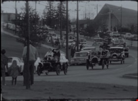
Easter parade and sod turning for Heritage Village
https://search.heritageburnaby.ca/link/museumdescription13054
- Repository
- Burnaby Village Museum
- Date
- April 11, 1971 (date of original), digitized in 2020
- Collection/Fonds
- Burnaby Centennial '71 Committee collection
- Description Level
- Item
- Physical Description
- 1 film reel (2 min., 22 sec.) : polyester, b&w, si. ; 16 mm
- Scope and Content
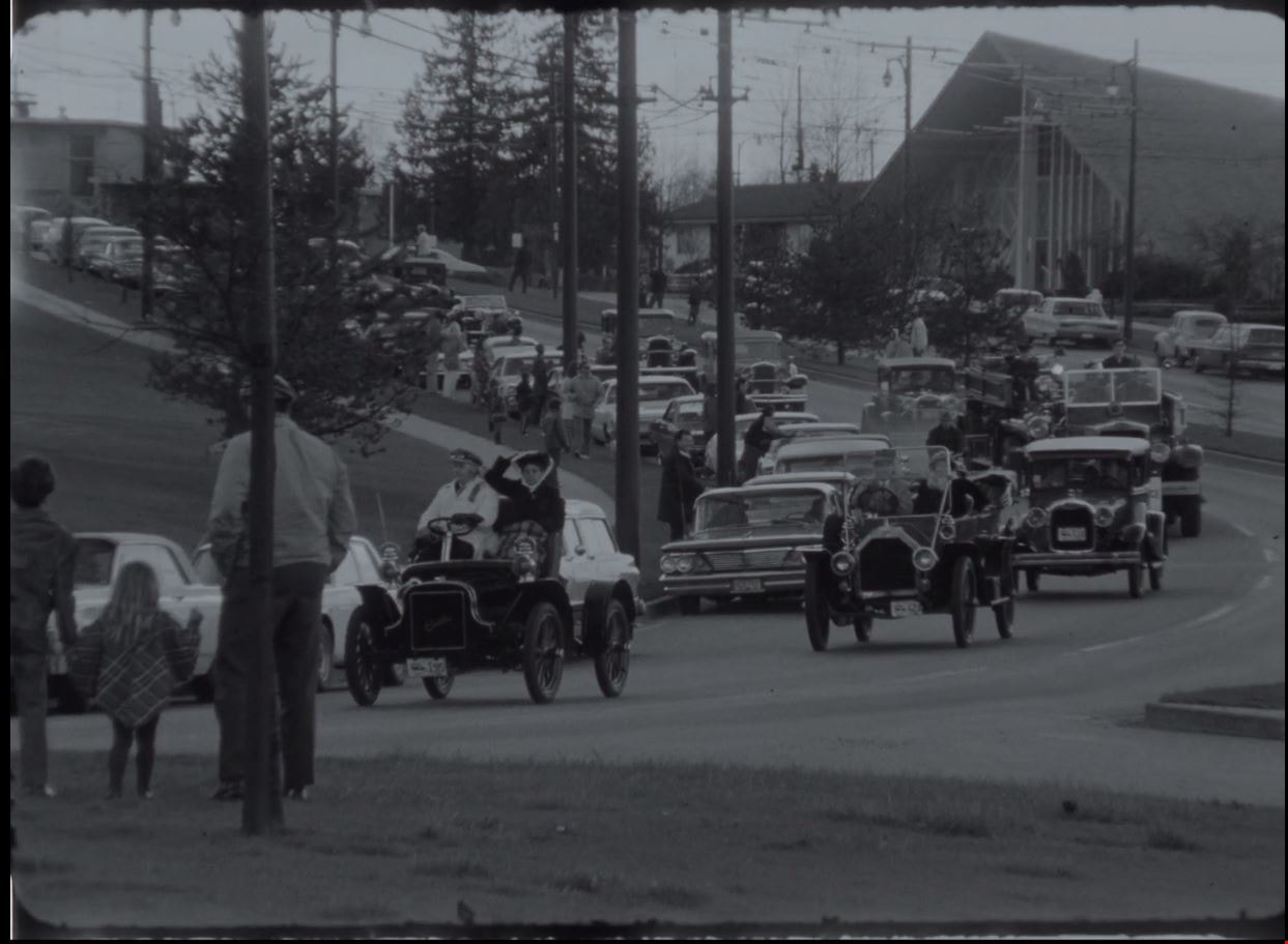
- Item consists of silent film footage of CBC news broadcast from April 11, 1971. Film footage opens with an Easter Parade of vintage cars travelling from the Oakridge Shopping Centre in Vancouver and ending in Burnaby for the sod turning ceremony of Heritage Village Museum (now Burnaby Village Museu…
- Repository
- Burnaby Village Museum
- Collection/Fonds
- Burnaby Centennial '71 Committee collection
- Description Level
- Item
- Physical Description
- 1 film reel (2 min., 22 sec.) : polyester, b&w, si. ; 16 mm
- Material Details
- Film footage is silent
- Scope and Content
- Item consists of silent film footage of CBC news broadcast from April 11, 1971. Film footage opens with an Easter Parade of vintage cars travelling from the Oakridge Shopping Centre in Vancouver and ending in Burnaby for the sod turning ceremony of Heritage Village Museum (now Burnaby Village Museum). Members of the public, Mayor Bob Prittie and members of the Burnaby Centennial '71 committee are present for the sod turning event. Mayor Bob Prittie turns the sod with a large tractor with a front end scoop.
- Publisher
- Canadian Broadcasting Corporation
- Subjects
- Events - Parades
- Names
- Burnaby Village Museum
- Accession Code
- BV020.5.708
- Access Restriction
- No restrictions
- Reproduction Restriction
- May be restricted by third party rights
- Date
- April 11, 1971 (date of original), digitized in 2020
- Media Type
- Moving Images
- Notes
- Title based on content of film
- See BV018.42.1 for reformatted footage of this film that includes narration from the original CBC script that was read by an actor, recorded and added to the digitized content in 2011
Images
Video
Easter parade and sod turning for Heritage Village, April 11, 1971 (date of original), digitized in 2020
Easter parade and sod turning for Heritage Village, April 11, 1971 (date of original), digitized in 2020
https://search.heritageburnaby.ca/media/hpo/_Data/_BVM_Moving_Images/2020_0005_0708_001.mp4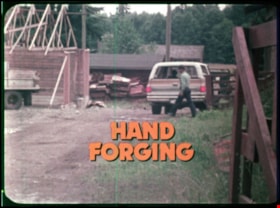
Hand forging
https://search.heritageburnaby.ca/link/museumlibrary7499
- Repository
- Burnaby Village Museum
- Collection
- Reference Collection
- Material Type
- Moving Images
- Accession Code
- BV020.5.707
- Call Number
- 682 BCE VR
- Place of Publication
- British Columbia
- Publisher
- A PEMC Production
- Publication Date
- 1978
- Physical Description
- 1 film reel (14 min., 14 sec.) : polyester, positive, col. , sd. ; 16 mm
- Library Subject (LOC)
- Blacksmithing
- Forging
- Tools
- Notes
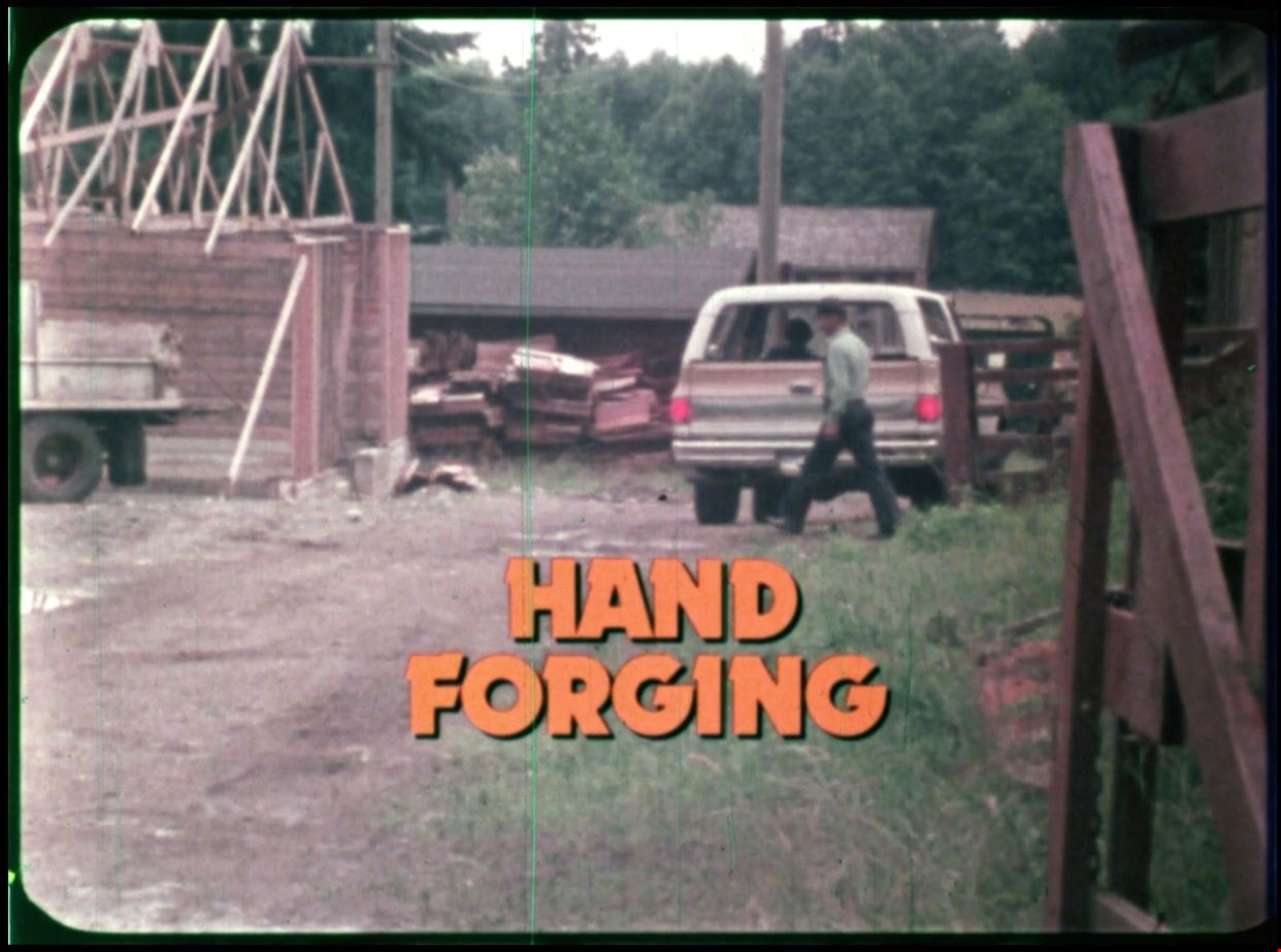
- Summary: Hand forging by constant hammering of red hot metal is contrasted with modern stamp forging where the metal is shaped by a stamp and die method of precision. Bob Marshall is a ferrier who's come to make new shoes for "Bonnie" a horse on a farm. Bob Marshall provides background on his work as a ferrier. He works on hand forging horseshoes for the horse and describes the blacksmithing process as he goes. Footage also includes scenes of blacksmiths at work in blacksmith shops including; Burnaby's Heritage Village and Mariner Shipbuilders and Canadian Chain and Forge Co. Ltd. Jim Moffett narrates and describes the blacksmithing process and tools that are used.
- Contact Burnaby Village Museum to view film
Images

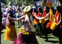
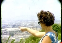
Hawaii
https://search.heritageburnaby.ca/link/archivedescription85436
- Repository
- City of Burnaby Archives
- Date
- 1970
- Collection/Fonds
- George H.F. McLean fonds
- Description Level
- Item
- Physical Description
- 1 digital file ( 4 min., 30 sec ) : digital , col., si.
- Scope and Content
- Item consists of one silent colour film of Edna and George McLean's visit to Hawaii. The film opens with blurry footage of Hawiian hula dancers and switches to aerial views of the Hawaiian islands, the oceanside and coastal views. The film closes with Edna McLean exiting an airplane and views of p…
- Repository
- City of Burnaby Archives
- Date
- 1970
- Collection/Fonds
- George H.F. McLean fonds
- Physical Description
- 1 digital file ( 4 min., 30 sec ) : digital , col., si.
- Description Level
- Item
- Record No.
- 567-001-21
- Access Restriction
- No restrictions
- Reproduction Restriction
- May be restricted by third party rights
- Accession Number
- 2014-03
- Scope and Content
- Item consists of one silent colour film of Edna and George McLean's visit to Hawaii. The film opens with blurry footage of Hawiian hula dancers and switches to aerial views of the Hawaiian islands, the oceanside and coastal views. The film closes with Edna McLean exiting an airplane and views of palm trees.
- Media Type
- Moving Images
- Photographer
- McLean, George H.F.
- Notes
- Title based on content of film
- Films originated in an 8mm format and were digitized by George McLean before being donated to the CBA
Images
Video
Hawaii, 1970

Interviews with Bill and Albert Parker by Colin Stevens January 17, 1992
https://search.heritageburnaby.ca/link/museumdescription9840
- Repository
- Burnaby Village Museum
- Date
- 1920-1930 (interview content), interviewed January 17, 1992 (date of original), digitized 2020
- Collection/Fonds
- Burnaby Village Museum fonds
- Description Level
- Item
- Physical Description
- 1 videocassette (53 min., 14 sec.) : col. , sd.
- Scope and Content
- Film footage documenting informal interviews with brothers William “Bill” and Albert Parker conducted by Burnaby Village Museum curator, Colin Stevens. The footage opens in the administration building of the Burnaby Village Museum where Bill Parker describes a pair of cross country skis that he is …
- Repository
- Burnaby Village Museum
- Collection/Fonds
- Burnaby Village Museum fonds
- Series
- Jesse Love farmhouse series
- Description Level
- Item
- Physical Description
- 1 videocassette (53 min., 14 sec.) : col. , sd.
- Material Details
- Interviewer: Colin Stevens
- Interviewee:William (Bill) Parker; Albert Parker; Mrs. William Parker
- Location of Interview: Jesse Love farmhouse at the Burnaby Village Museum
- Camera: Susan Green and Colin Stevens
- Scope and Content
- Film footage documenting informal interviews with brothers William “Bill” and Albert Parker conducted by Burnaby Village Museum curator, Colin Stevens. The footage opens in the administration building of the Burnaby Village Museum where Bill Parker describes a pair of cross country skis that he is donating to the museum. Bill recollects how he constructed the skis out of cedar in the late 1920s when he was about 9 or 10 years old. Bill tells of how he skied in the neighbourhood of the Jesse Love farmhouse on Cumberland Road, using the skis until the mid to late 1930s. The film continues with a tour of the Jesse Love farmhouse which is under restoration on site of the Burnaby Village Museum. Curator Colin Stevens takes Albert and Bill Parker through various rooms inside of the house sharing details of what staff have discovered during the restoration process and gathers informative details by interviewing them. During the interviews, the brothers recollect what it was like living in the house in the 1920s. They provide details on the house’s construction, fixtures, heating and water systems along with particulars regarding furnishings and décor. Information that was gathered through interviews such as this, supported the restoration to be completed as accurately as possible.
- History
- Albert and William Charles “Bill” Parker are the sons of Sarah Parker (nee Love) and William Parker. Sarah Parker was the daughter of Jesse and Martha Love and grew up in the Love farmhouse located at 1390 Cumberland Road in Burnaby. Sarah and William Parker and their three children (Albert, Bill and Elsie) moved into the Love farmhouse in about 1925, eventually buying it in 1928 following the death of Sarah’s father Jesse Love. Sarah continued to live in the house until after her husband William died and eventually sold the house to her daughter Elsie Hughes and her husband John Hughes in 1966.
- Creator
- Burnaby Village Museum
- Subjects
- Sports - Skiing
- Buildings - Heritage
- Accession Code
- BV018.41.50
- Access Restriction
- Restricted access
- Reproduction Restriction
- May be restricted by third party rights
- Date
- 1920-1930 (interview content), interviewed January 17, 1992 (date of original), digitized 2020
- Media Type
- Moving Images
- Photographer
- Green, Susan
- Stevens, Colin
- Notes
- Title based on contents of video
- Video was digitized to mp4 in March 2020 from original VHS tape
Images

Video
Interviews with Bill and Albert Parker by Colin Stevens January 17, 1992, 1920-1930 (interview content), interviewed January 17, 1992 (date of original), digitized 2020
Interviews with Bill and Albert Parker by Colin Stevens January 17, 1992, 1920-1930 (interview content), interviewed January 17, 1992 (date of original), digitized 2020
https://search.heritageburnaby.ca/media/hpo/_Data/_BVM_Moving_Images/2018_0041_0050_001.mp4![Interview with Kanwal Singh Neel, [1973-2023] (interview content), interviewed 5 Jul. 2023 thumbnail](/media/hpo/_Data/_BVM_Sound_Recordings/Oral_Histories/2023_0016_0011_002.jpg?width=280)
Interview with Kanwal Singh Neel
https://search.heritageburnaby.ca/link/museumdescription19607
- Repository
- Burnaby Village Museum
- Date
- [1973-2023] (interview content), interviewed 5 Jul. 2023
- Collection/Fonds
- Burnaby Village Museum fonds
- Description Level
- Item
- Physical Description
- 1 video recording (mp4) (50 min., 32 sec.) : digital, col., sd., stereo ; 30 fps
- Scope and Content
- Item consists of a recording of an oral history interview with Kanwal Singh Neel conducted by Burnaby Village Museum Registrar, Rajdeep. The interview was conducted and recorded on the Zoom platform. 00:00 – 00:06:47 Kanwal shares some of the mentors that influenced him in his life, education and …
- Repository
- Burnaby Village Museum
- Collection/Fonds
- Burnaby Village Museum fonds
- Series
- Museum Oral Histories series
- Subseries
- Many Voices Project Interviews subseries
- Description Level
- Item
- Physical Description
- 1 video recording (mp4) (50 min., 32 sec.) : digital, col., sd., stereo ; 30 fps
- Material Details
- Interviewer: Rajdeep Interviewee: Kanwal Singh Neel Interview Date: July 5, 2023 Total Number of tracks: 1 Total Length of all Tracks: 50 min., 32 sec. Recording Device: Zoom video communication platform
- Scope and Content
- Item consists of a recording of an oral history interview with Kanwal Singh Neel conducted by Burnaby Village Museum Registrar, Rajdeep. The interview was conducted and recorded on the Zoom platform. 00:00 – 00:06:47 Kanwal shares some of the mentors that influenced him in his life, education and career, how his three-year grandson has been an inspiration and how important it is to educate yourself in different ways. 00:06:48 - 00:19:02 Kanwal talks about the diversity in the schools that he’s encountered over the years as a student and as an educator and shares his experiences getting hired as an educator on public television and being known as "the math guy". 00:19:03 - 00:46:39 Kanwal talks about the “Friends of Simon” tutoring out-reach program and his involvement. 00:26:40 - 00:30:24 Kanwal shares his experiences officiating the Canada Summer Games, the Harry Jerome Track Classic, the Commonwealth Games and other world class sporting events. 00:30:25 - 00:38:58 Kanwal describes a typical day while working at Simon Fraser University as Associate Director of Professional Programs, as a sports official and his involvement with Friends of Simon. Kanwal speaks about the importance of finding a balance between staying connected, finding your purpose and carrying on the passions that you enjoy. Kanwal talks about some of his favourite places in Burnaby including Simon Fraser University, Burnaby Mountain, Deer Lake and Central Park. 00:38:59 - 00:43:31 Kanwal talks about the changes that he’s seen in the lower mainland over his life time including; diminishing agricultural land, the fishing industry, public transportation, housing and retail infrastructure and homelessness. 00:43:32 - 00:50:32 Kanwal talks about his involvement with the Punjabi Cultural Association, the introduction of Punjabi language courses in public schools and his involvement in a Bhangra event. Kanwal imparts a final message to youth of today emphasizing the importance of, building relationships, giving back to your community, learning through education and being respectful of your own journey and others.
- History
- Interviewee biography: Kanwal Singh Neel was born in Mombasa, Kenya in 1953 and immigrated with his family to Canada in 1969. For the first few weeks after immigrating the family stayed at the Sikh Temple on Second Avenue before moving into a house which they rented. Kanwal attended Kitsilano Secondary School and later transferred to Steveston High School when his family moved to Richmond. In 1972, Kanwal and friends formed a bhangra group "Punjab Cultural Association" and in 1974 they performed at the World Exposition in Spokane, Washington. The group performed at various venues including the Pacific National Exhibition and other cities in the Province. In 1973, Kanwal was an officiate during the Canada Summer Games at Swangard Stadium in Burnaby. Kanwal obtained a Bachelor’s of Science Degree from University of British Columbia in computer science and mathematics and got his first teaching job in 1977. In 1978, he was an officiate of the Commonwealth Games in Edmonton, Alberta. Over the next ten years he devoted himself to becoming an educator and during this time he became more involved with the B.C. Math Teachers Association. Kanwal and his wife Nancy married in 1982 and have two daughters. In the early 1990's, Kanwal joined Simon Fraser University as a faculty associate to work, train and mentor student teachers. Kanwal became President of the B.C. Math Teachers Association and travelled throughout the province to help solve issues being faced by students. In 1993, he co-hosted a TV show "Math Shop" on The Knowledge Network and he later co-authored a textbook series titled "Math Makes Sense". Kanwal continued to advance his knowledge in the field of mathematics obtaining a Doctorate from Simon Fraser University in 2008. Kanwal developed his doctoral work in Haida Gwaii, studying the mathematics that the Haida peoples used in day to day life, applying the applications and integrating the mathematics concepts with their cultural knowledge. Kanwal also worked with the Sḵwx̱wú7mesh Nation and the Stó:lō Nation in helping to develop resources for them. Kanwal has been recognized with various awards and honours including being awarded an honorary doctorate by Kwantlen Polytechnic University and in 2017 as an inductee in the Sports Wall of Fame in Richmond for his outstanding contribution to amateur sport as an International Athletics Official. Since retirement, Kanwal continues to be involved in a project at Simon Fraser University "Friends of Simon" where university students go out and mentor and tutor immigrant and refugee children from South Asia and Africa and other countries. Interviewer biography: Rajdeep was born and raised in the Lower Mainland and is of Punjabi (South Asian) descent. She has an Associate of Arts degree in Asian Studies from Kwantlen Polytechnic University, a Bachelor of Arts (Hons.) in Anthropology from the University of British Columbia. She is a student in the Restoration of Natural Systems program at the University of Victoria. Rajdeep works at Simon Fraser University as a Program Assistant and as a researcher with the City of Burnaby. At Burnaby Village Museum, Rajdeep contributed to the exhibit “Truths Not Often Told: Being South Asian in Burnaby”.
- Creator
- Burnaby Village Museum
- Subjects
- Persons - South Asian Canadians
- Education
- Social Issues
- Social Issues - Racism
- Sports
- Events - Competitions
- Housing
- Performances
- Names
- Neel, Kanwal Singh
- Simon Fraser University
- Friends of Simon
- Canada Summer Games
- Swangard Stadium
- Punjabi Cultural Association
- Responsibility
- Rajdeep
- Geographic Access
- Burnaby Mountain Conservation Area
- Central Park
- Accession Code
- BV023.16.11
- Date
- [1973-2023] (interview content), interviewed 5 Jul. 2023
- Media Type
- Moving Images
- Notes
- Title based on contents of item
Images
![Interview with Kanwal Singh Neel, [1973-2023] (interview content), interviewed 5 Jul. 2023 thumbnail](/media/hpo/_Data/_BVM_Sound_Recordings/Oral_Histories/2023_0016_0011_002.jpg)
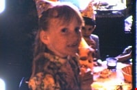
McLean family recreational activities and visit to Hawaii
https://search.heritageburnaby.ca/link/archivedescription85437
- Repository
- City of Burnaby Archives
- Date
- 1970
- Collection/Fonds
- George H.F. McLean fonds
- Description Level
- Item
- Physical Description
- 1 digital file ( 4 min., 22 sec ) : digital , col., si.
- Scope and Content
- Item consists of one silent colour film of the McLean family participating in a variety of recreational activities and a visit to Hawaii. The film opens with a birthday party celebration for Teresa McLean's eighth birthday followed by family members checking out a convertible car, playing golf, boa…
- Repository
- City of Burnaby Archives
- Date
- 1970
- Collection/Fonds
- George H.F. McLean fonds
- Physical Description
- 1 digital file ( 4 min., 22 sec ) : digital , col., si.
- Description Level
- Item
- Record No.
- 567-001-22
- Access Restriction
- No restrictions
- Reproduction Restriction
- May be restricted by third party rights
- Accession Number
- 2014-03
- Scope and Content
- Item consists of one silent colour film of the McLean family participating in a variety of recreational activities and a visit to Hawaii. The film opens with a birthday party celebration for Teresa McLean's eighth birthday followed by family members checking out a convertible car, playing golf, boating off Bowyer Island, Teresa McLean ridinig a minature train, and visiting the zoo and Vancouver Aquarium in Stanley Park. The film continues with views of the Hawaiian oceanside, islands, Hawaiian dancers and musicians and closes with Edna McLean learning to hawaiian dance with a group.
- Subjects
- Celebrations - Birthdays
- Recreational Activities - Golf
- Recreational Activities - Boating
- Recreational Activities - Dancing
- Geographic Features - Islands
- Media Type
- Moving Images
- Photographer
- McLean, George H.F.
- Notes
- Title based on content of film
- Films originated in an 8mm format and were digitized by George McLean before being donated to the CBA
Images

Video
McLean family recreational activities and visit to Hawaii, 1970
McLean family recreational activities and visit to Hawaii, 1970
https://search.heritageburnaby.ca/media/hpo/_Data/_Archives_Moving_Images/_Unrestricted/567-001-22.m4v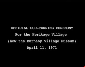
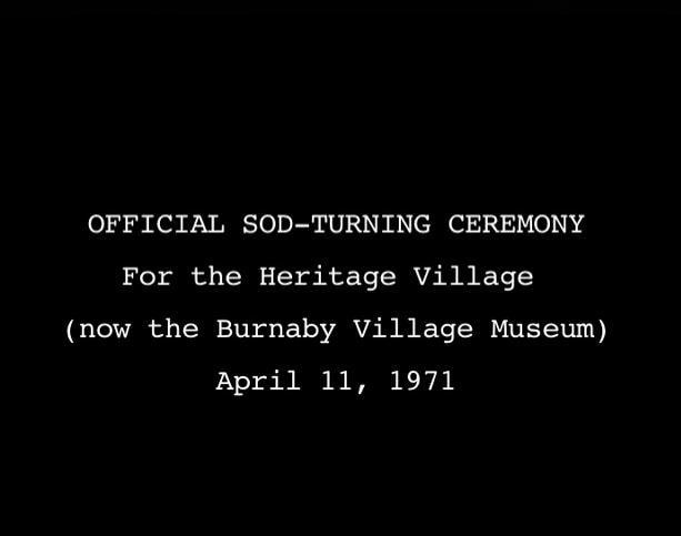
Official Sod Turning Ceremony for Heritage Village
https://search.heritageburnaby.ca/link/museumdescription9776
- Repository
- Burnaby Village Museum
- Date
- April 11 1971 (date of original), digitized in 2011
- Collection/Fonds
- Burnaby Centennial '71 Committee collection
- Description Level
- Item
- Physical Description
- 1 video recording (mp4) (3 min., 11 sec.) : digital, 29 fps, b&w, sd., stereo
- Scope and Content
- Film of Vintage car parade ending with the sod turning ceremony at Heritage Park Museum. CBC news item April 11, 1971.
- Repository
- Burnaby Village Museum
- Collection/Fonds
- Burnaby Centennial '71 Committee collection
- Description Level
- Item
- Physical Description
- 1 video recording (mp4) (3 min., 11 sec.) : digital, 29 fps, b&w, sd., stereo
- Material Details
- Script read by Mike Dobson
- Film footage was edited and digitized by Oliver Glaser at Newsreel Productions
- Audio production by emBall Productions
- Scope and Content
- Film of Vintage car parade ending with the sod turning ceremony at Heritage Park Museum. CBC news item April 11, 1971.
- History
- This footage was originally shot in 16 mm, on Sunday, April 11, 1971, and broadcast on CBC television. The original footage was silent: when it was broadcast, a news announcer read from a script to describe the events. In 2011, the footage was digitized. The original script was read by an actor, recorded, and added to the digitized footage to create this film.
- Subjects
- Events - Parades
- Names
- Burnaby Village Museum
- Responsibility
- Canadian Broadcasting Corporation
- Geographic Access
- Deer Lake Avenue
- Accession Code
- BV018.42.1
- Access Restriction
- No restrictions
- Reproduction Restriction
- May be restricted by third party rights
- Date
- April 11 1971 (date of original), digitized in 2011
- Media Type
- Moving Images
- Historic Neighbourhood
- Burnaby Lake (Historic Neighbourhood)
- Planning Study Area
- Burnaby Lake Area
- Notes
- Transcribed title
- BV020.5.708 is the original 16mm silent film that this film was created from
Images
Video
Official Sod Turning Ceremony for Heritage Village, April 11 1971 (date of original), digitized in 2011
Official Sod Turning Ceremony for Heritage Village, April 11 1971 (date of original), digitized in 2011
https://search.heritageburnaby.ca/media/hpo/_Data/_BVM_Moving_Images/2018_0042_0001_001.mp4![Survey and Subdivision plans in New Westminster District Group 1 – Burnaby
, [1861]-[1910] thumbnail](/media/hpo/_Data/_BVM_Cartographic_Material/1977/1977_0093_0019a_001.jpg?width=280)
Survey and Subdivision plans in New Westminster District Group 1 – Burnaby
https://search.heritageburnaby.ca/link/museumdescription6988
- Repository
- Burnaby Village Museum
- Date
- [1861]-[1910]
- Collection/Fonds
- Burnaby Village Museum Map collection
- Description Level
- File
- Physical Description
- 14 plans : 3 plans : black ink on paper hand col. + 7 plans : black ink on paper + 4 plans : graphite on paper mounted on 2 sides of cardboard 76 x 102 cm
- Scope and Content
- Item consists of a large board of four New Westminster District Gp 1 - subdivision plans mounted on one side and ten New Westminster District Gp 1 - subdivision plans mounted on the other side. Side A: 1. "Plan /of / Lots 166A, 166 and 167 /, Gr.1, N.W.D. / Showing Misconstructed Roads in Gree…
- Repository
- Burnaby Village Museum
- Collection/Fonds
- Burnaby Village Museum Map collection
- Description Level
- File
- Physical Description
- 14 plans : 3 plans : black ink on paper hand col. + 7 plans : black ink on paper + 4 plans : graphite on paper mounted on 2 sides of cardboard 76 x 102 cm
- Material Details
- Scales [between 1:2376 and 1:7920]
- Index number on edge of board reads: "19"
- Scope and Content
- Item consists of a large board of four New Westminster District Gp 1 - subdivision plans mounted on one side and ten New Westminster District Gp 1 - subdivision plans mounted on the other side. Side A: 1. "Plan /of / Lots 166A, 166 and 167 /, Gr.1, N.W.D. / Showing Misconstructed Roads in Green / 5 chs = 1 in.". (plan is drawn in black ink and hand coloured in red, green and orange ink). A section in the centre of the plan is coloured in red ink and identified as "C.S. Richmond" running from the North Arm of Fraser River to Wiggins Road and divided by "New Wiggins Rd. (as gazetted)" (coloured in orange ink) and two"Constructed Road(s)" (coloured in green ink). Plan is initialed by: "RB" [sic] (in blue pencil crayon) 2. Plan of / Subdivision of / Lot 166 / Group One / New Westminster District / Scale 4 chs = 1 in. / Map No 524". Plan is drawn in graphite and signed by "Surrig [sic] Welhams [sic] / P.L.S." Plan is initialed by: "RB" [sic] (in blue pencil crayon) 3. Plan of "Survey / of Highway / For / Burnaby Council / in / Lots 13 _14 / Group One / Scale 4 chs = 1 in." Signed by "Albert J. Hill, P.L.S." Caribou Street and Caribou Road run through the centre of the plan. Plan is stamped: "Albert J. Hill, Civil Engineer / and / Provincial Land Surveyor, / New Westminster, / B.C.". Plan is initialed by: "RB" [sic] (in blue pencil crayon) 4. A Plan of Lots 166A, 166 and 167, Group One, New Westminster District (drawn in graphite). A section in the centre of the plan is identified as "C.S. Richmond" running from the North Arm of Fraser River and divided by "New Wiggins Rd. (as gazetted)" and two "Constructed Road(s)". Plan is initialed by: "RB" [sic] (in blue pencil crayon) Side B: 1. Small plan drawn in black ink (no title) identifying lots north of the "North Arm" of the Fraser River. Lots identified include: Lot 99, Lot 98, Lot 157, Lot 158, Lot 163, Lot 162, Lot 159, Lot 163, Lot 162, Lot 165, Lot 166A, Lot 155B, Lot 155A and Lot 159. "Scale 40 chains to one inch" . Plan is initialed by: "RB" [sic] (in blue pencil crayon) (Geographic location: Burnaby) 2. Small plan drawn in black ink (no title) identifying lots north of the North Arm of the Fraser River as "Lots 155, 155A, 155B, 155C, 162, 163, 164, 165, 166A and 167". Plan is initialed by: "RB" [sic] (in blue pencil crayon) (Geographic location: Burnaby) 3. Small plan drawn in black ink (no title) which identifies "Lot 151 / Reserve/ for / Race Course"; "Reserve / 64 A / L. 152 G.1"; and other Lots: 32, 33, 34, 35, 36, 38, 39. The plan is signed "Surveyor G.Turn [sic] July / 61 / from Vol 40 R.L. notes [sic]" Plan is stamped: "Albert J. Hill, Civil Engineer / and / Provincial Land Surveyor, / New Westminster, / B.C." Plan is initialed by: "RB" [sic] (in blue pencil crayon) (Geographic location: Burnaby) 4. Small plan drawn in black in with faded red colouring on centre lot identified as "Lot 34" running north from "Vancouver Road" . Plan is stamped: "Albert J. Hill, Civil Engineer / and / Provincial Land Surveyor, / New Westminster, / B.C." Plan is initialed by: "RB" [sic] (in blue pencil crayon) (Geographic location: Burnaby) 5. Plan drawn in graphite and identified as "Lot 98, Gr.1," along with the intials "RB" [sic] (both are handwritten in blue crayon pencil on top of plan) The B.C.E.Railway is identified running through the plan along with Jubilee Road and Royal Oak Road. The plan is signed with the name "Wm. Murray" and the Plan is stamped: "Albert J. Hill, Civil Engineer / and / Provincial Land Surveyor, / New Westminster, / B.C.". (Geographic location: Burnaby) 6. Plan drawn in graphite identified as "Port Lot 13, Gr.1" along with the intials "RB" [sic] (both are handwritten in blue crayon pencil on top of plan) Plan is stamped: "Albert J. Hill, Civil Engineer / and / Provincial Land Surveyor, / New Westminster, / B.C.". (Geographic location: Burnaby) 7.Plan drawn in black ink and identified as "Lot 98 G.1" along with the intials "RB" [sic] (both are handwritten in blue crayon pencil on top of plan). A "Road Reservation" is identified running north between "Electric Tramway" and connecting with "Royal Oak Road". Plan is stamped: "Albert J. Hill, Civil Engineer / and / Provincial Land Surveyor, / New Westminster, / B.C." (Geographic location: Burnaby) 8. Plan drawn in black ink and divided into two sections, the upper plan is identified as "Portion / Lots 100 / area / 101, Gr.1" and the lower plan is identified as "Portion L. 3 G. 1" along with the intials "RB" [sic] (these identifiers are handwritten in blue crayon pencil on top of the plan). Portions of Lot 100 and Lot 101 are each divided into 6 sections and the Portion of Lot 3 plan is divided into 24 sections. The plan includes a note in black ink that reads: " Received from Wm Fromme [sic] / from Wm. Trapp / Nov. 28, 1895 / A. J. T...[sic]". (Geographic location: Burnaby) 9. Plan drawn in black ink (no title) identifying soil, buildings and geographic features in southern Burnaby. The plan is bordered by "New Westminster City" (Tenth Avenue and DL 172) to the south east and DL 173 to the south, DL 158 to the west and the B.C.E. Tramway to the north. Plan includes District Lots: 155A, 158, 159, 171, 160, 53 and 95 and identifies soil, marshland and ravines throughout. Plan identifies the following features: a "Team Road" running through Lots 158 and 159 along with "Fair Orchard Soil / Even Surface Throughout / No Ravines", "Gravel and Shingle" (bottom of Lot 158), "North Arm Road" crossing "Byrne Road" and connecting with "Power House Road" which runs north to connect with "Highland Park Station" and the B.C.E. Tramway, "Power Ho" in the northeast corner of DL 160, a "Brook" connected with a "Deep Ravine" running between DL 53, DL 95 and DL 160 along with "Good Soil" and "Fair Orchard Soil" identified nearby in DL 95. Scale is identified as "10 chs = 1 in." Plan is stamped: "Albert J. Hill, Civil Engineer / and / Provincial Land Surveyor, / New Westminster, / B.C." Plan is initialed by: "RB" [sic] (in blue pencil crayon) (Geographic location: Burnaby) 10. Plan drawn in black ink (no title) with Burnaby Lake and Deer Lake at the centre. The plan is bordered by the following District Lots identified as: 117, 118 and 68 to the west, Lots 80, 79 and 85 to the southwest, Lots 11, 13, and 1 (City of New Westminster) to the south east, the North Road boundary to the east and Lots 8, 56, 57, 59, and 136 to the North. The lower right hand corner of the plan has a small inset which reads: "Burnaby Lake" and "Page 19 R.B. Notes". Plan is initialed by: "RB" [sic] (in blue pencil crayon) (Geographic location: Burnaby)
- Creator
- Hill, Albert James
- Accession Code
- HV977.93.19
- Access Restriction
- No restrictions
- Reproduction Restriction
- No known restrictions
- Date
- [1861]-[1910]
- Media Type
- Cartographic Material
- Scan Resolution
- 300
- Scale
- 72
- Notes
- Title based on contents of file
- Scale is measured in chains. (One chain equals 792 inches)
- The term "Lot" can also refer to a "District Lot”
- Some plans are stamped: "Albert J. Hill, Civil Engineer / and / Provincial Land Surveyor, / New Westminster, / B.C." and intialed: "RB" [sic]
Images
![Survey and Subdivision plans in New Westminster District Group 1 – Burnaby
, [1861]-[1910] thumbnail](/media/hpo/_Data/_BVM_Cartographic_Material/1977/1977_0093_0019a_001.jpg)

![Survey and Subdivision plans in New Westminster District Group 1 – Burnaby, Port Moody, [1862-1908] thumbnail](/media/hpo/_Data/_BVM_Cartographic_Material/1977/1977_0093_0026a_001.jpg?width=280)
Survey and Subdivision plans in New Westminster District Group 1 – Burnaby, Port Moody
https://search.heritageburnaby.ca/link/museumdescription6995
- Repository
- Burnaby Village Museum
- Date
- [1862-1908]
- Collection/Fonds
- Burnaby Village Museum Map collection
- Description Level
- File
- Physical Description
- 9 plans : 6 plans : black ink on paper ; 57 x 36.5 cm or smaller + 1 plan : black ink and grahite on paper ; 46.5 x 49 cm + 1 plan : blueprint on paper ; 15.5 x 19.5 cm + cm + 1 plan : graphite on paper ; 25 x 17 cm ; mounted on both sides of board 76 x 102 cm
- Scope and Content
- Item consists of a large board of four New Westminster District subdivision plans mounted on one side and five New Westminster District subdivision plans mounted on the other side. Side A: 1. "Plan / of Subdivision / of a Portion / of / Lot 87 / Group One / New Westminster District / Scale 4 chs…
- Repository
- Burnaby Village Museum
- Collection/Fonds
- Burnaby Village Museum Map collection
- Description Level
- File
- Physical Description
- 9 plans : 6 plans : black ink on paper ; 57 x 36.5 cm or smaller + 1 plan : black ink and grahite on paper ; 46.5 x 49 cm + 1 plan : blueprint on paper ; 15.5 x 19.5 cm + cm + 1 plan : graphite on paper ; 25 x 17 cm ; mounted on both sides of board 76 x 102 cm
- Material Details
- Scales [between 1:792 and 1:3600]
- Index number on edge of board reads: "26"
- Scope and Content
- Item consists of a large board of four New Westminster District subdivision plans mounted on one side and five New Westminster District subdivision plans mounted on the other side. Side A: 1. "Plan / of Subdivision / of a Portion / of / Lot 87 / Group One / New Westminster District / Scale 4 chs = 1 in". Plan is stamped: "Albert J. Hill, Civil Engineer / and / Provincial Land Surveyor, / New Westminster, / B.C." and intialed by: "RB" [sic] (in blue pencil crayon). Names two of the subdivisons of District Lot 87 are identified as, "L.E. Sprott" and "John Ledger". (Geographic location: Burnaby) 2. "Plan of Subdivision / of / Portions of / Lot 136, 131 and Lots 44 and 78 Gr.1 / New Westminster District / Scale 300 ft = 1 inch". Annotation above title reads: "No. 901 / Deposited in Land Registry Office / New Westminster / Aug. 19th 1905 / Charles S. Keith D. Reg." Annotations and signatures at bottom of plan read: "I, William Nelson Draper, / W.H.R. Collister / Charles E. Perkins / E.B. Morgan / make / Surveys / correct / representation / upon / the / Land Registry Act / (sgd) W.N. Draper, P.L.S.". Plan includes a handwritten title: "Lots 136, 131, 44 & 78" and is initialed: "RB" [sic] (in blue pencil crayon) (Geographic location: Burnaby) 3. "Survey / of / a Portion / of / Lot 95, Gr.1 / Scale 1 ch = 1in." Plan is stamped: "Albert J. Hill, Civil Engineer / and / Provincial Land Surveyor, / New Westminster, / B.C." and is initialed : "RB" [sic] (in blue pencil crayon) (Geographic location: Burnaby) 4. Blueprint plan of "Lot 396. Group One." with Scale : 3 chs = 1 in. A two acre portion of District Lot 396 is filled in with red ink." Plan is signed by "Albert J. Hill / B.C.L.S." (Geographic location: Port Moody) Side B: 1. Plan titled "District Lot 92 / Burnaby / Municipality / for sale by / Mahon / McFarland & / Mahon Ltd. / Vancouver, B.C. / Scale : 4 chains to one inch". District Lot 92 is subdivided into 161 lots and identifies roads: Norwich Road, Pole Line Road, Oakland Road, Stanley Road, Burford Road, Dalhousie Road, Brantford Road, Colborne Road, Roberts Road, Vancouver & Westminster Road, B.C. Electric Railway, Gilley Stn. and Burnaby (Power House). The bottom of the plan reads: "G.S. Dawson, P.LS. Vancouver, B.C." (Geographic location: Burnaby) 2. "Plan / of Subdivision / of a Portion / of / Lot 29 / Group 1 / New Westminster District / Scale 2 chs = 1 in". Plan is stamped: "Albert J. Hill, Civil Engineer / and / Provincial Land Surveyor, / New Westminster, / B.C." and is initialed by: "RB" [sic] (in blue pencil crayon) (Geographic location: Burnaby) 3. Small handrawn plan (no title) identifying "Lot 84 / Hydes, Claim" at the centre surrounded by lots and features identified as: "Lot 85", "Lot 93", "Lot 94", "Lot 32", "Lot 82", "Lot 83", "Lot 79", "swamp" and a "Small Lake" (Burnaby Lake). Identifying marks in the right corner of the plan read: "Page 13 / Surveyed by G. Turner / May 62". Plan also includes surveyor's bearing measurements and trails to "Small Lake" (Burnaby Lake). (Geographic location: Burnaby) 4. Untitled plan showing District Lots west of North Road and north of Burnaby Lake including: Lots 2, 4, 6, 8, 15, 10, 56, 148, 57, 58, 40. and Lots 3, 5, 7 east of North Road (Coquitlam). Lots in Burnaby are identifed for timber including: "Heavily Timbered" (Lot 57), " "Some Fir and Cedar" (Lot 40), "Splendid Fir and Cedar" (Lot 143), "Heavy Fir etc" (Lots 143 and 148), " "Fine Cedar" (Lot 15), "Rough Light Timber" (Lot 56). Other features identified at the lower portion of the plan include "Burnaby Lake" and "Brunette River". (Geographic location: Burnaby) 5. Untitled plan drawn in graphite showing sections of District Lot 85 south of Burnaby Lake and north of Hazsard Road. Plan is signed: "Albert J. Hill / B.C.L.S." and dated "12/26/08". Plan is initialed by: "RB" [sic] (in blue pencil crayon) (Geographic location: Burnaby)
- Publisher
- Mahon, McFarland & Mahon Ltd
- Accession Code
- HV977.93.26
- Access Restriction
- No restrictions
- Reproduction Restriction
- No known restrictions
- Date
- [1862-1908]
- Media Type
- Cartographic Material
- Historic Neighbourhood
- Burnaby Lake (Historic Neighbourhood)
- Burquitlam (Historic Neighbourhood)
- Planning Study Area
- Burnaby Lake Area
- Scan Resolution
- 300
- Scale
- 72
- Notes
- Title based on contents of file
- Scale is measured in chains and feet. (One chain equals 792 inches)
- The term "Lot" can also refer to a "District Lot”
Images
![Survey and Subdivision plans in New Westminster District Group 1 – Burnaby, Port Moody, [1862-1908] thumbnail](/media/hpo/_Data/_BVM_Cartographic_Material/1977/1977_0093_0026a_001.jpg)


![Through the Lens of Andy Digney, [between 1934 and 1964] (date of original film), edited and narrated in 2016 thumbnail](/media/hpo/_Data/_BVM_Moving_Images/2019_0018_0001_001.JPG?width=280)
Through the Lens of Andy Digney
https://search.heritageburnaby.ca/link/museumdescription10099
- Repository
- Burnaby Village Museum
- Date
- [between 1934 and 1964] (date of original film), edited and narrated in 2016
- Collection/Fonds
- Burnaby Village Museum fonds
- Description Level
- Item
- Physical Description
- 1 video recording (mp4) (12 min., 17 sec.) : digital, 23 fps, col., sd., stereo
- Scope and Content
- Item consists of a short film featuring a compilation of film footage created by Andy Digney that was edited and narrated by the Burnaby Village Museum. Burnaby resident Andy Digney captured footage of Burnaby and beyond from 1934 to 1964. Highlights within this film compilaton include the constru…
- Repository
- Burnaby Village Museum
- Collection/Fonds
- Burnaby Village Museum fonds
- Description Level
- Item
- Physical Description
- 1 video recording (mp4) (12 min., 17 sec.) : digital, 23 fps, col., sd., stereo
- Material Details
- Research and Narration: Lisa Codd
- Editing and Audio Recording: Matthew Ball
- Special thanks to Paul Digney
- Scope and Content
- Item consists of a short film featuring a compilation of film footage created by Andy Digney that was edited and narrated by the Burnaby Village Museum. Burnaby resident Andy Digney captured footage of Burnaby and beyond from 1934 to 1964. Highlights within this film compilaton include the construction and events held at the Oak Theatre; Royal visit motorcade of King George VI and Queen Elizabeth; Sports Day at Central Park; Gymcana event at Burnaby Lake Riding Stables; lawn bowling at Central Park; a Depression-era May Day workers’ parade in 1936; May Day celebrations in Burnaby; visits to locations throughout the Lower Mainland, including Stanley Park, Capilano Suspension Bridge, Grouse Mountain and boat trip up Burrard Inlet; the Digney Speedway; the Digney family at their home on Bonsor Avenue and the Digney Bowling Alley.
- Creator
- Digney, Andy
- Names
- Digney, Andy
- Digney Bowling Alley
- Digney Speedway
- Codd, Lisa
- Oak Theatre
- Burnaby Lawn Bowling Club
- Geographic Access
- Kingsway
- Central Park
- Street Address
- 6521 Bonsor Avenue
- Accession Code
- BV019.18.1
- Access Restriction
- No restrictions
- Reproduction Restriction
- No known restrictions
- Date
- [between 1934 and 1964] (date of original film), edited and narrated in 2016
- Media Type
- Moving Images
- Related Material
- See also the City of Burnaby Archives "Digney Family fonds" MI catalogue 562.003 for film masters
- Notes
- Title based on contents
- City of Burnaby Archives holds the original Digney film masters (562.003) that this narrated segment was disseminated from. See Digney family fonds
Images
![Through the Lens of Andy Digney, [between 1934 and 1964] (date of original film), edited and narrated in 2016 thumbnail](/media/hpo/_Data/_BVM_Moving_Images/2019_0018_0001_001.JPG)
Video
Through the Lens of Andy Digney, [between 1934 and 1964] (date of original film), edited and narrated in 2016
Through the Lens of Andy Digney, [between 1934 and 1964] (date of original film), edited and narrated in 2016
https://search.heritageburnaby.ca/media/hpo/_Data/_BVM_Moving_Images/2019_0018_0001_001.mp4
Visit to Hawaii and horseback riding
https://search.heritageburnaby.ca/link/archivedescription85438
- Repository
- City of Burnaby Archives
- Date
- 1970
- Collection/Fonds
- George H.F. McLean fonds
- Description Level
- Item
- Physical Description
- 1 digital file ( 3 min., 10 sec ) : digital , col., si.
- Scope and Content
- Item consists of one silent colour film of the McLean family visiting Hawaii. The film opens with Edna McLean sightseeing and views of the Hawaiian countryside, cities, monuments, buildings, trees and ocean. The film switches to Teresa McLean playing in a swimming pool and closes with Teresa feedin…
- Repository
- City of Burnaby Archives
- Date
- 1970
- Collection/Fonds
- George H.F. McLean fonds
- Physical Description
- 1 digital file ( 3 min., 10 sec ) : digital , col., si.
- Description Level
- Item
- Record No.
- 567-001-23
- Access Restriction
- No restrictions
- Reproduction Restriction
- May be restricted by third party rights
- Accession Number
- 2014-03
- Scope and Content
- Item consists of one silent colour film of the McLean family visiting Hawaii. The film opens with Edna McLean sightseeing and views of the Hawaiian countryside, cities, monuments, buildings, trees and ocean. The film switches to Teresa McLean playing in a swimming pool and closes with Teresa feeding a horse, and horseback riding with friends looking on.
- Media Type
- Moving Images
- Photographer
- McLean, George H.F.
- Notes
- Title based on content of film
- Films originated in an 8mm format and were digitized by George McLean before being donated to the CBA
Images
Video
Visit to Hawaii and horseback riding, 1970
Visit to Hawaii and horseback riding, 1970
https://search.heritageburnaby.ca/media/hpo/_Data/_Archives_Moving_Images/_Unrestricted/567-001-23.m4v![Yellowstone National Park and Birthday Party, [Between 1963 - 1970] thumbnail](/media/Hpo/_Data/_Archives_Moving_Images/_Unrestricted/567-001-8.jpg?width=280)
Yellowstone National Park and Birthday Party
https://search.heritageburnaby.ca/link/archivedescription85423
- Repository
- City of Burnaby Archives
- Date
- [Between 1963 - 1970]
- Collection/Fonds
- George H.F. McLean fonds
- Description Level
- Item
- Physical Description
- 1 digital file ( 4 min., 19 sec ) : digital , col., si.
- Scope and Content
- Item consists of one silent colour film and opens with footage of the McLean family visiting the Old Faithfull Geyser at Yellowstone National Park and switches to Teresa McLean and friend with hula skirts dancing in a backyard, followed by footage of young girls playing games at Teresa's eighth bir…
- Repository
- City of Burnaby Archives
- Date
- [Between 1963 - 1970]
- Collection/Fonds
- George H.F. McLean fonds
- Physical Description
- 1 digital file ( 4 min., 19 sec ) : digital , col., si.
- Description Level
- Item
- Record No.
- 567-001-8
- Access Restriction
- No restrictions
- Reproduction Restriction
- May be restricted by third party rights
- Accession Number
- 2014-03
- Scope and Content
- Item consists of one silent colour film and opens with footage of the McLean family visiting the Old Faithfull Geyser at Yellowstone National Park and switches to Teresa McLean and friend with hula skirts dancing in a backyard, followed by footage of young girls playing games at Teresa's eighth birthday party at the McLean family home on Halley Avenue.
- Names
- McLean, Teresa
- Media Type
- Moving Images
- Photographer
- McLean, George H.F.
- Notes
- Title based on content of film
- Films originated in an 8mm format and were digitized by George McLean before being donated to the CBA
- Street Address
- 4378 Halley Avenue
- Historic Neighbourhood
- Broadview (Historic Neighbourhood)
- Planning Study Area
- Cascade-Schou Area
Images
![Yellowstone National Park and Birthday Party, [Between 1963 - 1970] thumbnail](/media/Hpo/_Data/_Archives_Moving_Images/_Unrestricted/567-001-8.jpg)
Video
Yellowstone National Park and Birthday Party, [Between 1963 - 1970]
Yellowstone National Park and Birthday Party, [Between 1963 - 1970]
https://search.heritageburnaby.ca/media/hpo/_Data/_Archives_Moving_Images/_Unrestricted/567-001-8.m4v