Narrow Results By
Decade
- 2020s 224
- 2010s 151
- 2000s
- 1990s 2872
- 1980s
- 1970s 3517
- 1960s 1358
- 1950s 1712
- 1940s 2148
- 1930s 2158
- 1920s 2488
- 1910s 2036
- 1900s 870
- 1890s 250
- 1880s 165
- 1870s
- 1860s 123
- 1850s 14
- 1840s 5
- 1830s 3
- 1820s 2
- 1810s 3
- 1800s 3
- 1790s 2
- 1780s 2
- 1770s 2
- 1760s 2
- 1750s 2
- 1740s 2
- 1730s 2
- 1720s 2
- 1710s 2
- 1700s 2
- 1690s 2
- 1680s 2
- 1670s 1
- 1660s 1
- 1650s 1
- 1640s 1
- 1630s 1
- 1620s 1
- 1610s 1
- 1600s 1
- 1590s 1
- 1580s 1
- 1570s 1
- 1560s 1
- 1550s
- 1540s 1
- 1530s 1
- 1520s 2
- 1510s 1
- 1500s 1
- 1490s 1
- 1480s 1
Subject
- Accidents 4
- Accidents - Automobile Accidents 7
- Adornment - Lapel Pins 1
- Advertising Medium 3
- Advertising Medium - Signs and Signboards 15
- Aerial Photographs 1
- Agricultural Tools and Equipment - Gardening Equipment 2
- Agriculture 3
- Agriculture - Farms 7
- Agriculture - Fruit and Berries 1
- Animals 7
- Animals - Birds 13

Stride Hill Neighbourhood
https://search.heritageburnaby.ca/link/landmark846
- Repository
- Burnaby Heritage Planning
- Associated Dates
- 1955-2008
- Heritage Value
- The residential areas that are located within the Stride Hill Neighbourhood were primarily developed in the 1950s during Burnaby's post-war building boom. The area lying to the south of Byrne Creek Ravine Park was used as a municipal garbage dump until the 1960s and as a landfill site for yard waste disposal until the early 1990s at which point the area was incorporated into the Edmonds Town Centre Plan and the land was made into park and open space.
- Historic Neighbourhood
- Edmonds (Historic Neighbourhood)
- Planning Study Area
- Stride Hill Area
Images


Suncrest Neighbourhood
https://search.heritageburnaby.ca/link/landmark839
- Repository
- Burnaby Heritage Planning
- Associated Dates
- 1955-2008
- Heritage Value
- The Suncrest Neighbourhood is a small residential area south of Burnaby's Central Park. The Ocean View Burial Park takes up a large area of land in the north-east corner of this neighbourhood and the majority of the housing was built during the 1930-1960 period.
- Historic Neighbourhood
- Alta Vista (Historic Neighbourhood)
- Planning Study Area
- Suncrest Area
Images


Sussex Avenue School
https://search.heritageburnaby.ca/link/landmark815
- Repository
- Burnaby Heritage Planning
- Geographic Access
- Irmin Street
- Associated Dates
- 1955-1982
- Heritage Value
- Sussex Avenue school was another school built during the peak expansion years of the 1950s and early 1960s. Burnaby's population was growing at such a fast pace during that decade that 10 new schools were built, and existing schools were expanded. Sussex Avenue School opened with 304 pupils. By the 1970s, student enrolment had slowed considerably from its peak and as a result, a number of schools - including Sussex - were closed.
- Historic Neighbourhood
- Alta Vista (Historic Neighbourhood)
- Planning Study Area
- Sussex-Nelson Area
- Street Address
- 4443 Irmin Street
Images

Sussex-Nelson Neighbourhood
https://search.heritageburnaby.ca/link/landmark838
- Repository
- Burnaby Heritage Planning
- Associated Dates
- 1955-2008
- Heritage Value
- The Sussex-Nelson Neighbourhood is located just south of Metrotown and in 1980 was characterised as the most populated of all of Burnaby's Planning Study areas. The area immediately south of Metrotown was initially developed as post-war 1950s housing stock, while the sector south of Rumble was developed after the 1960s and 1970s as single-family housing.
- Historic Neighbourhood
- Alta Vista (Historic Neighbourhood)
- Planning Study Area
- Sussex-Nelson Area
Images


Taylor Park Elementary School
https://search.heritageburnaby.ca/link/landmark847
- Repository
- Burnaby Heritage Planning
- Geographic Access
- Mission Avenue
- Associated Dates
- 2004
- Heritage Value
- Taylor Park Elementary School was opened in 2004 with 240 students from kindergarten to grade three (with older students attending Stride Avenue Community School). By 2006, Taylor Park had been designated as its own school and extended its classes from kindergarten through grade six.
- Historic Neighbourhood
- Edmonds (Historic Neighbourhood)
- Planning Study Area
- Stride Hill Area
- Street Address
- 7590 Mission Avenue
- Street View URL
- Google Maps Street View
Images


West Central Valley Neighbourhood
https://search.heritageburnaby.ca/link/landmark778
- Repository
- Burnaby Heritage Planning
- Associated Dates
- 1955-2008
- Heritage Value
- The West Central Valley Neighbourhood is home to the Bridge Business Park and is a primarily industrial neighbourhood. Similar to the adjacent Dawson-Delta Neighbourhood, West Central Valley offers businesses convenient access to major roads and highways.
- Historic Neighbourhood
- Broadview (Historic Neighbourhood)
- Planning Study Area
- West Central Valley Area
Images


Westridge Neighbourhood
https://search.heritageburnaby.ca/link/landmark791
- Repository
- Burnaby Heritage Planning
- Associated Dates
- 1955-2008
- Heritage Value
- The Westridge Neighbourhood is effectively separated into two areas by Inlet Drive. To the west of the highway lies a typical 1950s subdivision of single-family homes, while to the east is a newer (1970s) subdivision featuring larger lots and some low-rise units. In the 1980 Residential Neighbourhood Environment Study, Westridge was characterised as a stable community with little need for direct Municipal involvement in growth and development.
- Historic Neighbourhood
- Lochdale (Historic Neighbourhood)
- Planning Study Area
- Westridge Area
Images


Willingdon Heights Neighbourhood
https://search.heritageburnaby.ca/link/landmark777
- Repository
- Burnaby Heritage Planning
- Associated Dates
- 1955-2008
- Heritage Value
- The convenient location of Willingdon Heights to the Trans Canada Highway, Lougheed Highway and Hastings Street has fostered its development as a primarily residential commuter neighbourhood. Characterised in the post-World War Two period by predominantly single-family developments, the neighbourhood has retained this identity despite some higher density apartment buildings now found there.
- Planning Study Area
- Willingdon Heights Area
Images


Windsor Neighbourhood
https://search.heritageburnaby.ca/link/landmark803
- Repository
- Burnaby Heritage Planning
- Associated Dates
- 1955-2008
- Heritage Value
- The Windsor Neighbourhood comprises a number of different districts with different characteristics. To the north, stretching to the border of the Deer Lake Park, is the primarily residential area that was developed after the building boom of the 1950s and now consists of a mix of single-family and multi-family housing. To the south, from Kingsway to the Skytrain line, an industrial area was maintained along with a significant commercial corridor along Kingsway. In recent years, the growth and development of this area has been guided by the Royal Oak Community Plan adopted by Council in 1999.
- Planning Study Area
- Windsor Area
Images

2nd Annual Burnaby Edmonds Lions Santa Claus Parade
https://search.heritageburnaby.ca/link/archivedescription98452
- Repository
- City of Burnaby Archives
- Date
- November 27, 2004
- Collection/Fonds
- Burnaby Historical Society fonds
- Description Level
- File
- Physical Description
- 51 photographs : col. ; 10 cm x 15 cm
- Scope and Content
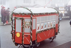
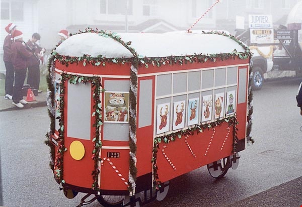
- File contains photographs from the Edmonds Lions Santa Claus Parade on November 27, 2004, including the Burnaby Historical Society's float.
- Repository
- City of Burnaby Archives
- Date
- November 27, 2004
- Collection/Fonds
- Burnaby Historical Society fonds
- Series
- Administration series
- Physical Description
- 51 photographs : col. ; 10 cm x 15 cm
- Description Level
- File
- Record No.
- 633-007
- Access Restriction
- No restrictions
- Reproduction Restriction
- No restrictions
- Accession Number
- 2020-06
- Scope and Content
- File contains photographs from the Edmonds Lions Santa Claus Parade on November 27, 2004, including the Burnaby Historical Society's float.
- Subjects
- Events - Parades
- Holidays - Christmas
- Media Type
- Photograph
- Notes
- Transcribed title
- Title transcribed from photo album cover
- Photographs were originally contained in a photograph album and removed by Archives staff for preservation purposes. Original order of photographs within the album is maintained.
- Most photographs in file have note on verso identifying individuals depicted
- Note in blue ink on inside front cover of album read: "Our float was designed by Brian Elder / Photo work by Sid Combers / Construction by Brian, Sid and assisted by Dennis Brown / "Goofer" and "Nag" Cice Brown
- Caption for 633-007-1 is: "Base of float"
- Caption for 633-007-2 is: "One of our few pictures of Brian"
- Caption for 633-007-3 is: "Side, float and 1223"
- Caption for 633-007-4 is: "Pixie and float"
- Caption for 633-004-5 is: "Sid working"
- Caption for 633-007-6 is: "Try-out around the parking lot"
- Caption for 633-007-8 is: "Dennis and float ready to load David's truck"
- Caption for 633-007-9 is: "7.30 am at warehouse float on Dave's truck cold and foggy"
- Caption for 633-007-10 is: "Taken by Brian following David's truck"
- Caption for 633-007-11 is: "Waiting for the parade to start"
- Caption for 633-007-12 is: "Ready to go"
- Caption for 633-007-13 is: "Ready to move"
- Caption for 633-007-14 is: "Tall and short of it"
- Caption for 633-007-24 is: "David Brown Dennis Dian [sic] Holt Diane Herberts Carol Rush"
- Caption for 633-007-26 is: "John Whiting helping from the rear"
- Caption for 633-007-30 is: "Still pushing"
- Caption for 633-007-32 is: "Carol Rush President of B.H.S."
- Caption for 633-007-51 is: "Cice and Bob in BVM depot-hack"
Images
![10th Avenue connector construction, [2002] thumbnail](/media/hpo/_Data/_Archives_Images/_Unrestricted/535/535-1984.jpg?width=280)
10th Avenue connector construction
https://search.heritageburnaby.ca/link/archivedescription96301
- Repository
- City of Burnaby Archives
- Date
- [2002]
- Collection/Fonds
- Burnaby NewsLeader photograph collection
- Description Level
- Item
- Physical Description
- 1 photograph (tiff) : col.
- Scope and Content
- Photograph of the view of the new 10th Avenue connector from Gord Thorneycroft's garage. Thorneycroft holds a mug and is silhouetted by the light coming from outside, where the Bombardier SkyTrain plant is visible in the distance.
- Repository
- City of Burnaby Archives
- Date
- [2002]
- Collection/Fonds
- Burnaby NewsLeader photograph collection
- Physical Description
- 1 photograph (tiff) : col.
- Description Level
- Item
- Record No.
- 535-1984
- Access Restriction
- No restrictions
- Reproduction Restriction
- No restrictions
- Accession Number
- 2018-12
- Scope and Content
- Photograph of the view of the new 10th Avenue connector from Gord Thorneycroft's garage. Thorneycroft holds a mug and is silhouetted by the light coming from outside, where the Bombardier SkyTrain plant is visible in the distance.
- Media Type
- Photograph
- Photographer
- Bartel, Mario
- Notes
- Title based on caption
- Collected by editorial for use in a February 2002 issue of the Burnaby NewsLeader
- Caption from metadata: "Gord Thorneycroft says he used to be able to enjoy his morning coffee looking out onto a quiet, tree-lined lane while working in his garage behind his home on 9th Ave. But workers building the new 10th Ave. connector tore out the trees last September, the City of Burnaby isn't making any promises to erect noise barriers, and his lane has become a thoroughfare to the Bombardier Skytrain plant."
- Geographic Access
- 10th Avenue
- Historic Neighbourhood
- Edmonds (Historic Neighbourhood)
- Planning Study Area
- Stride Avenue Area
Images
![10th Avenue connector construction, [2002] thumbnail](/media/hpo/_Data/_Archives_Images/_Unrestricted/535/535-1984.jpg)
![24 Hour Relay for Kids, [2001] thumbnail](/media/hpo/_Data/_Archives_Images/_Unrestricted/535/535-2507.jpg?width=280)
24 Hour Relay for Kids
https://search.heritageburnaby.ca/link/archivedescription96952
- Repository
- City of Burnaby Archives
- Date
- [2001]
- Collection/Fonds
- Burnaby NewsLeader photograph collection
- Description Level
- Item
- Physical Description
- 1 photograph (tiff) : col.
- Scope and Content
- Photograph of two unidentified runners handing a baton to each other at the start/finish line during the 24 Hour Relay for Kids fundraising event for Easter Seals Camps at Swangard Stadium. Other relay runners wait in the background and the stadium's stands are filled with spectators.
- Repository
- City of Burnaby Archives
- Date
- [2001]
- Collection/Fonds
- Burnaby NewsLeader photograph collection
- Physical Description
- 1 photograph (tiff) : col.
- Description Level
- Item
- Record No.
- 535-2507
- Access Restriction
- No restrictions
- Reproduction Restriction
- No restrictions
- Accession Number
- 2018-12
- Scope and Content
- Photograph of two unidentified runners handing a baton to each other at the start/finish line during the 24 Hour Relay for Kids fundraising event for Easter Seals Camps at Swangard Stadium. Other relay runners wait in the background and the stadium's stands are filled with spectators.
- Names
- Swangard Stadium
- Media Type
- Photograph
- Photographer
- Bartel, Mario
- Notes
- Title based on caption
- Collected by editorial for use in a June 2001 issue of the Burnaby NewsLeader
- Caption from metadata: "Runners hand off to each other at the hectic Start/Finish area in the early-going of The 24 Hour Relay for the Kids, held all weekend at Swangard Stadium. The annual event attracted more than 2400 runners on 120 teams, who covered almost 18,000 miles to raise money to send kids to Easter Seal Camps around BC."
- Geographic Access
- Central Park
- Imperial Street
- Street Address
- 3883 Imperial Street
- Historic Neighbourhood
- Central Park (Historic Neighbourhood)
- Planning Study Area
- Maywood Area
Images
![24 Hour Relay for Kids, [2001] thumbnail](/media/hpo/_Data/_Archives_Images/_Unrestricted/535/535-2507.jpg)
![24 Hour Relay for the Kids, [2000] thumbnail](/media/hpo/_Data/_Archives_Images/_Unrestricted/535/535-2449.jpg?width=280)
24 Hour Relay for the Kids
https://search.heritageburnaby.ca/link/archivedescription96891
- Repository
- City of Burnaby Archives
- Date
- [2000]
- Collection/Fonds
- Burnaby NewsLeader photograph collection
- Description Level
- Item
- Physical Description
- 1 photograph (tiff) : col.
- Scope and Content
- Photograph of crowd of runners at the starting line for the 21st annual 24 Hour Relay for the Kids at Swangard Stadium. The runners are starting from beneath a banner advertising the event and the stands in the background are filled with people.
- Repository
- City of Burnaby Archives
- Date
- [2000]
- Collection/Fonds
- Burnaby NewsLeader photograph collection
- Physical Description
- 1 photograph (tiff) : col.
- Description Level
- Item
- Record No.
- 535-2449
- Access Restriction
- No restrictions
- Reproduction Restriction
- No restrictions
- Accession Number
- 2018-12
- Scope and Content
- Photograph of crowd of runners at the starting line for the 21st annual 24 Hour Relay for the Kids at Swangard Stadium. The runners are starting from beneath a banner advertising the event and the stands in the background are filled with people.
- Names
- Swangard Stadium
- Media Type
- Photograph
- Photographer
- Bartel, Mario
- Notes
- Title based on caption
- Collected by editorial for use in a June 2000 issue of the Burnaby NewsLeader
- Caption from metadata: "Runners from 145 teams start the 21st annual 24 Hour Relay for the Kids at Swangard Stadium. Money raised by the relay goes towards funding one-week camping trips for children with disabilities."
- Geographic Access
- Imperial Street
- Central Park
- Street Address
- 3883 Imperial Street
- Historic Neighbourhood
- Central Park (Historic Neighbourhood)
- Planning Study Area
- Maywood Area
Images
![24 Hour Relay for the Kids, [2000] thumbnail](/media/hpo/_Data/_Archives_Images/_Unrestricted/535/535-2449.jpg)
50th wedding anniversary
https://search.heritageburnaby.ca/link/museumdescription5170
- Repository
- Burnaby Village Museum
- Date
- 1985
- Collection/Fonds
- Waplington family fonds
- Description Level
- Item
- Physical Description
- 1 photograph : col. ; 10 x 15 cm
- Scope and Content
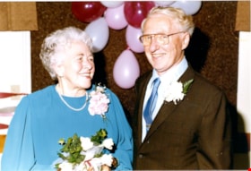
- Photograph of Ray and Frances Fleming at the celebration of their 50th wedding anniversary. They each have floral corsages, Frances is holding a bouquet of flowers and there is a bunch of balloons behind them.
- Repository
- Burnaby Village Museum
- Collection/Fonds
- Waplington family fonds
- Description Level
- Item
- Physical Description
- 1 photograph : col. ; 10 x 15 cm
- Scope and Content
- Photograph of Ray and Frances Fleming at the celebration of their 50th wedding anniversary. They each have floral corsages, Frances is holding a bouquet of flowers and there is a bunch of balloons behind them.
- Accession Code
- BV016.46.125
- Access Restriction
- No restrictions
- Reproduction Restriction
- May be restricted by third party rights
- Date
- 1985
- Media Type
- Photograph
- Scan Resolution
- 600
- Scan Date
- 13-Aug-2018
- Notes
- Title based on contents of photograph
- Photograph is part of Photograph album BV016.46.52
Images

50th wedding anniversary
https://search.heritageburnaby.ca/link/museumdescription5171
- Repository
- Burnaby Village Museum
- Date
- 1985
- Collection/Fonds
- Waplington family fonds
- Description Level
- Item
- Physical Description
- 1 photograph : col. ; 9 x 13 cm
- Scope and Content
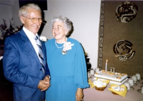
- Photograph of Ray and Frances Fleming at the celebration of their 50th wedding anniversary. The smiling couple is standing next to a table with a cake on it.
- Repository
- Burnaby Village Museum
- Collection/Fonds
- Waplington family fonds
- Description Level
- Item
- Physical Description
- 1 photograph : col. ; 9 x 13 cm
- Scope and Content
- Photograph of Ray and Frances Fleming at the celebration of their 50th wedding anniversary. The smiling couple is standing next to a table with a cake on it.
- Accession Code
- BV016.46.126
- Access Restriction
- No restrictions
- Reproduction Restriction
- May be restricted by third party rights
- Date
- 1985
- Media Type
- Photograph
- Scan Resolution
- 600
- Scan Date
- 13-Aug-2018
- Notes
- Title based on contents of photograph
- Photograph is part of Photograph album BV016.46.52
Images


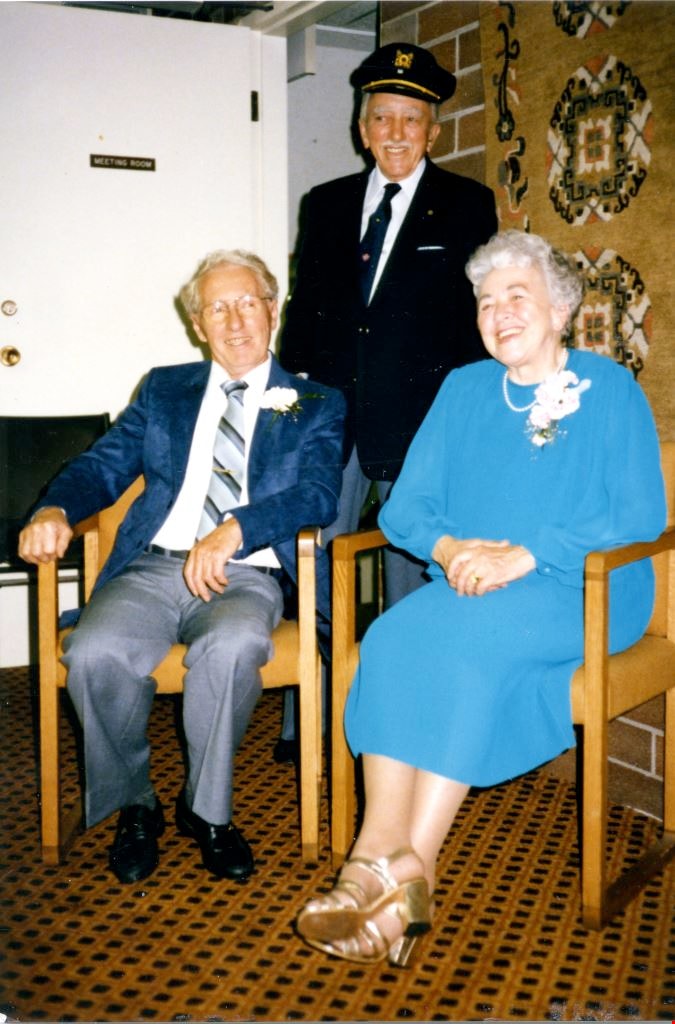
50th wedding anniversary
https://search.heritageburnaby.ca/link/museumdescription5172
- Repository
- Burnaby Village Museum
- Date
- 1985
- Collection/Fonds
- Waplington family fonds
- Description Level
- Item
- Physical Description
- 1 photograph : col. ; 13 x 9 cm
- Scope and Content
- Photograph of Ray and Frances Fleming at the celebration of their 50th wedding anniversary. Both are seated while Frances' brother John Waplington, dressed in a captain's hat is standing in behind them.
- Repository
- Burnaby Village Museum
- Collection/Fonds
- Waplington family fonds
- Description Level
- Item
- Physical Description
- 1 photograph : col. ; 13 x 9 cm
- Scope and Content
- Photograph of Ray and Frances Fleming at the celebration of their 50th wedding anniversary. Both are seated while Frances' brother John Waplington, dressed in a captain's hat is standing in behind them.
- Accession Code
- BV016.46.127
- Access Restriction
- No restrictions
- Reproduction Restriction
- May be restricted by third party rights
- Date
- 1985
- Media Type
- Photograph
- Scan Resolution
- 600
- Scan Date
- 13-Aug-2018
- Notes
- Title based on contents of photograph and notes in photograph album
- Photograph is part of Photograph album BV016.46.52
Images
![51st Annual Pacific Northwest Teen Square Dance Festival, [2000] thumbnail](/media/hpo/_Data/_Archives_Images/_Unrestricted/535/535-2397-1.jpg?width=280)
51st Annual Pacific Northwest Teen Square Dance Festival
https://search.heritageburnaby.ca/link/archivedescription96839
- Repository
- City of Burnaby Archives
- Date
- [2000]
- Collection/Fonds
- Burnaby NewsLeader photograph collection
- Description Level
- File
- Physical Description
- 2 photographs (tiff) : col.
- Scope and Content
- File contains photographs of competitors at the 51st Annual Pacific Northwest Teen Square Dance Festival, in the Chancellor's Gym at Simon Fraser University. Photographs depict two different dance couples, both in costume and in the midst of performing.
- Repository
- City of Burnaby Archives
- Date
- [2000]
- Collection/Fonds
- Burnaby NewsLeader photograph collection
- Physical Description
- 2 photographs (tiff) : col.
- Description Level
- File
- Record No.
- 535-2397
- Access Restriction
- No restrictions
- Reproduction Restriction
- No restrictions
- Accession Number
- 2018-12
- Scope and Content
- File contains photographs of competitors at the 51st Annual Pacific Northwest Teen Square Dance Festival, in the Chancellor's Gym at Simon Fraser University. Photographs depict two different dance couples, both in costume and in the midst of performing.
- Names
- Simon Fraser University
- Media Type
- Photograph
- Photographer
- Bartel, Mario
- Notes
- Title based on caption
- Collected by editorial for use in a May 2000 issue of the Burnaby NewsLeader
- Caption from metadata: "More than 300 young square dancers from BC, Washington and Oregon converged on Chacellor's Gym at SFU over the weekend to strut their stuff at the 51st Annual Pacific Northwest Teen Square Dance Festival."
- Geographic Access
- Burnaby Mountain Conservation Area
- University Drive
- Street Address
- 8888 University Drive
- Planning Study Area
- Burnaby Mountain Area
Images
![51st Annual Pacific Northwest Teen Square Dance Festival, [2000] thumbnail](/media/hpo/_Data/_Archives_Images/_Unrestricted/535/535-2397-1.jpg)
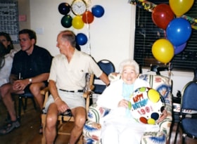
90th birthday celebration
https://search.heritageburnaby.ca/link/museumdescription5173
- Repository
- Burnaby Village Museum
- Date
- 2003
- Collection/Fonds
- Waplington family fonds
- Description Level
- Item
- Physical Description
- 1 photograph : col. ; 10 x 13.7 cm
- Scope and Content
- Photograph of Frances L. Fleming at her 90th Birthday celebration. Frances passed away on July 8, 2004 just one month short of her 91st birthday.
- Repository
- Burnaby Village Museum
- Collection/Fonds
- Waplington family fonds
- Description Level
- Item
- Physical Description
- 1 photograph : col. ; 10 x 13.7 cm
- Scope and Content
- Photograph of Frances L. Fleming at her 90th Birthday celebration. Frances passed away on July 8, 2004 just one month short of her 91st birthday.
- Accession Code
- BV016.46.129
- Access Restriction
- No restrictions
- Reproduction Restriction
- May be restricted by third party rights
- Date
- 2003
- Media Type
- Photograph
- Scan Resolution
- 600
- Scan Date
- 13-Aug-2018
- Notes
- Title based on contents of photograph and notes in photograph album
- Photograph is part of Photograph album BV016.46.52
Images


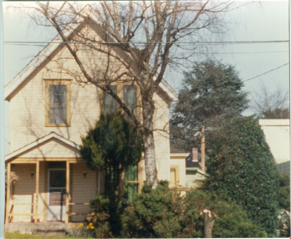
309 Pine Street
https://search.heritageburnaby.ca/link/museumdescription2814
- Repository
- Burnaby Village Museum
- Date
- 1987
- Collection/Fonds
- Hawkshaw family fonds
- Description Level
- Item
- Physical Description
- 1 photograph : col. ; 10 x 12.5 cm
- Scope and Content
- Photograph of 309 Pine Street, New Westminster. This was John and Mabel Hawkshaw’s first home in 1910.
- Repository
- Burnaby Village Museum
- Collection/Fonds
- Hawkshaw family fonds
- Description Level
- Item
- Physical Description
- 1 photograph : col. ; 10 x 12.5 cm
- Scope and Content
- Photograph of 309 Pine Street, New Westminster. This was John and Mabel Hawkshaw’s first home in 1910.
- Subjects
- Buildings - Residential - Houses
- Geographic Access
- New Westminster
- Accession Code
- BV996.6.288
- Access Restriction
- No restrictions
- Reproduction Restriction
- No known restrictions
- Date
- 1987
- Media Type
- Photograph
- Scan Resolution
- 600
- Scan Date
- 2024-05-07
- Notes
- Title based on contents of photograph
- Note on verso of photograph reads: "1987 / 309 Pine street / New Westminster / John + Mabel Hawkshaw's / 1st home / 1910"
Images

1982 - Moving the Roberts House
https://search.heritageburnaby.ca/link/archivedescription91880
- Repository
- City of Burnaby Archives
- Date
- 1982
- Collection/Fonds
- Small family fonds
- Description Level
- Item
- Physical Description
- 1 photograph : col. copy print ; 10 cm x 15 cm
- Scope and Content
- Photograph of the land being cleared at 5496 Dominion Street in order to create a path to move the Roberts' house onto the property. Included in the clearing are the stumps of two apples trees, a poplar tree, and a maple tree. The debris from the site was burned and smoke can seen rising from a s…
- Repository
- City of Burnaby Archives
- Date
- 1982
- Collection/Fonds
- Small family fonds
- Physical Description
- 1 photograph : col. copy print ; 10 cm x 15 cm
- Description Level
- Item
- Record No.
- 620-061
- Access Restriction
- No restrictions
- Reproduction Restriction
- No reproduction permitted
- Accession Number
- 2017-01
- Scope and Content
- Photograph of the land being cleared at 5496 Dominion Street in order to create a path to move the Roberts' house onto the property. Included in the clearing are the stumps of two apples trees, a poplar tree, and a maple tree. The debris from the site was burned and smoke can seen rising from a small pile of brush on the right.
- Media Type
- Photograph
- Notes
- Transcribed title
- Title transcribed from donor's notes
- Note in blue ink on verso of photograph reads: "p.3"
- Note in pencil on verso of photograph reads: "2"
- Street Address
- 5496 Dominion Street
- Historic Neighbourhood
- Burnaby Lake (Historic Neighbourhood)
- Planning Study Area
- Ardingley-Sprott Area
Images
