Narrow Results By
Decade
- 2020s 473
- 2010s 979
- 2000s
- 1990s 4535
- 1980s 3033
- 1970s 5028
- 1960s 2380
- 1950s 2541
- 1940s 2396
- 1930s 2311
- 1920s 2750
- 1910s 2165
- 1900s 986
- 1890s 298
- 1880s
- 1870s 42
- 1860s 47
- 1850s 25
- 1840s
- 1830s 9
- 1820s 9
- 1810s 6
- 1800s 6
- 1790s 5
- 1780s 5
- 1770s 5
- 1760s 5
- 1750s 5
- 1740s 5
- 1730s 5
- 1720s 5
- 1710s 5
- 1700s 5
- 1690s 5
- 1680s 5
- 1670s 4
- 1660s 4
- 1650s 4
- 1640s 4
- 1630s 4
- 1620s 4
- 1610s 4
- 1600s 4
- 1590s 1
- 1580s 1
- 1570s 1
- 1560s 1
- 1550s 1
- 1540s 1
- 1530s 1
- 1520s 2
- 1510s 1
- 1500s 1
- 1490s 1
- 1480s
Subject
- Accidents 3
- Accidents - Automobile Accidents 7
- Adornment - Jewelry 1
- Adornment - Lapel Pins 1
- Advertising Medium 2
- Advertising Medium - Signs and Signboards 10
- Aerial Photographs 8
- Agricultural Tools and Equipment - Gardening Equipment 1
- Agriculture 4
- Agriculture - Farms 7
- Agriculture - Fruit and Berries 1
- Animals 1

Byrne Creek Secondary School
https://search.heritageburnaby.ca/link/landmark849
- Repository
- Burnaby Heritage Planning
- Geographic Access
- 18th Street
- Associated Dates
- 2005
- Heritage Value
- Byrne Creek School opened in 2005 and accommodates students from grades 8 through 12. When built, the school was created to house as many as 1200 students, but by 2009, plans have been prepared to increase that capacity to 1500.
- Historic Neighbourhood
- Edmonds (Historic Neighbourhood)
- Planning Study Area
- Stride Avenue Area
- Street Address
- 7777 18th Street
- Street View URL
- Google Maps Street View
Images


Cameron Neighbourhood
https://search.heritageburnaby.ca/link/landmark824
- Repository
- Burnaby Heritage Planning
- Associated Dates
- 1955-2008
- Heritage Value
- The Cameron Neighbourhood falls within the Lougheed Town Centre area - one of four Town Centres in Burnaby. The Cameron Neighbourhood - while containing significant high-density residential components - is also home to the Town Centre's office and commercial core. The Lougheed Mall is situated in this neighbourhood, which is served by the Millennium Line SkyTrain.
- Historic Neighbourhood
- Burquitlam (Historic Neighbourhood)
- Planning Study Area
- Cameron Area
Images


Capitol Hill Neighbourhood
https://search.heritageburnaby.ca/link/landmark781
- Repository
- Burnaby Heritage Planning
- Associated Dates
- 1955-2008
- Heritage Value
- The Capitol Hill Neighbourhood remained a primarily residential neighbourhood after the population boom of the 1950s and 1960s. The commercial focus remained the Hastings Street corridor, while the City of Burnaby moved to protect a conservation area on the north side of Capitol Hill and dedicated parkland throughout the 1970s and 1980s.
- Historic Neighbourhood
- Capitol Hill (Historic Neighbourhood)
- Planning Study Area
- Capitol Hill Area
Images


Cascade-Schou Neighbourhood
https://search.heritageburnaby.ca/link/landmark798
- Repository
- Burnaby Heritage Planning
- Associated Dates
- 1955-2008
- Heritage Value
- The Cascade-Schou neighbourhood, sometimes referred to as the Cascade Heights area, includes both the Burnaby General Hospital site, the Discovery Park facilities and is bordered on its eastern boundary by BCIT. Despite these health and science developments, the neighbourhood can still be considered to be a residential community. The housing stock includes single family homes as well as newer multi-family residences that developed throughout the 1980s and 1990s.
- Historic Neighbourhood
- Broadview (Historic Neighbourhood)
- Planning Study Area
- Cascade-Schou Area
Images


Dawson-Delta Neighbourhood
https://search.heritageburnaby.ca/link/landmark779
- Repository
- Burnaby Heritage Planning
- Associated Dates
- 1955-2008
- Heritage Value
- The Dawson-Delta neighbourhood in Burnaby developed into one of Burnaby's numerous industrial areas after 1955. The Eastbrook Executive Business Park opened in the 1970s and the Willingdon Green Business Centre includes buildings from the 1980s to the 2000s. Convenient access to major roads and highways fostered these developments which remain zoned for industrial uses to this day.
- Planning Study Area
- Dawson-Delta Area
Images


Edmonds Street Neighbourhood
https://search.heritageburnaby.ca/link/landmark827
- Repository
- Burnaby Heritage Planning
- Associated Dates
- 1955-2008
- Heritage Value
- The Edmonds Street Neighbourhood is part of the larger Edmonds Town Centre - one of four Town Centres in Burnaby. This neighbourhood is considered to be primarily residential, but a strong local commercial component developed along Edmonds and Kingsway.
- Historic Neighbourhood
- Edmonds (Historic Neighbourhood)
- Planning Study Area
- Edmonds Area
Images


Government Road Neighbourhood
https://search.heritageburnaby.ca/link/landmark822
- Repository
- Burnaby Heritage Planning
- Associated Dates
- 1955-2008
- Heritage Value
- After the building boom of the 1950s, the Government Road Neighbourhood became characterised as a stable, single-family residential area. In addition to the residential component, the neighbourhood also has a significant industrial sector, along the north side of Burnaby Lake, and a commercial zone to the north along the Lougheed Highway.
- Historic Neighbourhood
- Lozells (Historic Neighbourhood)
- Planning Study Area
- Government Road Area
Images


Lake City Neighbourhood
https://search.heritageburnaby.ca/link/landmark793
- Repository
- Burnaby Heritage Planning
- Associated Dates
- 1955-2008
- Heritage Value
- When Simon Fraser University opened in 1965, approximately sixteen industrial properties had been developed in the Lake City Industrial Park. In addition, significant tracts of land in the western portion had been pre-cleared and graded in anticipation of additional development, while most of the eastern half remained forested. Some of the early companies to locate in the area were Nabob Foods, Volkswagen Canada, British Columbia Television Broadcasting, Simpson Sears, and H.Y. Louie Company Limited. Both Imperial Oil and Shell Oil established petroleum storage and distribution facilities in the area. Initially a heavy industrial area, by 1979, single family neighbourhoods south of Lougheed Highway and west of Eagle Creek had been largely developed. By the mid1980's, the Burnaby 200 multi-family development along Forest Grove Drive had also been completed.
- Planning Study Area
- Lake City Area
Images


Lakeview-Mayfield Neighbourhood
https://search.heritageburnaby.ca/link/landmark830
- Repository
- Burnaby Heritage Planning
- Associated Dates
- 1955-2008
- Heritage Value
- Like many other areas of the City, the Lakeview-Mayfield Neighbourhood was subdivided during the 1950s post-war building boom. Pockets of newer homes were built in the 1970s, and the neighbourhood retained its character as a primarily residential area. The neighbourhood is bordered to the east by Robert Burnaby Park.
- Planning Study Area
- Lakeview-Mayfield Area
Images


Lyndhurst Neighbourhood
https://search.heritageburnaby.ca/link/landmark823
- Repository
- Burnaby Heritage Planning
- Associated Dates
- 1955-2008
- Heritage Value
- The Lyndhurst Neighbourhood falls within the Lougheed Town Centre area - one of four Town Centres in Burnaby. The Lyndhurst Neighbourhood accounts for a significant portion of the residential component of the Town Centre. To the east of Stoney Creek Park, lies the Sullivan Heights single family subdivision which was built in the 1950s. To the west of the park, is a higher-density residential area consisting of multi-family buildings that were developed after 1974.
- Historic Neighbourhood
- Burquitlam (Historic Neighbourhood)
- Planning Study Area
- Lyndhurst Area
Images


Oakalla Neighbourhood
https://search.heritageburnaby.ca/link/landmark804
- Repository
- Burnaby Heritage Planning
- Associated Dates
- 1955-2008
- Heritage Value
- The phasing out and demolition of the Oakalla Prison farm allowed for the planned development of the Oakalla Neighbourhood in the 1980s. By 1991, the City of Burnaby had adopted the Oakalla Development Plan which called for the transfer of land to the Deer Lake Park reserve as well as the creation of a new residential area consisting of multi-family housing types.
- Historic Neighbourhood
- Central Park (Historic Neighbourhood)
- Planning Study Area
- Oakalla Area
Images


Sperling-Broadway Neighbourhood
https://search.heritageburnaby.ca/link/landmark789
- Repository
- Burnaby Heritage Planning
- Associated Dates
- 1955-2008
- Heritage Value
- By the 1970s, the Sperling-Broadway Neighbourhood was characterised as one of the Municipality's fastest growing residential areas. In 1980, it was estimated that slightly less than half of the homes were single-family residences, while the remaining development was taking the form of townhouse and high-rise apartments. The emphasis shifted back to single family housing during the construction of planned subdivisions such as the Camrose subdivision in the 1980s and the area remains primarily residential in nature. The neighbourhood is well-served by park facilities and is also home to the Burnaby Mountain Golf Course.
- Historic Neighbourhood
- Lochdale (Historic Neighbourhood)
- Planning Study Area
- Sperling-Broadway Area
Images


Brentwood Neighbourhood
https://search.heritageburnaby.ca/link/landmark780
- Repository
- Burnaby Heritage Planning
- Associated Dates
- 1955-2008
- Heritage Value
- Between 1955 and 2001, the Brentwood Neighbourhood developed into one of Burnaby's four official Town Centres. The Brentwood Town Centre serves the north-west sector of the Municipality, providing facilities such as commercial developments - of which the Brentwood Mall is the most significant. Under Burnaby's Residential Development Framework adopted by Council in 1981, the Town Centre also incorporated a full range of multi-housing types and forms in close relationship with their commercial facilities. In 1996, the City adopted the Brentwood Town Centre Development Plant to solidify the area as a focus of higher-density and higher-intensity residential and commercial opportunities, public transit and supporting leisure facilities.
- Planning Study Area
- Brentwood Area
Images

Burnaby Village Museum & Carousel - promotional footage
https://search.heritageburnaby.ca/link/museumdescription13063
- Repository
- Burnaby Village Museum
- Date
- 2000 (date of original), digitized in 2020
- Collection/Fonds
- Burnaby Village Museum fonds
- Description Level
- Item
- Physical Description
- 1 videocassette (29 min. , 33 sec.) : Betacam SP, 29 fps, col., sd.
- Scope and Content
- Item consists of promotional film footage for the Burnaby Village Museum & Carousel". Film footage includes glimpses of the Burnaby Village Museum site with visitors touring the various exhibits and programs through museum's interpreters including Heritage Christmas, Easter Weekend, Labour Day Week…
- Repository
- Burnaby Village Museum
- Collection/Fonds
- Burnaby Village Museum fonds
- Description Level
- Item
- Physical Description
- 1 videocassette (29 min. , 33 sec.) : Betacam SP, 29 fps, col., sd.
- Scope and Content
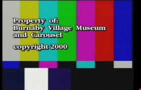
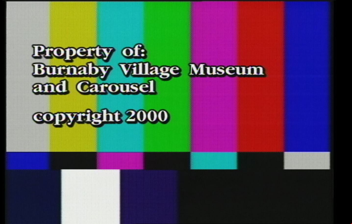
- Item consists of promotional film footage for the Burnaby Village Museum & Carousel". Film footage includes glimpses of the Burnaby Village Museum site with visitors touring the various exhibits and programs through museum's interpreters including Heritage Christmas, Easter Weekend, Labour Day Week, Fall Fair Event and a final versions with highlights. Summary of Content: 00:00-00:27 Blank screen 00:28-00:48 SMPTE colour bar screen reads "Property of: / Burnaby Village Museum / and Carousel / copyright 2000". 00:49-00:58 Blank screen 00:59-12:44 Heritage Christmas with entertainers, Father Christmas, Print Shop, Blacksmith Shop, Seaforth School, Elworth House, Herbalist, Village exteriors, Christmas Carolers, Love Farmhouse and the C.W. Parker Carousel. 12:45-15:29 Easter Weekend: Entertainment, Ice Cream Parlour, Speeches, Easter Bonnet Parade, bunnies and chicks. 15:30-22:40 Canada Day Celebrations and Labour Day Week: Visitors arriving, flag waving, singing O'Canada, cake cutting and entertainment. 22:41-24:18 Fall Fair Event: harvest displays, potatoe sack races, baking and preserves competition, fortune telling, 24:19- 24:25 Blank screen 24:26-26:45 Highlight Video: "Burnaby Village Museum & Carousel / Step back in time...". Includes compiled footage some gathered from previous content. This footage is followed by edited promotional footage "Burnaby Village Museum & Carousel / Step back in time" which includes some of the previous film footage. 26:46-29:33 Blank screen
- Creator
- Burnaby Village Museum
- Publisher
- Voice of the Fraser Productions Inc. 2000
- Subjects
- Recreational Devices - Carousels
- Names
- Burnaby Village Museum
- Shadbolt Centre for the Arts
- Burnaby Art Gallery
- C.W. Parker no. 119 Carousel
- Responsibility
- Burnaby Village Museum - City of Burnaby
- Accession Code
- BV020.4.36
- Access Restriction
- No restrictions
- Reproduction Restriction
- May be restricted by third party rights
- Date
- 2000 (date of original), digitized in 2020
- Media Type
- Moving Images
- Related Material
- See also: BV020.4.33; BV020.4.29b; BV929.4.38
- Notes
- Transcribed title from film content
- Label inside videocassette case reads: Burnaby Village Museum & Carousel / Promotional footage: / 00:01:00:00 Heritage Christmas... / 00:12:50:00 Easter Weekend... / 00:15:43:00 Canada Day Celebrations ... / 00:20:17:00 Labour Day Week / 00:21:54:00 Fall Fair Event.../ 00:24:28:00 Highlight Video / (2:00)"
Images
Video
Burnaby Village Museum & Carousel - promotional footage, 2000 (date of original), digitized in 2020
Burnaby Village Museum & Carousel - promotional footage, 2000 (date of original), digitized in 2020
https://search.heritageburnaby.ca/media/hpo/_Data/_BVM_Moving_Images/2020_0004_0036_001.mp4
Step Back in Time at the Burnaby Village Museum and Carousel
https://search.heritageburnaby.ca/link/museumdescription12339
- Repository
- Burnaby Village Museum
- Date
- 2000 (date of original), digitized in 2020
- Collection/Fonds
- Burnaby Village Museum fonds
- Description Level
- Item
- Physical Description
- 1 videocassette (29 min. , 59 sec.) : VHS, 29 fps, col., sd.
- Scope and Content
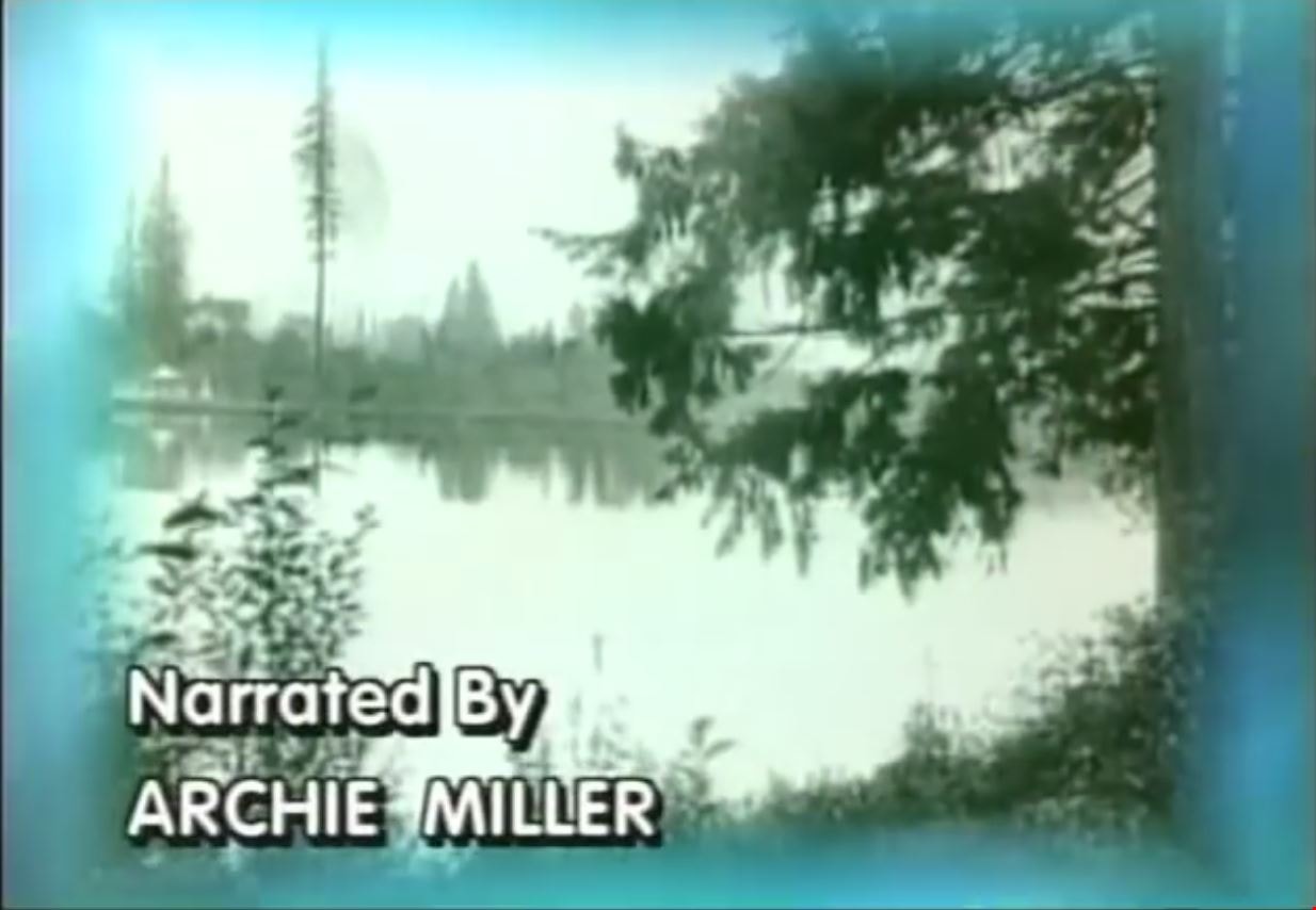
- Film titled “Step Back in Time at the Burnaby Village Museum & Carousel” includes narration by Archie Miller. The film opens with historical background regarding land settlement and development in Burnaby supported with historical images. The film then transverses into contemporary images and foota…
- Repository
- Burnaby Village Museum
- Collection/Fonds
- Burnaby Village Museum fonds
- Description Level
- Item
- Physical Description
- 1 videocassette (29 min. , 59 sec.) : VHS, 29 fps, col., sd.
- Material Details
- Sponsored in part by: The Burnaby Historical Society; Poetry Written by: Don Benson; Voices: Arlie Mason; Tom Worledge
- Scope and Content
- Film titled “Step Back in Time at the Burnaby Village Museum & Carousel” includes narration by Archie Miller. The film opens with historical background regarding land settlement and development in Burnaby supported with historical images. The film then transverses into contemporary images and footage of the Burnaby Village Museum which opened in Burnaby on November 19, 1971 in commemoration of British Columbia joining the confederation of Canada. The film’s title text, “Step Back / In Time / at the Burnaby Village / Museum & Carousel” appears a few minutes past the opening footage. Narration continues throughout the film along with interviews with various staff members and museum interpreters. The film is divided into various segments containing titles in order of appearance: “Deer Lake Park” provides glimpses of and information about Deer Lake Park, its heritage buildings and cultural facilities including The Burnaby Art Gallery, The Shadbolt Centre for the Arts and Burnaby Village Museum. “A Living Museum” takes you on a tour of some of the museum’s exhibits and programs through the museum’s interpreters. “The Magical Carousel” provides background on the historic C.W. Parker Carousel #119 that was restored and opened on the site in 1993. “Keeping History Alive” speaks to the interpretive, artifact and archival collection of the Burnaby Village Museum with information provided by Curator Colin Stevens, Assistant Curator Steve Turnbull and Assistant Director of Cultural Services, Denis Nokony. “A Step Back in Time” speaks to the various 1920s highlights and features that the museum has to offer. “Something Special / is Always Happening” tells of the annual events that the museum offers to capture the interests of visitors. “A Day at the / Burnaby Village / Museum & Carousel” includes Denis Nokony speaking about the importance of the museum and what it means to visitors and the community.
- Creator
- Burnaby Village Museum
- Publisher
- Voice of the Fraser Productions Inc. 2000
- Subjects
- Recreational Devices - Carousels
- Names
- Burnaby Village Museum
- Shadbolt Centre for the Arts
- Burnaby Art Gallery
- C.W. Parker no. 119 Carousel
- Responsibility
- Burnaby Village Museum - City of Burnaby
- Accession Code
- BV020.4.29b
- Access Restriction
- No restrictions
- Reproduction Restriction
- May be restricted by third party rights
- Date
- 2000 (date of original), digitized in 2020
- Media Type
- Moving Images
- Related Material
- See also: BV020.4.33; BV020.4.36; BV929.4.38
- Notes
- Transcribed title from film content
Images
Video
Step Back in Time at the Burnaby Village Museum and Carousel, 2000 (date of original), digitized in 2020
Step Back in Time at the Burnaby Village Museum and Carousel, 2000 (date of original), digitized in 2020
https://search.heritageburnaby.ca/media/hpo/_Data/_BVM_Moving_Images/2020_0004_0029b_001.mp4
Maywood Neighbourhood
https://search.heritageburnaby.ca/link/landmark801
- Repository
- Burnaby Heritage Planning
- Associated Dates
- 1955-2008
- Heritage Value
- Burnaby's Maywood Neighbourhood consists of the Metrotown Town Centre - one of four Town Centres in the City. Metrotown is one of the region's most developed and fastest growing centres. It is served by the first SkyTrain line developed in the mid-1980s and anchored by B.C.'s largest shopping and entertainment complex. As an older centre that has progressively added new developments over the years, Metrotown offers a range of housing types and tenures from three-storey walk-up apartments to modern residential towers.
- Historic Neighbourhood
- Central Park (Historic Neighbourhood)
- Planning Study Area
- Maywood Area
Images


Stride Hill Neighbourhood
https://search.heritageburnaby.ca/link/landmark846
- Repository
- Burnaby Heritage Planning
- Associated Dates
- 1955-2008
- Heritage Value
- The residential areas that are located within the Stride Hill Neighbourhood were primarily developed in the 1950s during Burnaby's post-war building boom. The area lying to the south of Byrne Creek Ravine Park was used as a municipal garbage dump until the 1960s and as a landfill site for yard waste disposal until the early 1990s at which point the area was incorporated into the Edmonds Town Centre Plan and the land was made into park and open space.
- Historic Neighbourhood
- Edmonds (Historic Neighbourhood)
- Planning Study Area
- Stride Hill Area
Images


Suncrest Neighbourhood
https://search.heritageburnaby.ca/link/landmark839
- Repository
- Burnaby Heritage Planning
- Associated Dates
- 1955-2008
- Heritage Value
- The Suncrest Neighbourhood is a small residential area south of Burnaby's Central Park. The Ocean View Burial Park takes up a large area of land in the north-east corner of this neighbourhood and the majority of the housing was built during the 1930-1960 period.
- Historic Neighbourhood
- Alta Vista (Historic Neighbourhood)
- Planning Study Area
- Suncrest Area
Images


Sussex-Nelson Neighbourhood
https://search.heritageburnaby.ca/link/landmark838
- Repository
- Burnaby Heritage Planning
- Associated Dates
- 1955-2008
- Heritage Value
- The Sussex-Nelson Neighbourhood is located just south of Metrotown and in 1980 was characterised as the most populated of all of Burnaby's Planning Study areas. The area immediately south of Metrotown was initially developed as post-war 1950s housing stock, while the sector south of Rumble was developed after the 1960s and 1970s as single-family housing.
- Historic Neighbourhood
- Alta Vista (Historic Neighbourhood)
- Planning Study Area
- Sussex-Nelson Area
Images

![Burnaby Village Museum & Carousel Highlights, [1993] (date of original), digitized in 2020 thumbnail](/media/hpo/_Data/_BVM_Moving_Images/2020_0004_0033_001.jpg?width=280)
Burnaby Village Museum & Carousel Highlights
https://search.heritageburnaby.ca/link/museumdescription12343
- Repository
- Burnaby Village Museum
- Date
- [1993] (date of original), digitized in 2020
- Collection/Fonds
- Burnaby Village Museum fonds
- Description Level
- Item
- Physical Description
- 1 videocassette (2 min., 9 sec.) : VHS, 29 fps, col. , sd.
- Scope and Content
- Film footage highlights about the Burnaby Village Museum and Carousel. Film opens with title “Burnaby Village Museum & Carousel / Step back in time” followed by a montage of various events, programs and exhibits taking place at the museum. Montage is supported with background music and choral singi…
- Repository
- Burnaby Village Museum
- Collection/Fonds
- Burnaby Village Museum fonds
- Description Level
- Item
- Physical Description
- 1 videocassette (2 min., 9 sec.) : VHS, 29 fps, col. , sd.
- Scope and Content
- Film footage highlights about the Burnaby Village Museum and Carousel. Film opens with title “Burnaby Village Museum & Carousel / Step back in time” followed by a montage of various events, programs and exhibits taking place at the museum. Montage is supported with background music and choral singing, there is no narration.
- Creator
- Burnaby Village Museum
- Subjects
- Recreational Devices - Carousels
- Responsibility
- City of Burnaby
- Accession Code
- BV020.4.33
- Access Restriction
- No restrictions
- Reproduction Restriction
- May be restricted by third party rights
- Date
- [1993] (date of original), digitized in 2020
- Media Type
- Moving Images
- Related Material
- See also: BV020.4.36; BV020.4.38; BV929.4.29b
- Notes
- Transcribed title from film
Images
![Burnaby Village Museum & Carousel Highlights, [1993] (date of original), digitized in 2020 thumbnail](/media/hpo/_Data/_BVM_Moving_Images/2020_0004_0033_001.jpg)
Video
Burnaby Village Museum & Carousel Highlights, [1993] (date of original), digitized in 2020
Burnaby Village Museum & Carousel Highlights, [1993] (date of original), digitized in 2020
https://search.heritageburnaby.ca/media/hpo/_Data/_BVM_Moving_Images/2020_0004_0033_001.m4v