Narrow Results By
Subject
- Buildings - Civic - Museums 1
- Buildings - Heritage 1
- Buildings - Schools 10
- Businesses - Real Estate Agencies 1
- Events - May Day 1
- Events - Parades 1
- First Nations reserves - British Columbia 3
- Geographic Features - Mountains 1
- Indigenous peoples - Indian Territory 3
- Recreational Activities - Canoeing 1
- Recreational Devices - Carousels 3
- Sports - Bowling 1
Creator
- British Columbia Underwriters' Association 7
- Burnaby Village Museum 4
- Burnaby Village Museum - City of Burnaby 2
- Burnett and McGugan B.C. Land Surveyors, New Westminster 5
- Burnett, Geoffrey K. 1
- Burnett & McGugan, Engineers and Surveyors 5
- City of Burnaby 1
- Digney, Andy 1
- Dominion Map and Blueprint Co. 1
- Geoffrey K. Burnett 1
- Gierach, Cindy 1
- Green, Susan 1

Armstrong Street School site
https://search.heritageburnaby.ca/link/museumdescription11133
- Repository
- Burnaby Village Museum
- Date
- 1915
- Collection/Fonds
- Ronald G. Scobbie collection
- Description Level
- Item
- Physical Description
- 1 survey plan : blueprint on paper ; 56 x 54 cm
- Scope and Content
- Survey plan of "Armstrong Street School Site / Burnaby Municipality" "Being a 2 acre portion of Lot 13 Group 1, & according to map 1722 which shows this as Lot E. Block 2 of subdivision of a portion, of Lot 13, Group 1, New Westminster District".
- Repository
- Burnaby Village Museum
- Collection/Fonds
- Ronald G. Scobbie collection
- Description Level
- Item
- Physical Description
- 1 survey plan : blueprint on paper ; 56 x 54 cm
- Material Details
- Scale 40 feet = 1 inch
- Scope and Content
- Survey plan of "Armstrong Street School Site / Burnaby Municipality" "Being a 2 acre portion of Lot 13 Group 1, & according to map 1722 which shows this as Lot E. Block 2 of subdivision of a portion, of Lot 13, Group 1, New Westminster District".
- Creator
- Burnett, Geoffrey K.
- Subjects
- Buildings - Schools
- Names
- Armstrong Avenue School
- Responsibility
- Burnett & McGugan, Engineers and Surveyors
- Geographic Access
- Armstrong Avenue
- Street Address
- 8757 Armstrong Avenue
- Accession Code
- BV003.83.12
- Access Restriction
- No restrictions
- Reproduction Restriction
- No known restrictions
- Date
- 1915
- Media Type
- Cartographic Material
- Historic Neighbourhood
- East Burnaby (Historic Neighbourhood)
- Planning Study Area
- Cariboo-Armstrong Area
- Scan Resolution
- 440
- Scan Date
- 22-Dec-2020
- Scale
- 100
- Notes
- Title based on contents of plan
- Note in black ink on verso of plan reads: "1746"
- Oath on plan reads: "I, Geoffrey K. Burnett...and did personally superintend the survey represented..." "Completed on the 18th day of March 1915"; signed by Geoffrey K. Burnett and notarized by "K.A. Eastman", sworn "...19th day of April 1915"; "Burnett and McGugan., B.C. Land Surveyors. Etc.. New Westminster, B.C.."
Zoomable Images


Barnet School site
https://search.heritageburnaby.ca/link/museumdescription11140
- Repository
- Burnaby Village Museum
- Date
- May 27, 1915
- Collection/Fonds
- Ronald G. Scobbie collection
- Description Level
- Item
- Physical Description
- 1 survey plan : blueprint on paper ; 56 x 54 cm
- Scope and Content
- Survey plan of "Barnet School Site / Burnaby Municipality" "Being a portion of the west half of lot / 214, Group 1 / New Westminster District”.
- Repository
- Burnaby Village Museum
- Collection/Fonds
- Ronald G. Scobbie collection
- Description Level
- Item
- Physical Description
- 1 survey plan : blueprint on paper ; 56 x 54 cm
- Material Details
- Scale 40 feet = 1 inch
- Scope and Content
- Survey plan of "Barnet School Site / Burnaby Municipality" "Being a portion of the west half of lot / 214, Group 1 / New Westminster District”.
- Creator
- McGugan, Donald Johnston
- Subjects
- Buildings - Schools
- Names
- Barnet School
- Responsibility
- Burnett & McGugan, Engineers and Surveyors
- Geographic Access
- Barnet Road
- Street Address
- 7820 Barnet Road
- Accession Code
- BV003.83.19
- Access Restriction
- No restrictions
- Reproduction Restriction
- No known restrictions
- Date
- May 27, 1915
- Media Type
- Cartographic Material
- Historic Neighbourhood
- Barnet (Historic Neighbourhood)
- Planning Study Area
- Burnaby Mountain Area
- Scan Resolution
- 440
- Scan Date
- 22-Dec-2020
- Scale
- 100
- Notes
- Title based on contents of plan
- handwritten on back "Burnaby Schools" "23R" twice, "1783"
- Oath on plan reads: "I, D.J. McGugan...and did personally superintend the survey..." "completed on the 27th day of May 1915"; signed by D.J. McGugan, notarized by "Walter Edmonds" "sworn "...29th day of May 1915" "Burnett and McGugan" "B.C. Land Surveyors Etc. New Westminster, B.C.";
Zoomable Images

![Bird's eye view of New Westminster, Burnaby and Vancouver, [ca. 1911] thumbnail](/media/hpo/_Data/_BVM_Cartographic_Material/1983/1983_0012_0001_002%20Web.jpg?width=280)
Bird's eye view of New Westminster, Burnaby and Vancouver
https://search.heritageburnaby.ca/link/museumdescription8199
- Repository
- Burnaby Village Museum
- Date
- [ca. 1911]
- Collection/Fonds
- Burnaby Village Museum Map collection
- Description Level
- Item
- Physical Description
- 1 map : hand painted ; 65.5 x 99 cm
- Scope and Content
- An untitled monochromatic grayscale map of a developer's bird's eye view looking north west from Burnaby Mountain. View includes Burnaby, New Westminster, Vancouver with the North shore in the distance. Burnaby neighbourhood subdivisions of "Burnaby Heights" and "Buena Vista" are featured near the…
- Repository
- Burnaby Village Museum
- Collection/Fonds
- Burnaby Village Museum Map collection
- Description Level
- Item
- Physical Description
- 1 map : hand painted ; 65.5 x 99 cm
- Scope and Content
- An untitled monochromatic grayscale map of a developer's bird's eye view looking north west from Burnaby Mountain. View includes Burnaby, New Westminster, Vancouver with the North shore in the distance. Burnaby neighbourhood subdivisions of "Burnaby Heights" and "Buena Vista" are featured near the centre of the map. These neighbourhood subdivisions were marketed by Real Estate Agents Liebly & Blumer in 1911. Roads, buildings, factories, railways and bridges are identified on the map.
- Subjects
- Businesses - Real Estate Agencies
- Responsibility
- Leibly & Blumer Realty Co. Incorporated
- Accession Code
- HV983.12.1
- Access Restriction
- No restrictions
- Reproduction Restriction
- No known restrictions
- Date
- [ca. 1911]
- Media Type
- Cartographic Material
- Historic Neighbourhood
- East Burnaby (Historic Neighbourhood)
- Vancouver Heights (Historic Neighbourhood)
- Planning Study Area
- Cariboo-Armstrong Area
- Burnaby Heights Area
- Scan Resolution
- 300
- Scan Date
- December 2020
- Scale
- 100
- Notes
- Title based on contents of map
- Note in pencil on verso of photograph reads: "Make tint block of Buena Vista / Blocks only as shown in lots"
Zoomable Images
![Bird's eye view of New Westminster, Burnaby and Vancouver, [ca. 1911] thumbnail](/media/hpo/_Data/_BVM_Cartographic_Material/1983/1983_0012_0001_001_seadragon/1983_0012_0001_001.jpg?w=280)
![Burnaby Village Museum & Carousel Highlights, [1993] (date of original), digitized in 2020 thumbnail](/media/hpo/_Data/_BVM_Moving_Images/2020_0004_0033_001.jpg?width=280)
Burnaby Village Museum & Carousel Highlights
https://search.heritageburnaby.ca/link/museumdescription12343
- Repository
- Burnaby Village Museum
- Date
- [1993] (date of original), digitized in 2020
- Collection/Fonds
- Burnaby Village Museum fonds
- Description Level
- Item
- Physical Description
- 1 videocassette (2 min., 9 sec.) : VHS, 29 fps, col. , sd.
- Scope and Content
- Film footage highlights about the Burnaby Village Museum and Carousel. Film opens with title “Burnaby Village Museum & Carousel / Step back in time” followed by a montage of various events, programs and exhibits taking place at the museum. Montage is supported with background music and choral singi…
- Repository
- Burnaby Village Museum
- Collection/Fonds
- Burnaby Village Museum fonds
- Description Level
- Item
- Physical Description
- 1 videocassette (2 min., 9 sec.) : VHS, 29 fps, col. , sd.
- Scope and Content
- Film footage highlights about the Burnaby Village Museum and Carousel. Film opens with title “Burnaby Village Museum & Carousel / Step back in time” followed by a montage of various events, programs and exhibits taking place at the museum. Montage is supported with background music and choral singing, there is no narration.
- Creator
- Burnaby Village Museum
- Responsibility
- City of Burnaby
- Accession Code
- BV020.4.33
- Access Restriction
- No restrictions
- Reproduction Restriction
- May be restricted by third party rights
- Date
- [1993] (date of original), digitized in 2020
- Media Type
- Moving Images
- Related Material
- See also: BV020.4.36; BV020.4.38; BV929.4.29b
- Notes
- Transcribed title from film
Images
![Burnaby Village Museum & Carousel Highlights, [1993] (date of original), digitized in 2020 thumbnail](/media/hpo/_Data/_BVM_Moving_Images/2020_0004_0033_001.jpg)
Video
Burnaby Village Museum & Carousel Highlights, [1993] (date of original), digitized in 2020
Burnaby Village Museum & Carousel Highlights, [1993] (date of original), digitized in 2020
https://search.heritageburnaby.ca/media/hpo/_Data/_BVM_Moving_Images/2020_0004_0033_001.m4v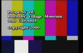
Burnaby Village Museum & Carousel - promotional footage
https://search.heritageburnaby.ca/link/museumdescription13063
- Repository
- Burnaby Village Museum
- Date
- 2000 (date of original), digitized in 2020
- Collection/Fonds
- Burnaby Village Museum fonds
- Description Level
- Item
- Physical Description
- 1 videocassette (29 min. , 33 sec.) : Betacam SP, 29 fps, col., sd.
- Scope and Content
- Item consists of promotional film footage for the Burnaby Village Museum & Carousel". Film footage includes glimpses of the Burnaby Village Museum site with visitors touring the various exhibits and programs through museum's interpreters including Heritage Christmas, Easter Weekend, Labour Day Week…
- Repository
- Burnaby Village Museum
- Collection/Fonds
- Burnaby Village Museum fonds
- Description Level
- Item
- Physical Description
- 1 videocassette (29 min. , 33 sec.) : Betacam SP, 29 fps, col., sd.
- Scope and Content
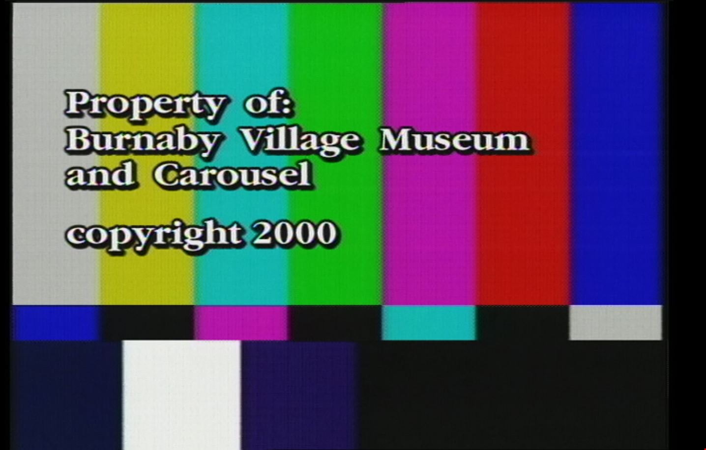
- Item consists of promotional film footage for the Burnaby Village Museum & Carousel". Film footage includes glimpses of the Burnaby Village Museum site with visitors touring the various exhibits and programs through museum's interpreters including Heritage Christmas, Easter Weekend, Labour Day Week, Fall Fair Event and a final versions with highlights. Summary of Content: 00:00-00:27 Blank screen 00:28-00:48 SMPTE colour bar screen reads "Property of: / Burnaby Village Museum / and Carousel / copyright 2000". 00:49-00:58 Blank screen 00:59-12:44 Heritage Christmas with entertainers, Father Christmas, Print Shop, Blacksmith Shop, Seaforth School, Elworth House, Herbalist, Village exteriors, Christmas Carolers, Love Farmhouse and the C.W. Parker Carousel. 12:45-15:29 Easter Weekend: Entertainment, Ice Cream Parlour, Speeches, Easter Bonnet Parade, bunnies and chicks. 15:30-22:40 Canada Day Celebrations and Labour Day Week: Visitors arriving, flag waving, singing O'Canada, cake cutting and entertainment. 22:41-24:18 Fall Fair Event: harvest displays, potatoe sack races, baking and preserves competition, fortune telling, 24:19- 24:25 Blank screen 24:26-26:45 Highlight Video: "Burnaby Village Museum & Carousel / Step back in time...". Includes compiled footage some gathered from previous content. This footage is followed by edited promotional footage "Burnaby Village Museum & Carousel / Step back in time" which includes some of the previous film footage. 26:46-29:33 Blank screen
- Creator
- Burnaby Village Museum
- Publisher
- Voice of the Fraser Productions Inc. 2000
- Subjects
- Recreational Devices - Carousels
- Names
- Burnaby Village Museum
- Shadbolt Centre for the Arts
- Burnaby Art Gallery
- C.W. Parker no. 119 Carousel
- Responsibility
- Burnaby Village Museum - City of Burnaby
- Accession Code
- BV020.4.36
- Access Restriction
- No restrictions
- Reproduction Restriction
- May be restricted by third party rights
- Date
- 2000 (date of original), digitized in 2020
- Media Type
- Moving Images
- Related Material
- See also: BV020.4.33; BV020.4.29b; BV929.4.38
- Notes
- Transcribed title from film content
- Label inside videocassette case reads: Burnaby Village Museum & Carousel / Promotional footage: / 00:01:00:00 Heritage Christmas... / 00:12:50:00 Easter Weekend... / 00:15:43:00 Canada Day Celebrations ... / 00:20:17:00 Labour Day Week / 00:21:54:00 Fall Fair Event.../ 00:24:28:00 Highlight Video / (2:00)"
Images
Video
Burnaby Village Museum & Carousel - promotional footage, 2000 (date of original), digitized in 2020
Burnaby Village Museum & Carousel - promotional footage, 2000 (date of original), digitized in 2020
https://search.heritageburnaby.ca/media/hpo/_Data/_BVM_Moving_Images/2020_0004_0036_001.mp4
Edmonds Street School site
https://search.heritageburnaby.ca/link/museumdescription11125
- Repository
- Burnaby Village Museum
- Date
- March 8, 1915
- Collection/Fonds
- Ronald G. Scobbie collection
- Description Level
- Item
- Physical Description
- 1 survey plan : blueprint on paper ; 56 x 54 cm
- Scope and Content
- Survey plan of "Edmonds Street School Site" "Burnaby Municipality" "Being Lots 28 and 29 of the Subdivision of Lot 30, Group 1, New Westminster District";
- Repository
- Burnaby Village Museum
- Collection/Fonds
- Ronald G. Scobbie collection
- Description Level
- Item
- Physical Description
- 1 survey plan : blueprint on paper ; 56 x 54 cm
- Material Details
- Scale: 4 feet = 1 inch
- Scope and Content
- Survey plan of "Edmonds Street School Site" "Burnaby Municipality" "Being Lots 28 and 29 of the Subdivision of Lot 30, Group 1, New Westminster District";
- Subjects
- Buildings - Schools
- Names
- Edmonds Community School
- Responsibility
- Burnett and McGugan B.C. Land Surveyors, New Westminster
- Geographic Access
- Edmonds Street
- Street Address
- 7641 Edmonds Street
- Accession Code
- BV003.83.5
- Access Restriction
- No restrictions
- Reproduction Restriction
- No known restrictions
- Date
- March 8, 1915
- Media Type
- Cartographic Material
- Historic Neighbourhood
- Edmonds (Historic Neighbourhood)
- Planning Study Area
- Edmonds Area
- Scan Resolution
- 440
- Scan Date
- 22-Dec-2020
- Scale
- 100
- Notes
- Title based on contents of plan
- Oath in bottom left corner reads: "I, D.J. McGugan...and did personally superintend the survey..." "...completed on the 8th day of March 1915"; signed "D.J. McGugan", notarized by "S.F. Mark" "sworn...12th Day of April 1915"
- handwritten on back, "1756"
Zoomable Images


Fire insurance key plan - Greater Vancouver - Volume XIX - Municipality of Burnaby
https://search.heritageburnaby.ca/link/museumdescription17799
- Repository
- Burnaby Village Museum
- Date
- 1927
- Collection/Fonds
- Burnaby Village Museum Map collection
- Description Level
- Item
- Physical Description
- 1 plan on 1 sheet : col. lithographic print ; 64 x 54 cm
- Scope and Content
- Item consists of a one page fire insurance key plan titled "Greater Vancouver / Volume XIX / Municipality / of Burnaby / Key Plan" surveyed May 1927. Key plan from compilation, "Insurance Plans of Greater Vancouver Plan No. 11, Volumes 15 to 19 Burnaby".
- Repository
- Burnaby Village Museum
- Collection/Fonds
- Burnaby Village Museum Map collection
- Description Level
- Item
- Physical Description
- 1 plan on 1 sheet : col. lithographic print ; 64 x 54 cm
- Material Details
- Scale [1:6000]
- Scope and Content
- Item consists of a one page fire insurance key plan titled "Greater Vancouver / Volume XIX / Municipality / of Burnaby / Key Plan" surveyed May 1927. Key plan from compilation, "Insurance Plans of Greater Vancouver Plan No. 11, Volumes 15 to 19 Burnaby".
- Publisher
- Plan Department of Fire Branch of British Columbia Underwriters' Association
- Accession Code
- BV987.1.70
- Access Restriction
- No restrictions
- Reproduction Restriction
- May be restricted by third party rights
- Date
- 1927
- Media Type
- Cartographic Material
- Historic Neighbourhood
- Fraser Arm (Historic Neighbourhood)
- Planning Study Area
- Big Bend Area
- Scan Resolution
- 400
- Scan Date
- 2021-11-17
- Notes
- Title based on contents of item
- Scale 500 feet = 1 inch
- These plans were removed from a bound book with labels on cover page reading: "Plan No. 90 / THIS INSURANCE PLAN / of / Vancouver VOLUME "8" / IN THE PROPERTY OF THE / British Columbia Insurance Underwriter's Association / Vancouver B.C. / AND IS LOANED / MELVILLE F. THOMSON CO. .../ Date May 26th, 1934"; / "Plan No. 74 / THIS INSURANCE PLAN / OF / VANCOUVER VOLUME "9"" / Plan No. 11 / THIS INSURANCE PLAN / OF / BURNABY VOLUMES 15-19" / "THIS PLAN IS THE PROPERTY OF / THE / BRITISH LAW INSURANCE COMPANY / LIMITED"
- Does not include the corresponding key plan page or associated plans numbered 1901 to 1914
- Contact Burnaby Village Museum to view associated fire insurance plans
Zoomable Images

Fire insurance key plan - Greater Vancouver - Volume XIX - Municipality of Burnaby, 1927
Zoom into Image
Fire insurance key plan - Greater Vancouver - Volume XVI - Municipality of Burnaby
https://search.heritageburnaby.ca/link/museumdescription17796
- Repository
- Burnaby Village Museum
- Date
- 1927
- Collection/Fonds
- Burnaby Village Museum Map collection
- Description Level
- Item
- Physical Description
- 2 plans on 2 sheets: col. lithographic print ; 64 x 54 cm
- Scope and Content
- Item consists of a two page fire insurance key plan titled "Greater Vancouver / Volume XVI / Municipality / of Burnaby / Key Plan" surveyed May 1927. Volume XVI includes a two page Key Plan (C and D). .
- Repository
- Burnaby Village Museum
- Collection/Fonds
- Burnaby Village Museum Map collection
- Description Level
- Item
- Physical Description
- 2 plans on 2 sheets: col. lithographic print ; 64 x 54 cm
- Scope and Content
- Item consists of a two page fire insurance key plan titled "Greater Vancouver / Volume XVI / Municipality / of Burnaby / Key Plan" surveyed May 1927. Volume XVI includes a two page Key Plan (C and D). .
- Publisher
- Plan Department of Fire Branch of British Columbia Underwriters Association
- Accession Code
- BV987.1.70
- Access Restriction
- No restrictions
- Reproduction Restriction
- May be restricted by third party rights
- Date
- 1927
- Media Type
- Cartographic Material
- Scan Resolution
- 400
- Scan Date
- 11/17/2021
- Notes
- Title based on contents of item
- Item "GREATER VANCOUVER / VOLUME XVI / MUNICIPALITY OF / BURNABY / KEY PLAN" does not include associated numbered plans (1601 to 1651)
- These plans were removed from a bound book with labels on cover page reading: "Plan No. 90 / THIS INSURANCE PLAN / of / Vancouver VOLUME "8" / IN THE PROPERTY OF THE / British Columbia Insurance Underwriter's Association / Vancouver B.C. / AND IS LOANED / MELVILLE F. THOMSON CO. .../ Date May 26th, 1934"; / "Plan No. 74 / THIS INSURANCE PLAN / OF / VANCOUVER VOLUME "9"" / Plan No. 11 / THIS INSURANCE PLAN / OF / BURNABY VOLUMES 15-19" / "THIS PLAN IS THE PROPERTY OF / THE / BRITISH LAW INSURANCE COMPANY / LIMITED"
Zoomable Images

Fire insurance key plan - Greater Vancouver - Volume XVI - Municipality of Burnaby, 1927
Zoom into Image

Gilmour Avenue School site
https://search.heritageburnaby.ca/link/museumdescription11129
- Repository
- Burnaby Village Museum
- Date
- May 27, 1915
- Collection/Fonds
- Ronald G. Scobbie collection
- Description Level
- Item
- Physical Description
- 1 survey plan : blueprint on paper ; 56 x 54 cm
- Scope and Content
- Survey plan of Gilmore Avenue School site. Title on plan reads: "Gilmour Avenue School Site / Burnaby Municipality / Being Lots 1-10 inc. & Lots 27-36 inc. of Block 9 / of Subdivision of a Portion of Lot 187, GP.1 / New Westminster District". "Note. School site is as shown below, the original...am…
- Repository
- Burnaby Village Museum
- Collection/Fonds
- Ronald G. Scobbie collection
- Description Level
- Item
- Physical Description
- 1 survey plan : blueprint on paper ; 56 x 54 cm
- Material Details
- Scale: 40 feet = 1 inch
- Scope and Content
- Survey plan of Gilmore Avenue School site. Title on plan reads: "Gilmour Avenue School Site / Burnaby Municipality / Being Lots 1-10 inc. & Lots 27-36 inc. of Block 9 / of Subdivision of a Portion of Lot 187, GP.1 / New Westminster District". "Note. School site is as shown below, the original...amended" "by cancelling Lots 1-10 & 27-30 inc....order of court filed No.4938".
- History
- The school was named after Hugh B. Gilmour, but an error by a municipal clerk in the Street Naming Bylaw in 1912 (Bylaw Number 135) changed the spelling to "Gilmore" Avenue and the school name was spelled "Gilmore" Avenue School hereafter.
- Creator
- McGugan, Donald Johnston
- Subjects
- Buildings - Schools
- Names
- Gilmore Avenue School
- Responsibility
- Burnett & McGugan, Engineers and Surveyors
- Geographic Access
- Gilmore Avenue
- Accession Code
- BV003.83.8
- Access Restriction
- No restrictions
- Reproduction Restriction
- No known restrictions
- Date
- May 27, 1915
- Media Type
- Cartographic Material
- Historic Neighbourhood
- Vancouver Heights (Historic Neighbourhood)
- Planning Study Area
- Willingdon Heights Area
- Scan Resolution
- 440
- Scan Date
- 22-Dec-2020
- Scale
- 100
- Notes
- Transcribed title taken from plan
- Oath in bottom left corner reads: "I, D.J. McGugan...did superintend the survey", "...completed on the 27th day of May 1915" and noterized by Walter Edmonds" "sworn...29th Day of May 1915"; "Burnett and McGugan. B.C. Land Surveyors Etc. New Westminster. B.C."
- Note in black ink on verso of plan reads: "1782"
Zoomable Images


Howard Avenue School site
https://search.heritageburnaby.ca/link/museumdescription11124
- Repository
- Burnaby Village Museum
- Date
- March 24, 1915
- Collection/Fonds
- Ronald G. Scobbie collection
- Description Level
- Item
- Physical Description
- 1 survey plan : blueprint on paper ; 56 x 54 cm
- Scope and Content
- Survey plan of "Howard Avenue School Site" "Burnaby Municipality", "Being Lots 1-5 and 14-18 Inc. Block 5 of the Subd. of Easterly 3/4 of Lot 127. Group 1, New Westminster District";
- Repository
- Burnaby Village Museum
- Collection/Fonds
- Ronald G. Scobbie collection
- Description Level
- Item
- Physical Description
- 1 survey plan : blueprint on paper ; 56 x 54 cm
- Material Details
- Scale: 40 feet = 1 inch
- Scope and Content
- Survey plan of "Howard Avenue School Site" "Burnaby Municipality", "Being Lots 1-5 and 14-18 Inc. Block 5 of the Subd. of Easterly 3/4 of Lot 127. Group 1, New Westminster District";
- Creator
- McGugan, Donald Johnston
- Subjects
- Buildings - Schools
- Names
- Howard Avenue School
- Responsibility
- Burnett and McGugan B.C. Land Surveyors, New Westminster
- Geographic Access
- Howard Avenue
- Georgia Street
- Accession Code
- BV003.83.4
- Access Restriction
- No restrictions
- Reproduction Restriction
- No known restrictions
- Date
- March 24, 1915
- Media Type
- Cartographic Material
- Historic Neighbourhood
- Capitol Hill (Historic Neighbourhood)
- Planning Study Area
- Capitol Hill Area
- Scan Resolution
- 440
- Scan Date
- 22-Dec-2020
- Scale
- 100
- Notes
- Title based on contents of plan
- Oath in bottom left corner reads: "I, D.J. McGugan...and did personally superintend the survey..." "...completed on the 24th day of March 1915"; signed "D.J. McGugan", notarized on April 12th, 1915 by "R. Chapman"
- handwritten on back, "1754"
Zoomable Images

![Indexed guide map of the City of Vancouver and suburbs, [1920] thumbnail](/media/hpo/_Data/_BVM_Cartographic_Material/1975/1975_0061_0013_001.jpg?width=280)
Indexed guide map of the City of Vancouver and suburbs
https://search.heritageburnaby.ca/link/museumdescription8678
- Repository
- Burnaby Village Museum
- Date
- [1920]
- Collection/Fonds
- Burnaby Village Museum Map collection
- Description Level
- Item
- Physical Description
- 1 map + textual record : col. lithographic print on paper ; 51.5 x 71 cm folded to 21 x 10 cm
- Scope and Content
- Item consists of a fold out map entitled "Indexed Guide Map of Vancouver and Suburbs" with index. Map includes concentric circles raditating out from Vancouver City Hall on corner of Hastings Street and Main Street; electric railways are indicated by heavy red lines in centres of streets. Includes …
- Repository
- Burnaby Village Museum
- Collection/Fonds
- Burnaby Village Museum Map collection
- Description Level
- Item
- Physical Description
- 1 map + textual record : col. lithographic print on paper ; 51.5 x 71 cm folded to 21 x 10 cm
- Material Details
- Scale [1:47520]
- Index on 4 pages within cardstock cover with advertisements on verso
- Scope and Content
- Item consists of a fold out map entitled "Indexed Guide Map of Vancouver and Suburbs" with index. Map includes concentric circles raditating out from Vancouver City Hall on corner of Hastings Street and Main Street; electric railways are indicated by heavy red lines in centres of streets. Includes old and new street names. Index includes a District Lot Index and Street Index.
- Publisher
- Vancouver Map and Blue Print Company
- Accession Code
- HV975.61.13
- Access Restriction
- No restrictions
- Reproduction Restriction
- No known restrictions
- Date
- [1920]
- Media Type
- Cartographic Material
- Textual Record
- Publisher Series
- 6th edition revised June 1920
- Scan Resolution
- 600
- Scan Date
- 2023-11-10
- Notes
- Title based on contents of map
- Cover of booklet reads: "INDEXED / Guide Map / of the CITY of / VANCOUVER / and / SUBURBS / Compiled and Published by / The Vancouver Map & Blue Print Co. / ...."INTERNATIONAL / BOOK SHOP / Cor. Columbia and Hastings Sts._Vancouver, B.C.".
Documents
Zoomable Images
![Indexed guide map of the City of Vancouver and suburbs, [1920] thumbnail](/media/hpo/_Data/_BVM_Cartographic_Material/1975/1975_0061_0013_002_seadragon/1975_0061_0013_002.jpg?w=280)

Indexed guide map of the city of Vancouver and Suburbs
https://search.heritageburnaby.ca/link/museumdescription8694
- Repository
- Burnaby Village Museum
- Date
- 1914
- Collection/Fonds
- Burnaby Village Museum Map collection
- Description Level
- Item
- Physical Description
- 1 map + textual record : col. lithographic print on paper ; 55 x 78 cm on sheet 58.5 x 82 cm folded to 20 x 10 cm
- Scope and Content
- Item consists of a map "Indexed Guide Map of the City of Vancouver and Suburbs compiled and published by The Vancouver Map and Blueprint Co. Ltd. Map shows district lots, blocks and boundaries between City of Vancouver, Point Grey, South Vancouver, Burnaby, New Westminster and parts of Richmond, No…
- Repository
- Burnaby Village Museum
- Collection/Fonds
- Burnaby Village Museum Map collection
- Description Level
- Item
- Physical Description
- 1 map + textual record : col. lithographic print on paper ; 55 x 78 cm on sheet 58.5 x 82 cm folded to 20 x 10 cm
- Material Details
- Scale not defined
- Map is folded into booklet form
- Scope and Content
- Item consists of a map "Indexed Guide Map of the City of Vancouver and Suburbs compiled and published by The Vancouver Map and Blueprint Co. Ltd. Map shows district lots, blocks and boundaries between City of Vancouver, Point Grey, South Vancouver, Burnaby, New Westminster and parts of Richmond, North Vancouver and West Vancouver. Concentric cirlces indicate the distance in miles from the intersection of Main Street and Hastings Street, Vancouver in intervals of 1/2 mile. Map is folded into booklet form and includes a four page index with cardstock cover. Index page 1 is titled "Hotels"; page 2 is titled "District Lot Index"; pages 3-8 "Street Index".
- Publisher
- Vancouver Map and Blueprint Company Limited
- Edition
- 5th Edition revised to June 1914
- Geographic Access
- Vancouver
- Accession Code
- HV983.9.18
- Date
- 1914
- Media Type
- Cartographic Material
- Scan Resolution
- 600
- Scan Date
- 2023-08-17
- Notes
- Transcribed title from map and cover
- Sticker adhered to front cover of index of two lions "Service / "WE GIVE IT" / WESTERN SPECIALTY / LIMITED/ STATIONERS AND PRINTERS / VANCOUVER - B.C."
Documents
Zoomable Images


Inman Avenue School site
https://search.heritageburnaby.ca/link/museumdescription11128
- Repository
- Burnaby Village Museum
- Date
- May 3, 1915
- Collection/Fonds
- Ronald G. Scobbie collection
- Description Level
- Item
- Physical Description
- 1 survey plan : blueprint on paper ; 56 x 54 cm
- Scope and Content
- Survey plan of "Inman Avenue School Site" "Burnaby Municipality" "Being Lots 3 -12 inc. Blk. C. of Subd. of Blks.5" "13-19 inc. & 21-28 inc. of Subd. of Westerly 80 Acres of, and portion of D.L. 34, Group One. New Westminster District".
- Repository
- Burnaby Village Museum
- Collection/Fonds
- Ronald G. Scobbie collection
- Description Level
- Item
- Physical Description
- 1 survey plan : blueprint on paper ; 56 x 54 cm
- Material Details
- Scale: 40 feet = 1 inch
- Scope and Content
- Survey plan of "Inman Avenue School Site" "Burnaby Municipality" "Being Lots 3 -12 inc. Blk. C. of Subd. of Blks.5" "13-19 inc. & 21-28 inc. of Subd. of Westerly 80 Acres of, and portion of D.L. 34, Group One. New Westminster District".
- Creator
- McGugan, Donald Johnston
- Subjects
- Buildings - Schools
- Names
- Inman Avenue School
- Responsibility
- Burnett & McGugan, Engineers and Surveyors
- Geographic Access
- Brandon Street
- Street Address
- 3963 Brandon Street
- Accession Code
- BV003.83.7
- Access Restriction
- No restrictions
- Reproduction Restriction
- No known restrictions
- Date
- May 3, 1915
- Media Type
- Cartographic Material
- Historic Neighbourhood
- Central Park (Historic Neighbourhood)
- Planning Study Area
- Garden Village Area
- Scan Resolution
- 440
- Scan Date
- 22-Dec-2020
- Scale
- 100
- Notes
- Title based on contents of plan
- Oath in bottom left corner reads: "I, D.J. McGugan...did...superintend the survey...", "...completed on the 3rd day of May 1915"; signed "D.J. McGugan", notariz- ed by "Walter Edmonds" "sworn...22nd Day of May 1915"; "Burnett and McGugan. B.C. Land Surveyors. Etc. New Westminster. B.C.";
- handwritten note reads: "Note: Before using this Mon. see plan / of resubdivision of Lots 5 & 6 / of Block 'B' D.L. 34 / June 1945"
- handwritten twice on back, "1776"
Zoomable Images


Interviews with Bill and Albert Parker by Colin Stevens January 17, 1992
https://search.heritageburnaby.ca/link/museumdescription9840
- Repository
- Burnaby Village Museum
- Date
- 1920-1930 (interview content), interviewed January 17, 1992 (date of original), digitized 2020
- Collection/Fonds
- Burnaby Village Museum fonds
- Description Level
- Item
- Physical Description
- 1 videocassette (53 min., 14 sec.) : col. , sd.
- Scope and Content
- Film footage documenting informal interviews with brothers William “Bill” and Albert Parker conducted by Burnaby Village Museum curator, Colin Stevens. The footage opens in the administration building of the Burnaby Village Museum where Bill Parker describes a pair of cross country skis that he is …
- Repository
- Burnaby Village Museum
- Collection/Fonds
- Burnaby Village Museum fonds
- Series
- Jesse Love farmhouse series
- Description Level
- Item
- Physical Description
- 1 videocassette (53 min., 14 sec.) : col. , sd.
- Material Details
- Interviewer: Colin Stevens
- Interviewee:William (Bill) Parker; Albert Parker; Mrs. William Parker
- Location of Interview: Jesse Love farmhouse at the Burnaby Village Museum
- Camera: Susan Green and Colin Stevens
- Scope and Content
- Film footage documenting informal interviews with brothers William “Bill” and Albert Parker conducted by Burnaby Village Museum curator, Colin Stevens. The footage opens in the administration building of the Burnaby Village Museum where Bill Parker describes a pair of cross country skis that he is donating to the museum. Bill recollects how he constructed the skis out of cedar in the late 1920s when he was about 9 or 10 years old. Bill tells of how he skied in the neighbourhood of the Jesse Love farmhouse on Cumberland Road, using the skis until the mid to late 1930s. The film continues with a tour of the Jesse Love farmhouse which is under restoration on site of the Burnaby Village Museum. Curator Colin Stevens takes Albert and Bill Parker through various rooms inside of the house sharing details of what staff have discovered during the restoration process and gathers informative details by interviewing them. During the interviews, the brothers recollect what it was like living in the house in the 1920s. They provide details on the house’s construction, fixtures, heating and water systems along with particulars regarding furnishings and décor. Information that was gathered through interviews such as this, supported the restoration to be completed as accurately as possible.
- History
- Albert and William Charles “Bill” Parker are the sons of Sarah Parker (nee Love) and William Parker. Sarah Parker was the daughter of Jesse and Martha Love and grew up in the Love farmhouse located at 1390 Cumberland Road in Burnaby. Sarah and William Parker and their three children (Albert, Bill and Elsie) moved into the Love farmhouse in about 1925, eventually buying it in 1928 following the death of Sarah’s father Jesse Love. Sarah continued to live in the house until after her husband William died and eventually sold the house to her daughter Elsie Hughes and her husband John Hughes in 1966.
- Creator
- Burnaby Village Museum
- Subjects
- Sports - Skiing
- Buildings - Heritage
- Accession Code
- BV018.41.50
- Access Restriction
- Restricted access
- Reproduction Restriction
- May be restricted by third party rights
- Date
- 1920-1930 (interview content), interviewed January 17, 1992 (date of original), digitized 2020
- Media Type
- Moving Images
- Photographer
- Green, Susan
- Stevens, Colin
- Notes
- Title based on contents of video
- Video was digitized to mp4 in March 2020 from original VHS tape
Images

Video
Interviews with Bill and Albert Parker by Colin Stevens January 17, 1992, 1920-1930 (interview content), interviewed January 17, 1992 (date of original), digitized 2020
Interviews with Bill and Albert Parker by Colin Stevens January 17, 1992, 1920-1930 (interview content), interviewed January 17, 1992 (date of original), digitized 2020
https://search.heritageburnaby.ca/media/hpo/_Data/_BVM_Moving_Images/2018_0041_0050_001.mp4
Kingsway East School
https://search.heritageburnaby.ca/link/museumdescription11121
- Repository
- Burnaby Village Museum
- Date
- April 27, 1915
- Collection/Fonds
- Ronald G. Scobbie collection
- Description Level
- Item
- Physical Description
- 1 survey plan : blueprint on paper ; 56 x 54 cm
- Scope and Content
- Survey plan of "Kingsway East School Site" "Burnaby Municipality" / "Lot 10, of the Subdivision of Lot "D" of... Lot 96, Group 1, New Westminster District"
- Repository
- Burnaby Village Museum
- Collection/Fonds
- Ronald G. Scobbie collection
- Description Level
- Item
- Physical Description
- 1 survey plan : blueprint on paper ; 56 x 54 cm
- Material Details
- Scale: 40 feet = 1 inch
- Scope and Content
- Survey plan of "Kingsway East School Site" "Burnaby Municipality" / "Lot 10, of the Subdivision of Lot "D" of... Lot 96, Group 1, New Westminster District"
- Subjects
- Buildings - Schools
- Names
- Kingsway East School
- Geographic Access
- Kingsway
- Mission Avenue
- Street Address
- 6650 Southoaks Crescent
- Accession Code
- BV003.83.1
- Access Restriction
- No restrictions
- Reproduction Restriction
- No known restrictions
- Date
- April 27, 1915
- Media Type
- Cartographic Material
- Historic Neighbourhood
- Edmonds (Historic Neighbourhood)
- Planning Study Area
- Kingsway-Beresford Area
- Scan Resolution
- 440
- Scan Date
- 22-Dec-2020
- Scale
- 100
- Notes
- Title based on contents of plan
- handwritten on back, "1753"
- signed "Geoffrey Burnett"; notarized, signature illegible
- "Oath of I, Geoffrey K. Burnett...did personally superintend the survey..." "Survey was completed on the 27th day of April 1915.
Zoomable Images


Kingsway West School site
https://search.heritageburnaby.ca/link/museumdescription11122
- Repository
- Burnaby Village Museum
- Date
- March 16, 1915
- Collection/Fonds
- Ronald G. Scobbie collection
- Description Level
- Item
- Physical Description
- 1 survey plan : blueprint on paper with pencil notations ; 56 x 54 cm
- Scope and Content
- Survey plan of "Kingsway West School Site" "Burnaby Municipality" "being Lot 1, D.L.32, Lot 1 of Lot 21, Portion of Lot 21 and Portion of Lot 20, of subdivision of D.L.152, 153 & Portion of Lot 151, Group 1, New Westminster District". Notations in pencil extend along the south boundary line of Dist…
- Repository
- Burnaby Village Museum
- Collection/Fonds
- Ronald G. Scobbie collection
- Description Level
- Item
- Physical Description
- 1 survey plan : blueprint on paper with pencil notations ; 56 x 54 cm
- Material Details
- Scale: 40 feet = 1 inch
- Scope and Content
- Survey plan of "Kingsway West School Site" "Burnaby Municipality" "being Lot 1, D.L.32, Lot 1 of Lot 21, Portion of Lot 21 and Portion of Lot 20, of subdivision of D.L.152, 153 & Portion of Lot 151, Group 1, New Westminster District". Notations in pencil extend along the south boundary line of District Lot 32.
- Creator
- McGugan, Donald Johnston
- Subjects
- Buildings - Schools
- Names
- Kingsway West School
- Responsibility
- Burnett and McGugan B.C. Land Surveyors, New Westminster
- Geographic Access
- Kingsway
- Sussex Avenue
- Accession Code
- BV003.83.2
- Access Restriction
- No restrictions
- Reproduction Restriction
- No known restrictions
- Date
- March 16, 1915
- Media Type
- Cartographic Material
- Historic Neighbourhood
- Central Park (Historic Neighbourhood)
- Planning Study Area
- Maywood Area
- Scan Resolution
- 440
- Scan Date
- 22-Dec-2020
- Scale
- 100
- Notes
- Transcribed title
- Oath in bottom left corner reads: "I, D.J. McGugan...did personally superintend the survey ..." "...completed on the 16th day of March 1915", signed "D.J. McGugan" and is notarized on March 19th, 1915 by "S.F. Frank" with a seal
- handwritten on back, "1753";
- See also BV003.83.9 - duplicate blueprint plan without annotations
- See also BV003.83.3 for original plan on waxed linen
Zoomable Images


Laying Down My Paddle
https://search.heritageburnaby.ca/link/museumdescription9677
- Repository
- Burnaby Village Museum
- Date
- 2016
- Collection/Fonds
- Burnaby Village Museum Film and Video collection
- Description Level
- Item
- Physical Description
- 1 video recording (mp4) (5 min., 14 sec.) : digital, 25 fps, col., sd., stereo
- Scope and Content
- This film is created was Cindy Gierarch. The film shares happy memories of canoeing with her husband, Lester, on beautiful glacier fed Moraine Lake in the Canadian Rockies in Alberta. This trip, in 2007, was a long dreamt of reward for paying off the mortgage on their Burnaby condo suite. While c…
- Repository
- Burnaby Village Museum
- Collection/Fonds
- Burnaby Village Museum Film and Video collection
- Description Level
- Item
- Physical Description
- 1 video recording (mp4) (5 min., 14 sec.) : digital, 25 fps, col., sd., stereo
- Scope and Content
- This film is created was Cindy Gierarch. The film shares happy memories of canoeing with her husband, Lester, on beautiful glacier fed Moraine Lake in the Canadian Rockies in Alberta. This trip, in 2007, was a long dreamt of reward for paying off the mortgage on their Burnaby condo suite. While canoeing on the lake, Cindy learned a valuable lesson that she would never forget - “life will glide along smoothly and joyfully as long as I keep my paddle on the bottom of our canoe.”
- History
- Cindy Gierach has lived in Burnaby for the past 22 years.
- Creator
- Gierach, Cindy
- Other Title Information
- title supplied by film maker
- Accession Code
- BV016.37.8
- Access Restriction
- No restrictions
- Reproduction Restriction
- May be restricted by third party rights
- Date
- 2016
- Media Type
- Moving Images
- Notes
- Transcribed title
Images

Video
Laying Down My Paddle, 2016
Laying Down My Paddle, 2016
https://search.heritageburnaby.ca/media/hpo/_Data/_BVM_Moving_Images/2016_0037_0008_001.mp4
Map of Municipality of Burnaby
https://search.heritageburnaby.ca/link/museumdescription8200
- Repository
- Burnaby Village Museum
- Date
- 1921
- Collection/Fonds
- Burnaby Village Museum Map collection
- Description Level
- Item
- Physical Description
- 1 map : lithographic print, b&w ; 83 x 56 cm
- Scope and Content
- Item consists of a map of the Municipality of Burnaby compiled and published by Dominion Blueprint & Map Company.
- Repository
- Burnaby Village Museum
- Collection/Fonds
- Burnaby Village Museum Map collection
- Description Level
- Item
- Physical Description
- 1 map : lithographic print, b&w ; 83 x 56 cm
- Material Details
- Scale : 1:24,000 inches
- Scope and Content
- Item consists of a map of the Municipality of Burnaby compiled and published by Dominion Blueprint & Map Company.
- Creator
- Dominion Map and Blueprint Co.
- Publisher
- Blue Printers, Map Publishers and Draughtsmen
- Accession Code
- HV976.11.1
- Access Restriction
- No restrictions
- Reproduction Restriction
- No known restrictions
- Date
- 1921
- Media Type
- Cartographic Material
- Scan Resolution
- 340
- Scan Date
- 22 Dec. 2020
- Scale
- 100
- Notes
- Title based on contents of map
- Cardstock map cover reads: "Map / of the / Municipality of / Burnaby / Published by / Dominion Map & Blue Print Co. / Arts and Crafts Bldg /576 Seymour St., Vancouver, B.C. / Blue Printers, Map Publishers and Draughtsmen / Phone Sey 4670 / Price, 50 c."
- Title on map reads: "Burnaby / Municipality."
Zoomable Images

![Map of the Municipality of Burnaby, [ca.1913] thumbnail](/media/hpo/_Data/_BVM_Cartographic_Material/1988/1988_0056_0001_002%20WEB.jpg?width=280)
Map of the Municipality of Burnaby
https://search.heritageburnaby.ca/link/museumdescription14766
- Repository
- Burnaby Village Museum
- Date
- [ca.1913]
- Collection/Fonds
- Burnaby Village Museum Map collection
- Description Level
- Item
- Physical Description
- 1 map : lithographic print, b&w ; 82 x 62 cm
- Scope and Content
- Item is a map of the Municipality of Burnaby, "Published by Archibald Moir and Company, 570 Granville St., Vancouver". Map was published compliments of "Walker Brothers Real Estate Brokers and Insurance Agents", Vancouver.
- Repository
- Burnaby Village Museum
- Collection/Fonds
- Burnaby Village Museum Map collection
- Description Level
- Item
- Physical Description
- 1 map : lithographic print, b&w ; 82 x 62 cm
- Material Details
- Scale 1 inch = 1000 feet
- Scope and Content
- Item is a map of the Municipality of Burnaby, "Published by Archibald Moir and Company, 570 Granville St., Vancouver". Map was published compliments of "Walker Brothers Real Estate Brokers and Insurance Agents", Vancouver.
- Publisher
- Archibald Moir and Company
- Responsibility
- Walker Brothers Real Estate Brokers and Insurance Agents
- Accession Code
- BV988.56.1
- Access Restriction
- No restrictions
- Reproduction Restriction
- No known restrictions
- Date
- [ca.1913]
- Media Type
- Cartographic Material
- Scan Resolution
- 350
- Scan Date
- Dec. 22,2020
- Scale
- 100
- Notes
- Title based on contents of map
Zoomable Images
![Map of the Municipality of Burnaby, [ca.1913] thumbnail](/media/hpo/_Data/_BVM_Cartographic_Material/1988/1988_0056_0001_001_seadragon/1988_0056_0001_001.jpg?w=280)

Municipality of Burnaby - Volume XV and Volume XVIII
https://search.heritageburnaby.ca/link/museumdescription8680
- Repository
- Burnaby Village Museum
- Date
- May 1927
- Collection/Fonds
- Burnaby Village Museum Map collection
- Description Level
- File
- Physical Description
- 4 plans on 4 sheets : col. lithographic prints ; 63.5 x 53.5 cm folded to 53 x 31.5 cm
- Scope and Content
- File consists of four pages of plans removed from a bound book containing a series of fire insurance plans of the Municipality of Burnaby. The first two pages are numbered "A" and "B" and are key plans from "GREATER VANCOUVER B.C. / VOLUME XV / Surveyed _ May 1927 / MUNICIPALITY OF / BURNABY", "PLA…
- Repository
- Burnaby Village Museum
- Collection/Fonds
- Burnaby Village Museum Map collection
- Description Level
- File
- Physical Description
- 4 plans on 4 sheets : col. lithographic prints ; 63.5 x 53.5 cm folded to 53 x 31.5 cm
- Material Details
- Scales [1:1200] and [1:6000]
- Scope and Content
- File consists of four pages of plans removed from a bound book containing a series of fire insurance plans of the Municipality of Burnaby. The first two pages are numbered "A" and "B" and are key plans from "GREATER VANCOUVER B.C. / VOLUME XV / Surveyed _ May 1927 / MUNICIPALITY OF / BURNABY", "PLAN DEPT. FIRE BRANCH _ B.C. INSURANCE UNDERWRITERS ASSN.". Key Plan "B" covers plans: 1505; 1506; 1512 to 1516; 1540 to 1544; 1550 to 1557 and District Lots: 129 to 132; 135 to 138; 205 to 208 and 215 to 218. Key Plan "A" covers plans: 1501 to 1504; 1507 to 1511; 1517 to 1525; 1531 to 1539; 1545 to 1550 and District Lots: 116 to 127 and 186 to 189. Plan "1806" is part of "GREATER VANCOUVER B.C. / VOLUME XVIII / Municipality of Burnaby / May, 1927" and covers District Lot 153. Plan "1807" is from "GREATER VANCOUVER B.C. / VOLUME XVIII / Municipality of Burnaby / May, 1927" and covers District Lots: 99,149 and 152.
- Responsibility
- British Columbia Underwriters' Association
- Accession Code
- HV972.111.2
- Access Restriction
- No restrictions
- Reproduction Restriction
- May be restricted by third party rights
- Date
- May 1927
- Media Type
- Cartographic Material
- Historic Neighbourhood
- Vancouver Heights (Historic Neighbourhood)
- Lochdale (Historic Neighbourhood)
- Capitol Hill (Historic Neighbourhood)
- Central Park (Historic Neighbourhood)
- Alta Vista (Historic Neighbourhood)
- Planning Study Area
- Burnaby Heights Area
- Sperling-Broadway Area
- Lochdale Area
- Parkcrest-Aubrey Area
- Westridge Area
- Willingdon Heights Area
- Capitol Hill Area
- Maywood Area
- Marlborough Area
- Scan Resolution
- 400
- Scan Date
- 2021-11-18
- Notes
- Title based on content of plans
- Scales are measured 1 inch = 100 feet and 1 inch = 500 feet
- See also BV987.1.70d for revised versions of plans

