Narrow Results By
Creator
- Bellinger, Bernard 1
- Canada. Department of Mines and Technical Surveys. Geographical Branch
- Canadian National Railways 1
- Canadian Pacific Railway Company 1
- City of Winnipeg 1
- Donoahue, J. 1
- Frank, Leonard 1
- Government of Canada - Department of the Interior
- Green, George, 1872-1955 1
- Hopkins, D. 1
- Library and Archives Canada 1
- Luxton, Donald, 1954- 1
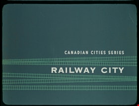
Railway City
https://search.heritageburnaby.ca/link/museumlibrary7535
- Repository
- Burnaby Village Museum
- Publication Date
- c[1960]
- Repository
- Burnaby Village Museum
- Collection
- Special Collection
- Material Type
- Photograph
- Accession Code
- BV016.7.9
- Contributor
- Hopkins, D.
- Donoahue, J.
- Moller, Hans
- Canadian National Railways
- Canadian Pacific Railway Company
- City of Winnipeg
- Manitoba Hydro
- Province of Manitoba
- Library and Archives Canada
- Place of Publication
- Ottawa
- Publisher
- National Film Board of Canada
- Publication Date
- c[1960]
- Physical Description
- 52 photographs : filmstrip ; cellulose aacetate, col. pos.
- Library Subject (LOC)
- Documentary Films
- Filmstrips
- Subjects
- Transportation - Rail
- Object History
- Came in with Oakalla Prison records and artifacts in 1991. Filmstrip was utilized by staff and inmates of Oakalla. Digitized by BVM into preservation and accessible formats in 2020.
- Notes
- A Canadian Series educational filmstrip about the history of Winnipeg and its development as a railway city. Visual material was provided by: Canadian National Railways and Canadian Pacific Railway, Montreal; City of Winnipeg Engineering Departments; Manitoba Hydro Electric Board - Winnipeg; Province of Manitoba, Department of Industry and Commerce and The Public Archives of Canada - Ottawa.
Images

Documents
Map of Dominion of Canada
https://search.heritageburnaby.ca/link/museumdescription11396
- Repository
- Burnaby Village Museum
- Date
- [1932]
- Collection/Fonds
- Burnaby Village Museum Map collection
- Description Level
- Item
- Physical Description
- 1 map : col. ink on paper ; 50 x 88 cm on paper 58.5 x 96 cm
- Scope and Content
- Item consists of "Map of the Dominion of Canada" produced by the Department of the Interior and the National Development Bureau in 1932. The map includes information about the railway lines in operation and under construction for the Canadian National Railways, Canadian Pacific Railways, and other …
- Repository
- Burnaby Village Museum
- Collection/Fonds
- Burnaby Village Museum Map collection
- Description Level
- Item
- Physical Description
- 1 map : col. ink on paper ; 50 x 88 cm on paper 58.5 x 96 cm
- Material Details
- Scale 100 miles = 1 inch
- Scope and Content
- Item consists of "Map of the Dominion of Canada" produced by the Department of the Interior and the National Development Bureau in 1932. The map includes information about the railway lines in operation and under construction for the Canadian National Railways, Canadian Pacific Railways, and other railways. The map also includes Steamship Routes with distances included.
- Accession Code
- BV006.24.20
- Access Restriction
- No restrictions
- Reproduction Restriction
- May be restricted by third party rights
- Date
- [1932]
- Media Type
- Cartographic Material
- Notes
- Transcribed title