Narrow Results By
Creator
- Adams, John 2
- Associated Factory Mutual Fire Insurance Cos 1
- Bancroft, Rose 1
- Bekins Moving and Storage Company Limited 1
- British Columbia Underwriters' Association 13
- Bureau of Post War Rehabilitation and Reconstruction Regional Planning Division 1
- Burnaby Centennial '71 Committee
- Burnaby Village Museum 1
- Burnett and McGugan B.C. Land Surveyors, New Westminster
- Burnett, David H. 2
- Burnett, Geoffrey K. 6
- Burnett & McGugan, Engineers and Surveyors 25
Burnaby Centennial '71 Committee collection
https://search.heritageburnaby.ca/link/museumdescription12986
- Repository
- Burnaby Village Museum
- Date
- 1970-1971
- Collection/Fonds
- Burnaby Centennial '71 Committee collection
- Description Level
- Fonds
- Physical Description
- 57 architectural drawings + approx. 45 cm of textual records + 94 photographs + 1 video recording (mp4) + 1 film reel
- Scope and Content
- Collection consists of records documenting the planning and development of the Burnaby Centennial '71 Committee's commemorative project, Heritage Village (Burnaby Village Museum) prior to it's opening in November 1971. These records were created and/or accumulated by various members of the Burnaby…
- Repository
- Burnaby Village Museum
- Collection/Fonds
- Burnaby Centennial '71 Committee collection
- Description Level
- Fonds
- Physical Description
- 57 architectural drawings + approx. 45 cm of textual records + 94 photographs + 1 video recording (mp4) + 1 film reel
- Scope and Content
- Collection consists of records documenting the planning and development of the Burnaby Centennial '71 Committee's commemorative project, Heritage Village (Burnaby Village Museum) prior to it's opening in November 1971. These records were created and/or accumulated by various members of the Burnaby ’71 Centennial Committee sub-committee, Heritage Village staff and the Century Park Museum Association.
- History
- The Burnaby Centennial '71 Committee was formed in accordance with the British Columbia Centennial '71 Act and was directed by the Provincial Centennial '71 Committee. In April 1970, a representative group of Burnaby citizens were appointed to the committee. Members of the committee included: Ex-Officio Mayor Robert W. Prittie; Chairman, James A. Barrrington; Vice Chairman, Gordon H. Skene; Secretary-Treasurer, Charles B. Brown; Alderman, John D. Drummond; Mrs. Joan Johnston; Mrs. Martin Dunsmuir; Miss Rose Bancroft; Msgr. J.E. Brown; Messrs. Elmer Buckingham; A.B. "Sandy" Stewart; Vic Stusiak; Fraser Wilson; Don Copan and Richard Smith. The purpose of the committee was to ensure that all Burnaby citizens as individuals, family groups or members of community organizations had an opportunity to participate and contribute to celebrations marking the 100th Anniversary of the entry of British Columbia into Confederation and further to make written suggestions of a permanent Centennial project of lasting value and significance to the community. Programs and special events sponsored by the committee included; Flag raising ceremony on January 1, 1971, New Year's Day Ceremony, parades, plays (including "Barkerville '71"), musical events, Burnaby pioneer award presentations, a horse show, lacrosse jamboree, minor baseball, volleyball, tennis, football, soccer, judo and field hockey tournaments, a swim meet, an antique car rally, Easter egg hunt, Rocketry meet, Boy Scouts outdoor action show, Girl Guides "camporee", Midsummer Festival at Burnaby Arts Centre, Rhododendrun Festival at Century Gardens, Variety show, Centennial Ball, Burnaby Rhodendrun Flower show, a Miss Burnaby Pageant, Sports Day, Burnaby Amateur Radio Club party, Centennial '71 Caravan, Centennial High School Art Contest, Sod Turning Ceremony at Heritage park Museum and opening of Heritage Village Museum in November. A sub-committee of the Centennial Committee was responsible for the development of a City of Burnaby permanent commemorative project which became Heritage Village. Sandy Stewart was the sub-committee chair who worked with Richie Smith and Vic Stusiak to develop the concept for an open- air museum reflective of a tram stop community. Architect Rudy Kovacs was hired to come up with a design for the project. Official sod-turning of Heritage Village took place on April 11, 1971. Mayor Bob Prittie officially turned the sod in front of the Elworth house before a crowd of 500. In the spring of 1971, a Heritage Village Director and Curator were hired to oversee the development of the project and acquire artifacts. Salaries were paid through the Parks Commission. The sub-committee continued to assist in overseeing the project to completion. Vic Stusiak set up an administrative structure to govern the new museum. The building of the museum was contracted by Ballarin Bros. Construction at a cost of $121,000 and work began in mid July. Trevi Construction Co. was contracted to do the finished carpentry on the project. The Century Park Museum Association was formed to govern Heritage Village with directors elected on October 26, 1971. Heritage Village officially opened on November 19, 1971 with Mayor Bob Prittie and Governor General Roland Michener in attendance. On January 27, 1972 the committee turned over the Heritage Village Project to the Corporation of the District of Burnaby. After this, the committee was dissolved and all remaining funds were transferred to the Century Park Museum Association which took over the governance of Heritage Village, later known as Burnaby Village Museum.
- Creator
- Burnaby Centennial '71 Committee
- Accession Code
- BV985.6018
- BV000.18
- BV019.52
- BV020.5
- BV022.9
- Date
- 1970-1971
- Related Material
- Century Park Museum Association fonds
- Donald Copan collection
- Burnaby Village Museum fonds
- Arrangement
- Records were accumulated and donated by various donors over time. They were arranged and described by subject and format as discrete items originating from this committee.
- Notes
- Title based on content of collection
- Some records within this collection have restricted access - contact Burnaby Village Museum for further information
- Further accruals are expected
Edmonds Street School site
https://search.heritageburnaby.ca/link/museumdescription11125
- Repository
- Burnaby Village Museum
- Date
- March 8, 1915
- Collection/Fonds
- Ronald G. Scobbie collection
- Description Level
- Item
- Physical Description
- 1 survey plan : blueprint on paper ; 56 x 54 cm
- Scope and Content
- Survey plan of "Edmonds Street School Site" "Burnaby Municipality" "Being Lots 28 and 29 of the Subdivision of Lot 30, Group 1, New Westminster District";
- Repository
- Burnaby Village Museum
- Collection/Fonds
- Ronald G. Scobbie collection
- Description Level
- Item
- Physical Description
- 1 survey plan : blueprint on paper ; 56 x 54 cm
- Material Details
- Scale: 4 feet = 1 inch
- Scope and Content
- Survey plan of "Edmonds Street School Site" "Burnaby Municipality" "Being Lots 28 and 29 of the Subdivision of Lot 30, Group 1, New Westminster District";
- Subjects
- Buildings - Schools
- Names
- Edmonds Community School
- Responsibility
- Burnett and McGugan B.C. Land Surveyors, New Westminster
- Geographic Access
- Edmonds Street
- Street Address
- 7641 Edmonds Street
- Accession Code
- BV003.83.5
- Access Restriction
- No restrictions
- Reproduction Restriction
- No known restrictions
- Date
- March 8, 1915
- Media Type
- Cartographic Material
- Historic Neighbourhood
- Edmonds (Historic Neighbourhood)
- Planning Study Area
- Edmonds Area
- Scan Resolution
- 440
- Scan Date
- 22-Dec-2020
- Scale
- 100
- Notes
- Title based on contents of plan
- Oath in bottom left corner reads: "I, D.J. McGugan...and did personally superintend the survey..." "...completed on the 8th day of March 1915"; signed "D.J. McGugan", notarized by "S.F. Mark" "sworn...12th Day of April 1915"
- handwritten on back, "1756"
Zoomable Images
Howard Avenue School site
https://search.heritageburnaby.ca/link/museumdescription11124
- Repository
- Burnaby Village Museum
- Date
- March 24, 1915
- Collection/Fonds
- Ronald G. Scobbie collection
- Description Level
- Item
- Physical Description
- 1 survey plan : blueprint on paper ; 56 x 54 cm
- Scope and Content
- Survey plan of "Howard Avenue School Site" "Burnaby Municipality", "Being Lots 1-5 and 14-18 Inc. Block 5 of the Subd. of Easterly 3/4 of Lot 127. Group 1, New Westminster District";
- Repository
- Burnaby Village Museum
- Collection/Fonds
- Ronald G. Scobbie collection
- Description Level
- Item
- Physical Description
- 1 survey plan : blueprint on paper ; 56 x 54 cm
- Material Details
- Scale: 40 feet = 1 inch
- Scope and Content
- Survey plan of "Howard Avenue School Site" "Burnaby Municipality", "Being Lots 1-5 and 14-18 Inc. Block 5 of the Subd. of Easterly 3/4 of Lot 127. Group 1, New Westminster District";
- Creator
- McGugan, Donald Johnston
- Subjects
- Buildings - Schools
- Names
- Howard Avenue School
- Responsibility
- Burnett and McGugan B.C. Land Surveyors, New Westminster
- Geographic Access
- Howard Avenue
- Georgia Street
- Accession Code
- BV003.83.4
- Access Restriction
- No restrictions
- Reproduction Restriction
- No known restrictions
- Date
- March 24, 1915
- Media Type
- Cartographic Material
- Historic Neighbourhood
- Capitol Hill (Historic Neighbourhood)
- Planning Study Area
- Capitol Hill Area
- Scan Resolution
- 440
- Scan Date
- 22-Dec-2020
- Scale
- 100
- Notes
- Title based on contents of plan
- Oath in bottom left corner reads: "I, D.J. McGugan...and did personally superintend the survey..." "...completed on the 24th day of March 1915"; signed "D.J. McGugan", notarized on April 12th, 1915 by "R. Chapman"
- handwritten on back, "1754"
Zoomable Images
Kingsway West School site
https://search.heritageburnaby.ca/link/museumdescription11122
- Repository
- Burnaby Village Museum
- Date
- March 16, 1915
- Collection/Fonds
- Ronald G. Scobbie collection
- Description Level
- Item
- Physical Description
- 1 survey plan : blueprint on paper with pencil notations ; 56 x 54 cm
- Scope and Content
- Survey plan of "Kingsway West School Site" "Burnaby Municipality" "being Lot 1, D.L.32, Lot 1 of Lot 21, Portion of Lot 21 and Portion of Lot 20, of subdivision of D.L.152, 153 & Portion of Lot 151, Group 1, New Westminster District". Notations in pencil extend along the south boundary line of Dist…
- Repository
- Burnaby Village Museum
- Collection/Fonds
- Ronald G. Scobbie collection
- Description Level
- Item
- Physical Description
- 1 survey plan : blueprint on paper with pencil notations ; 56 x 54 cm
- Material Details
- Scale: 40 feet = 1 inch
- Scope and Content
- Survey plan of "Kingsway West School Site" "Burnaby Municipality" "being Lot 1, D.L.32, Lot 1 of Lot 21, Portion of Lot 21 and Portion of Lot 20, of subdivision of D.L.152, 153 & Portion of Lot 151, Group 1, New Westminster District". Notations in pencil extend along the south boundary line of District Lot 32.
- Creator
- McGugan, Donald Johnston
- Subjects
- Buildings - Schools
- Names
- Kingsway West School
- Responsibility
- Burnett and McGugan B.C. Land Surveyors, New Westminster
- Geographic Access
- Kingsway
- Sussex Avenue
- Accession Code
- BV003.83.2
- Access Restriction
- No restrictions
- Reproduction Restriction
- No known restrictions
- Date
- March 16, 1915
- Media Type
- Cartographic Material
- Historic Neighbourhood
- Central Park (Historic Neighbourhood)
- Planning Study Area
- Maywood Area
- Scan Resolution
- 440
- Scan Date
- 22-Dec-2020
- Scale
- 100
- Notes
- Transcribed title
- Oath in bottom left corner reads: "I, D.J. McGugan...did personally superintend the survey ..." "...completed on the 16th day of March 1915", signed "D.J. McGugan" and is notarized on March 19th, 1915 by "S.F. Frank" with a seal
- handwritten on back, "1753";
- See also BV003.83.9 - duplicate blueprint plan without annotations
- See also BV003.83.3 for original plan on waxed linen
Zoomable Images
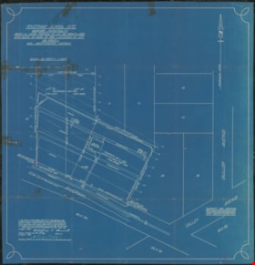
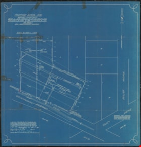
Riverway School site
https://search.heritageburnaby.ca/link/museumdescription11134
- Repository
- Burnaby Village Museum
- Date
- April 16, 1915
- Collection/Fonds
- Ronald G. Scobbie collection
- Description Level
- Item
- Physical Description
- 1 survey plan : blueprint on paper ; 56 x 54 cm
- Scope and Content
- Survey plan of "Riverway School Site / Burnaby Municipality" "Being a 1 acre portion of Lot 159 Group 1, and Lots 30 & 31 of subd. of Bks. 1, 1a, 2, 3, 4 & 5 of Lot 159, Group 1, New Westminster District".
- Repository
- Burnaby Village Museum
- Collection/Fonds
- Ronald G. Scobbie collection
- Description Level
- Item
- Physical Description
- 1 survey plan : blueprint on paper ; 56 x 54 cm
- Material Details
- Scale 40 feet = 1 inch
- Scope and Content
- Survey plan of "Riverway School Site / Burnaby Municipality" "Being a 1 acre portion of Lot 159 Group 1, and Lots 30 & 31 of subd. of Bks. 1, 1a, 2, 3, 4 & 5 of Lot 159, Group 1, New Westminster District".
- Creator
- Geoffrey K. Burnett
- Subjects
- Buildings - Schools
- Names
- Riverway East School
- Responsibility
- Burnett and McGugan B.C. Land Surveyors, New Westminster
- Geographic Access
- Gilley Avenue
- Marine Drive
- Street Address
- 5787 Marine Drive
- Accession Code
- BV003.83.13
- Access Restriction
- No restrictions
- Reproduction Restriction
- No known restrictions
- Date
- April 16, 1915
- Media Type
- Cartographic Material
- Historic Neighbourhood
- Alta Vista (Historic Neighbourhood)
- Planning Study Area
- Clinton-Glenwood Area
- Scan Resolution
- 440
- Scan Date
- 22-Dec-2020
- Scale
- 100
- Notes
- Title based on contents of plan
- Note in black ink on verso of plan reads: "1744" / "Riverway School"
- Oath on plan reads: "I, Geoffrey K. Burnett...and did personally superintend the survey..." "...completed on the 16th day of April 1915"; signed by Geoffrey K. Burnett and notarized by "K.A. Eastman", sworn "...19th day of April 1915"
Zoomable Images
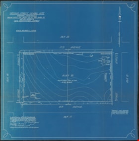
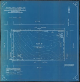
Second Street School site
https://search.heritageburnaby.ca/link/museumdescription11920
- Repository
- Burnaby Village Museum
- Date
- May 29, 1915
- Collection/Fonds
- Ronald G. Scobbie collection
- Description Level
- Item
- Physical Description
- 1 survey plan : blueprint on paper ; 56 x 54 cm
- Scope and Content
- Survey plan of "Second Street School Site" "Burnaby Municipality" "Being Lots 1 & 2 , Block 20 of the Subd of / Lot 27. Group 1 / New Westminster District".
- Repository
- Burnaby Village Museum
- Collection/Fonds
- Ronald G. Scobbie collection
- Description Level
- Item
- Physical Description
- 1 survey plan : blueprint on paper ; 56 x 54 cm
- Material Details
- Scale: 40 feet = 1 inch
- Scope and Content
- Survey plan of "Second Street School Site" "Burnaby Municipality" "Being Lots 1 & 2 , Block 20 of the Subd of / Lot 27. Group 1 / New Westminster District".
- Creator
- McGugan, Donald Johnston
- Subjects
- Buildings - Schools
- Names
- Edmonds Community School
- Responsibility
- Burnett and McGugan B.C. Land Surveyors, New Westminster
- Geographic Access
- Edmonds Street
- Street Address
- 7641 Edmonds Street
- Accession Code
- BV003.83.6
- Access Restriction
- No restrictions
- Reproduction Restriction
- No known restrictions
- Date
- May 29, 1915
- Media Type
- Cartographic Material
- Historic Neighbourhood
- Edmonds (Historic Neighbourhood)
- Planning Study Area
- Edmonds Area
- Scan Resolution
- 440
- Scan Date
- 22-Dec-2020
- Scale
- 100
- Notes
- Title based on contents of plan
- Oath in bottom left corner reads: "I, D.J. McGugan...and did personally superintend the survey..." "...completed on the 8th day of March 1915"; signed "D.J. McGugan / BCLS / sworn...29 day / of May 1915"
- handwritten on back, "1733"


