Narrow Results By
Creator
- Bartel, Mario 3
- Bureau of Post War Rehabilitation and Reconstruction Regional Planning Division
- Burnaby Village Museum
- Burnett & McGugan, Engineers and Surveyors 1
- Campbell, Peg 1
- Chapman, Fred 1
- McGugan, Donald Johnston
- McLean, George H.F. 1
- Petrusa, Kate 1
- Stride, Charles Edgar 1
- Surridge, Jack 1
- Topical Press Agency Limited 1

Detail of brass plates for monuments in connection with school sites in Burnaby
https://search.heritageburnaby.ca/link/museumdescription11919
- Repository
- Burnaby Village Museum
- Date
- March 6, 1915
- Collection/Fonds
- Ronald G. Scobbie collection
- Description Level
- Item
- Physical Description
- 1 architectural drawing : pencil and watercolour on blueprint paper ; 43.5 x 30 cm
- Scope and Content
- Item consists of a detail drawing titled "Detail of Brass Plates / for monuments in connection / with School sites, Burnaby - / Full Size”.
- Repository
- Burnaby Village Museum
- Collection/Fonds
- Ronald G. Scobbie collection
- Description Level
- Item
- Physical Description
- 1 architectural drawing : pencil and watercolour on blueprint paper ; 43.5 x 30 cm
- Scope and Content
- Item consists of a detail drawing titled "Detail of Brass Plates / for monuments in connection / with School sites, Burnaby - / Full Size”.
- Creator
- McGugan, Donald Johnston
- Subjects
- Buildings - Schools
- Responsibility
- Burnett & McGugan, Engineers and Surveyors
- Accession Code
- BV003.83.11
- Access Restriction
- No restrictions
- Reproduction Restriction
- No known restrictions
- Date
- March 6, 1915
- Media Type
- Architectural Drawing
- Scan Resolution
- 600
- Scan Date
- 15-Jan-2021
- Scale
- 100
- Notes
- Title based on contents of drawing
- Text on bottom right corner of drawing reads: "Burnett & McGugan / C.E. & B.C. Land Surveyors / New Westminster, BC / 6th March 1915"
- Red crayon marking on plan reads: "001819"
- verso of page is blue
Images

![Monuments for school sites, [1915] thumbnail](/media/hpo/_Data/_BVM_Cartographic_Material/2003/2003_0083_0010_001.jpg?width=280)
Monuments for school sites
https://search.heritageburnaby.ca/link/museumdescription11915
- Repository
- Burnaby Village Museum
- Date
- [1915]
- Collection/Fonds
- Ronald G. Scobbie collection
- Description Level
- Item
- Physical Description
- 1 architectural drawing : pencil on paper ; 27.5 x 21 cm
- Scope and Content
- Item consists of a drawing titled "Plans of Proposed concrete monuments for corners of / school sites for Burnaby School Board".
- Repository
- Burnaby Village Museum
- Collection/Fonds
- Ronald G. Scobbie collection
- Description Level
- Item
- Physical Description
- 1 architectural drawing : pencil on paper ; 27.5 x 21 cm
- Scope and Content
- Item consists of a drawing titled "Plans of Proposed concrete monuments for corners of / school sites for Burnaby School Board".
- Creator
- McGugan, Donald Johnston
- Subjects
- Buildings - Schools
- Accession Code
- BV003.83.10
- Access Restriction
- No restrictions
- Reproduction Restriction
- No known restrictions
- Date
- [1915]
- Media Type
- Architectural Drawing
- Scan Resolution
- 600
- Scale
- 100
- Notes
- Title based on contents of drawing
- Red crayon marking on plan reads: "001819"
Images
![Monuments for school sites, [1915] thumbnail](/media/hpo/_Data/_BVM_Cartographic_Material/2003/2003_0083_0010_001.jpg)
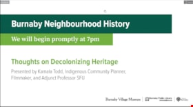
Thoughts on decolonizing heritage
https://search.heritageburnaby.ca/link/museumdescription14757
- Repository
- Burnaby Village Museum
- Date
- 1 Oct. 2020
- Collection/Fonds
- Burnaby Village Museum fonds
- Description Level
- Item
- Physical Description
- 1 video recording (mp4) (88 min., 3 sec.) : digital, col., sd., stereo ; 29 fps
- Scope and Content
- Item consists of a video recording of a live Zoom webinar hosted by Burnaby Village Museum's Kate Petrusa. The webinar is titled "Thoughts on Decolonizing Heritage" and is presented by Kamala Todd - Indigenous Community Planner, Filmmaker, and Adjunct Professor SFU. The zoom webinar is the second i…
- Repository
- Burnaby Village Museum
- Collection/Fonds
- Burnaby Village Museum fonds
- Description Level
- Item
- Physical Description
- 1 video recording (mp4) (88 min., 3 sec.) : digital, col., sd., stereo ; 29 fps
- Material Details
- Presenter: Kamala Todd
- Host: Kate Petrusa
- Date of Presentation: October 1, 7:00 pm - 8:30 pm
- Total Number of tracks: 1
- Total Length of all tracks: 88 min., 3 sec.
- Recording Device: Zoom video communication platform
- Scope and Content
- Item consists of a video recording of a live Zoom webinar hosted by Burnaby Village Museum's Kate Petrusa. The webinar is titled "Thoughts on Decolonizing Heritage" and is presented by Kamala Todd - Indigenous Community Planner, Filmmaker, and Adjunct Professor SFU. The zoom webinar is the second in a collection of seven "Neighbourhood Speaker series" webinars that were presented and made available to the public between September 29 and October 27, 2020. The live webinar and recording was also made available on the Burnaby Village Museum's facebook page. In this webinar, Kamala Todd speaks about how narratives and sense of place shape our connection to the lands we live upon. Kamala highlights how dominant colonial narratives are embedded into the built environment, place names, heritage landscapes, and the very planning of our cities contributing to exclusion and erasure of the hən̓q̓əmin̓əm and Sḵwx̱wú7mesh speaking people, who have lived on their unceded territories since time immemorial.Todd provides her perspectives by asking the questions; How has “Heritage” contributed to colonial harms and erasures? And what will it take to decolonize and re-Indigenize the stories, landscapes, and understandings of the places we call home? The presentation is supported with contemporary and historic photographs. Kamala takes questions from webinar participants and reads from writings of different authors including Stó:lō author, Lee Maracle and Salish poet, Will George.
- Creator
- Burnaby Village Museum
- Subjects
- Indigenous peoples - British Columbia
- Indigenous peoples - Canada - Government relations
- Indigenous peoples - Canada - , Treatment of
- Persons - Pioneers
- Government - Colonial Government
- Monuments
- Responsibility
- Petrusa, Kate
- Geographic Access
- Vancouver
- Accession Code
- BV020.29.2
- Access Restriction
- No restrictions
- Reproduction Restriction
- No known restrictions
- Date
- 1 Oct. 2020
- Media Type
- Moving Images
- Notes
- Title based on contents of video recording
- Video recording was edited for publication on Heritage Burnaby. Original mp4 video recording (BV020.29.2.1) is 103 min., 49 sec.
Images

Video
Thoughts on decolonizing heritage, 1 Oct. 2020
Thoughts on decolonizing heritage, 1 Oct. 2020
https://search.heritageburnaby.ca/media/hpo/_Data/_BVM_Moving_Images/2020_0029_0002_002.mp4Lower Mainland Regional Plan
https://search.heritageburnaby.ca/link/archivedescription90139
- Repository
- City of Burnaby Archives
- Date
- 1945
- Collection/Fonds
- Planning Department fonds
- Description Level
- Item
- Physical Description
- 7 maps : col. ; 22.5 x 53.5 cm on sheets 42 x 65 cm
- Scope and Content
- A collection of seven maps titled "Lower Mainland Regional Plan". Maps are numbered and subtitled as: "Light and Power Distribution / Map No. 5"; "Harbour Areas" / Map No. 8"; "Land Use" / Map No. 2"; "Water Supply" / Map No. 6"; "Dykes" / Map No. 7"; "Population Distribution / Map_No._1". All maps…
- Repository
- City of Burnaby Archives
- Date
- 1945
- Collection/Fonds
- Planning Department fonds
- Series
- Planning General series
- Physical Description
- 7 maps : col. ; 22.5 x 53.5 cm on sheets 42 x 65 cm
- Material Details
- Scale : in miles
- Map no. 4 is missing
- Description Level
- Item
- Record No.
- 59929
- Access Restriction
- Open access
- Accession Number
- 2016-09
- Scope and Content
- A collection of seven maps titled "Lower Mainland Regional Plan". Maps are numbered and subtitled as: "Light and Power Distribution / Map No. 5"; "Harbour Areas" / Map No. 8"; "Land Use" / Map No. 2"; "Water Supply" / Map No. 6"; "Dykes" / Map No. 7"; "Population Distribution / Map_No._1". All maps have are marked with boundaries, and landmarks including Historical Monuments, Custom Ports, Airports and Railways.
- Media Type
- Cartographic Material
- Notes
- Transcribed title
- Credit on maps read as: "Bureau_of_Post_War / Rehabilitation_and_Reconstruction / Regional_Planning_Design / Parliament_Buildings_Victoria_BC / Date_Sept_1st_1945 / (signed by ) [A.G._Graham]"