More like 'basket with lid'
Narrow Results By
![Survey plans in New Westminster District Group 1 - Maple Ridge, Pitt Meadows, [190-] thumbnail](/media/hpo/_Data/_BVM_Cartographic_Material/1977/1977_0093_0105_001.jpg?width=280)
Survey plans in New Westminster District Group 1 - Maple Ridge, Pitt Meadows
https://search.heritageburnaby.ca/link/museumdescription7074
- Repository
- Burnaby Village Museum
- Date
- [190-]
- Collection/Fonds
- Burnaby Village Museum Map collection
- Description Level
- File
- Physical Description
- 6 plans : graphite and ink on paper and linen; various sizes mounted on 2 sides of cardboard 76 x 102 cm
- Scope and Content
- File consists of a large board with three plans mounted on one side and two on the other side. All plans are located in New Westminster District, Group 2, covering geographic areas within Maple Ridge and Pitt Meadows. Side A: 1. Plan : black ink on linen ; 34 x 86 cm. Title reads: "Survey / of / …
- Repository
- Burnaby Village Museum
- Collection/Fonds
- Burnaby Village Museum Map collection
- Description Level
- File
- Physical Description
- 6 plans : graphite and ink on paper and linen; various sizes mounted on 2 sides of cardboard 76 x 102 cm
- Material Details
- Scales vary (One chain equals 792 inches)
- Indexed number on tape on edge of board reads "105"
- Scope and Content
- File consists of a large board with three plans mounted on one side and two on the other side. All plans are located in New Westminster District, Group 2, covering geographic areas within Maple Ridge and Pitt Meadows. Side A: 1. Plan : black ink on linen ; 34 x 86 cm. Title reads: "Survey / of / Dyke and Waterfront / Sec's 9, 10, 11, 13 & 14 / B5N R1E". Scale: 400 feet = 1 inch. Stamp in red ink on plan reads: "Albert J. Hill, M.A., / Civil Engineer / And / Provincial Land Surveyor, / New Westminster, / B.C." (Geographic location: Pitt Meadows) 2. 2 plans : black ink and graphite on paper ; 34.5 x 51 cm. Titles read: "Survey / For Highway / in / Section 4, Township 15, / New Westminster District. / For Maple Ridge Council." and "Survey / for Highway / in / Section 5, Tp. 15, / New Westminster Dist. / For Maple Ridge Council." Survey plan in Section 5, Township 15, covers SW quarter of Sec. 5, Tp. 15 with "Indian Reserve" (Whonnock Indian Reserve No. 1 - Kwantlen First Nation) identified. Stamp in red ink on plan reads: "Albert J. Hill, M.A., / Civil Engineer / And / Provincial Land Surveyor, / New Westminster, / B.C." Scales vary per drawing: 4 chains = 1 inch and 2 chains = 1 inch. (Geographic location: Maple Ridge) 3. Plan, black ink and graphite on paper ; 41 x 34 cm. Title reads: "Plan / of Subdivision / of / Fractional S.E. Quarter / of Sec. 6, TP. 15 / New Westminster District". Scale: 4 chains = 1 inch tamp in red ink on plan reads: "Albert J. Hill, M.A., / Civil Engineer / And / Provincial Land Surveyor, / New Westminster, / B.C." . Annotation in blue crayon reads: "also Board 122. (Geographic location: Maple Ridge) Side B: 1. Plan : black ink and col. red ink on linen ; 25.5 x 16 cm. Title reads: "Plan of Survey in Lot 398 Gr. 1 / For Lougheed & Abernathy". Scale: 3 chains = 1 inch. Plan is signed by "G.K. Burnett" September 25, 1907. (Geographic location: Maple Ridge) 2. Plan : graphite on paper with annotations in blue ; 91 x 67 cm. Title on survey plan reads: "Lot 441, 439, 438, 440, Gr. 1 / Showing bank of Stave River" (in blue crayon). Survey plan includes lot numbers and identifies "Indian Reserve" (Whonnock Indian Reserve No. 1 - Kwantlen First Nation) (Geographic location: Maple Ridge)
- Accession Code
- HV977.93.105
- Access Restriction
- No restrictions
- Reproduction Restriction
- No known restrictions
- Date
- [190-]
- Media Type
- Cartographic Material
- Scan Resolution
- 600
- Scan Date
- 2023-06-26
- Notes
- Title based on contents of file
Zoomable Images
![Survey plans in New Westminster District Group 1 - Maple Ridge, Pitt Meadows, [190-] thumbnail](/media/hpo/_Data/_BVM_Cartographic_Material/1977/1977_0093_0105_003_seadragon/1977_0093_0105_003.jpg?w=280)
Survey plans in New Westminster District Group 1 - Maple Ridge, Pitt Meadows, [190-]
Zoom into Image
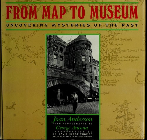
From map to museum : uncovering mysteries of the past
https://search.heritageburnaby.ca/link/museumlibrary1334
- Repository
- Burnaby Village Museum
- Author
- Anderson, Joan, 1943-
- Publication Date
- 1988
- Call Number
- 975.8733 AND
- Repository
- Burnaby Village Museum
- Collection
- Reference Collection
- Material Type
- Book
- ISBN
- 0688069142
- 0688069150
- Call Number
- 975.8733 AND
- Author
- Anderson, Joan, 1943-
- Contributor
- Ancona, George
- Place of Publication
- New York
- Publisher
- Morrow Junior Books
- Publication Date
- 1988
- Physical Description
- 63 p. : ill. ; 21 cm.
- Library Subject (LOC)
- Archaeology
- Notes
- Describes an archaeological dig off the coast of Georgia, the methods used to uncover artifacts there, and what was learned about a mission run there by the Spanish for the Guale Indians.
- Includes index.
![East Burnaby Public School, [1911 or 1912] thumbnail](/media/hpo/_Data/_BVM_Images/2022/2022_0032_0224_001.jpg?width=280)
East Burnaby Public School
https://search.heritageburnaby.ca/link/museumdescription19802
- Repository
- Burnaby Village Museum
- Date
- [1911 or 1912]
- Collection/Fonds
- Esther Love Stanley fonds
- Description Level
- Item
- Physical Description
- 1 photograph : b&w postcard ; 8.5 x 14 cm
- Scope and Content
- Photograph of students at East Burnaby (Edmonds Street) School. Students are identified, front row, left to right: George Gregson, [unidentified], and George Powys. Second row, left to right: Phyllis Brown, Hazel Allen, Etta Bonsor, Mary Buchanan, Jane Allen, Lila Skelly, and Eileen Jordan. Third …
- Repository
- Burnaby Village Museum
- Collection/Fonds
- Esther Love Stanley fonds
- Description Level
- Item
- Physical Description
- 1 photograph : b&w postcard ; 8.5 x 14 cm
- Scope and Content
- Photograph of students at East Burnaby (Edmonds Street) School. Students are identified, front row, left to right: George Gregson, [unidentified], and George Powys. Second row, left to right: Phyllis Brown, Hazel Allen, Etta Bonsor, Mary Buchanan, Jane Allen, Lila Skelly, and Eileen Jordan. Third row (girls standing), left to right: Margaret Stride, Lucy Jackson, Esther Love, Grace Morrison, Lillie Lewis, Anna Doole, and Lillie Vernon. Back row (boys standing), left to right: Burnie Feedham, [unidentified], Leonard Ettinger, Edward Clayton, and Mr. Lowther (teacher).
- Subjects
- Persons - Students
- Names
- Edmonds Community School
- Allen, Hazel
- Allen, Jane
- Bonsor, Etta
- Brown, Phyllis
- Buchanan, Mary
- Clayton, Edward
- Feedham, Colonel Burnaby "Burnie"
- Ettinger, Leonard
- Gregson, George
- Jackson, Lucy
- Jordan, Eileen
- Morrison, Grace
- Porter, Lillie Lewis
- Powys, George
- Stanley, Esther Love
- Stride, Margaret
- Vernon, Lillie
- Accession Code
- BV022.32.224
- Access Restriction
- No restrictions
- Reproduction Restriction
- No known restrictions
- Date
- [1911 or 1912]
- Media Type
- Photograph
- Related Material
- See also City of Burnaby Archives 140-008
- Scan Resolution
- 600
- Scan Date
- 2023-04-18
- Photographer
- Brown, W.
- Notes
- Title based on contents of photograph
- Photograph is part of Esther Love Stanley photograph album 1 (BV022.32.1)
- Stamp in red ink at top of photograph postcard reads: "East Burnaby_Public School"
Images
![East Burnaby Public School, [1911 or 1912] thumbnail](/media/hpo/_Data/_BVM_Images/2022/2022_0032_0224_001.jpg)