Narrow Results By
Creator
- Adams, John
- Associated Factory Mutual Fire Insurance Cos 1
- Bancroft, Rose 1
- Bekins Moving and Storage Company Limited 1
- British Columbia Hydro and Power Authority 1
- British Columbia Underwriters' Association 13
- Bureau of Post War Rehabilitation and Reconstruction Regional Planning Division 1
- Burnaby Parks and Recreation Commission
- Burnaby Village Museum 9
- Burnett and McGugan B.C. Land Surveyors, New Westminster 5
- Burnett, David H. 2
- Burnett, Geoffrey K. 6

Bird's Eye View of the Burnaby Lake Area
https://search.heritageburnaby.ca/link/museumdescription15144
- Repository
- Burnaby Village Museum
- Date
- 1977
- Collection/Fonds
- Century Park Museum Association fonds
- Description Level
- Item
- Physical Description
- 1 map : b&w print on paper ; 43 x 63.5 cm
- Scope and Content
- Item consists of a map titled "Birds Eye View of the Burnaby Lake Area Circa 1910". The overview of the Burnaby Lake area was compiled and drawn at Heritage Village by curator John Adams and artist, Carol Swan. The map identifies the Burnaby Lake inter-urban tram line; roads including: Sperling Ave…
- Repository
- Burnaby Village Museum
- Collection/Fonds
- Century Park Museum Association fonds
- Description Level
- Item
- Physical Description
- 1 map : b&w print on paper ; 43 x 63.5 cm
- Material Details
- Scale indeterminable
- Scope and Content
- Item consists of a map titled "Birds Eye View of the Burnaby Lake Area Circa 1910". The overview of the Burnaby Lake area was compiled and drawn at Heritage Village by curator John Adams and artist, Carol Swan. The map identifies the Burnaby Lake inter-urban tram line; roads including: Sperling Avenue (Pole Line Road); Gilpin Avenue; Douglas Road; trail to Vancouver Westminster Road (Kingsway); Buckingham Avenue; Haszard Street; various farms and residences including: Charles Sprott "Norland"; H.T. Ceperley "Fairacres"; Claude Hill's "Brookfield farm" and "Broadview"; F.J. Hart's "Avalon"; Miss Woodward's former and new home, school and post office; Councillor Edgar's hunting cabin; Edgar Sprott's "Mayfield farm" and "Mayfield Lodge"; F.J. Peers "Greyfriars"; Arthur de Windt Haszard; Bernard Hill's boathouse as well as other landmarks including: Doran's Mill; tram stations; Burnaby Lake Store; logging camps; wood cutter's shacks; ice houses; cranberry bog; Still Creek; Deer Lake; Burnaby Lake; Deer Lake Creek; Provincial Government Reserve Proposed Hospital (later Oakalla Prison).
- Creator
- Adams, John
- Swan, Carol
- Names
- Hill, Arthur Claude
- Sprott, Charles Frederick
- Sprott, Louis "Edgar"
- Hart, Frederick John, 1884-1945
- Ceperley, H.T.
- Woodward, Maude
- Woodward, Harriet
- Peers, Francis J.
- Haszard, Arthur de Windt
- Hill, Bernard R.
- Geographic Access
- Deer Lake Avenue
- Sperling Avenue
- Haszard Street
- Buckingham Avenue
- Accession Code
- BV021.1.3
- Access Restriction
- No restrictions
- Reproduction Restriction
- No known restrictions
- Date
- 1977
- Media Type
- Cartographic Material
- Historic Neighbourhood
- Burnaby Lake (Historic Neighbourhood)
- Planning Study Area
- Burnaby Lake Area
- Related Material
- See also: Life with the Moores of Hart House : pioneer days on Burnaby's Deer Lake
- Scan Resolution
- 600
- Scan Date
- 2021-11-12
- Scale
- 100
- Notes
- Transcribed title
- Compiled by John Adams; illustration by Carol Swan
- The map depicts the Burnaby Lake Tram Line as being double tracked, whereas in reality it was single tracked.
- Map is part of the book "Life with the Moores of Hart House : pioneer days on Burnaby's Deer Lake https://search.heritageburnaby.ca/permalink/museumlibrary6314-102
Images


Bird's Eye View of the Burnaby Lake Area
https://search.heritageburnaby.ca/link/museumdescription17543
- Repository
- Burnaby Village Museum
- Date
- 1977
- Collection/Fonds
- Century Park Museum Association fonds
- Description Level
- Item
- Physical Description
- 1 map : b&w print with watercolour ; 43 x 63.5 cm
- Scope and Content
- Item consists of a map titled "Birds Eye View of the Burnaby Lake Area Circa 1910". The overview of the Burnaby Lake area was compiled and drawn at Heritage Village by curator John Adams and artist, Carol Swan. The map identifies the Burnaby Lake inter-urban tram line; roads including: Sperling Ave…
- Repository
- Burnaby Village Museum
- Collection/Fonds
- Century Park Museum Association fonds
- Description Level
- Item
- Physical Description
- 1 map : b&w print with watercolour ; 43 x 63.5 cm
- Material Details
- Scale indeterminable
- Scope and Content
- Item consists of a map titled "Birds Eye View of the Burnaby Lake Area Circa 1910". The overview of the Burnaby Lake area was compiled and drawn at Heritage Village by curator John Adams and artist, Carol Swan. The map identifies the Burnaby Lake inter-urban tram line; roads including: Sperling Avenue (Pole Line Road); Gilpin Avenue; Douglas Road; trail to Vancouver Westminster Road (Kingsway); Buckingham Avenue; Haszard Street; various farms and residences including: Charles Sprott "Norland"; H.T. Ceperley "Fairacres"; Claude Hill's "Brookfield farm" and "Broadview"; F.J. Hart's "Avalon"; Miss Woodward's former and new home, school and post office; Councillor Edgar's hunting cabin; Edgar Sprott's "Mayfield farm" and "Mayfield Lodge"; F.J. Peers "Greyfriars"; Arthur de Windt Haszard; Bernard Hill's boathouse as well as other landmarks including: Doran's Mill; tram stations; Burnaby Lake Store; logging camps; wood cutter's shacks; ice houses; cranberry bog; Still Creek; Deer Lake; Burnaby Lake; Deer Lake Creek; Provincial Government Reserve Proposed Hospital (later Oakalla Prison).
- Creator
- Adams, John
- Swan, Carol
- Names
- Hill, Arthur Claude
- Sprott, Charles Frederick
- Sprott, Louis "Edgar"
- Hart, Frederick John, 1884-1945
- Ceperley, H.T.
- Woodward, Maude
- Woodward, Harriet
- Peers, Francis J.
- Haszard, Arthur de Windt
- Hill, Bernard R.
- Geographic Access
- Deer Lake Avenue
- Sperling Avenue
- Haszard Street
- Buckingham Avenue
- Accession Code
- BV021.1.4
- Access Restriction
- No restrictions
- Reproduction Restriction
- No known restrictions
- Date
- 1977
- Media Type
- Cartographic Material
- Historic Neighbourhood
- Burnaby Lake (Historic Neighbourhood)
- Planning Study Area
- Burnaby Lake Area
- Related Material
- See also: Life with the Moores of Hart House : pioneer days on Burnaby's Deer Lake
- Scan Resolution
- 600
- Scan Date
- 2021-11-12
- Scale
- 100
- Notes
- Transcribed title
- Compiled by John Adams; illustration by Carol Swan
- The map depicts the Burnaby Lake Tram Line as being double tracked, whereas in reality it was single tracked.
- Map is part of the book "Life with the Moores of Hart House : pioneer days on Burnaby's Deer Lake https://search.heritageburnaby.ca/permalink/museumlibrary6314-102
- This is a print made from original illustration and appears to be hand-coloured with watercolour at a later date.
Images

brochure
https://search.heritageburnaby.ca/link/museumartifact91373
- Repository
- Burnaby Village Museum
- Accession Code
- BV020.5.2124
- Description
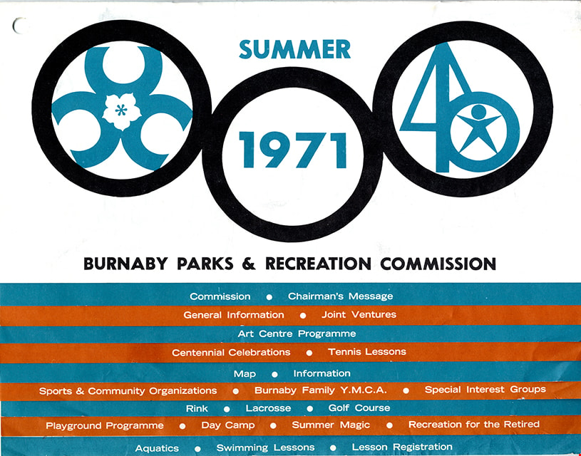
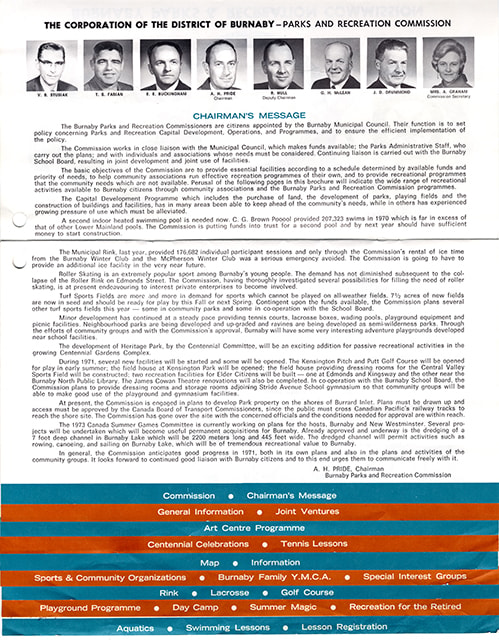
- Burnaby Parks and Recreation brochure; five pages folded and stapled offset to create 10 tabs in aqua blue and orange separating sections by subject. Title on cover page reads "SUMMER 1971" with three rings linked together; B.C. Centennial logo with dogwood flower inside left circle; "1971" inside centre circle and a sports logo inside circle on right; text beneath reads "BURNBY PARKS & RECREATION COMMISSION". Tabbed sections in aqua blue and orange are titled "Commission _ Chairman's Message / General Information_Joint Ventures / Art Centre Programme / Centennial Celebrations_Tennis Lessons / Map_Information / Sports & Community Organizations_Burnaby Family Y.M.C.A._Special Interest Groups / Rink_Lacrosse_Golf Course / Playground Programme_Day Camp_Summer Magic _Recreation for the Retired / Aquatics_Swimming Lessons_Lesson Registration". Verso of Brochure includes information "SWIMMING LESSON REGISTRATION" and a "SWIMMING LESSON REGISTRATION CARD"
- Object History
- Brochure created by the Corporation of the District of Burnaby Parks and Recreation Commission and made available to Burnaby citizens during the Centennial 1971 festivities in Burnaby.
- Category
- 08. Communication Artifacts
- Classification
- Documentary Artifacts - - Other Documents
- Object Term
- Brochure
- Marks/Labels
- invitation has marks from being handled
- Colour
- Blue
- Orange
- White
- Black
- Measurements
- Length: 28 cm
- Width: 22 cm
- Country Made
- Canada
- Province Made
- British Columbia
- Site/City Made
- Burnaby
- Publication Date
- 1971
- Subjects
- Sports
- Celebrations - Centennials
Images